Pointe Sommeiller and Tunnel du Parpillon

Day 6 – Saturday 5th August – Offroad routes and back to Briançon (278km)


Not many reach the summit, since the road is most likely to be covered in snow’.

Some hard parts, which make you wonder whether to continue’.

Difficulty up to 8 out of 10, 10 being impossible’.

The highest you can go on a motor vehicle in Europe’.

These are some of the comments I had found online about the route to Pointe Sommeiller when I was planning the trip. It was a challenging road to face alone, but I was feeling up for it after the previous day’s routes and somehow, I felt I could not leave the area without at least trying to complete one of the legendary mountain routes in the region.

This mountain road was opened in 1962, not as a military road, since it is a dead-end road that does not connect to the French side and there are no fortifications, but as the access to build a ski resort. The project was abandoned in 1980, but the road has remained open.

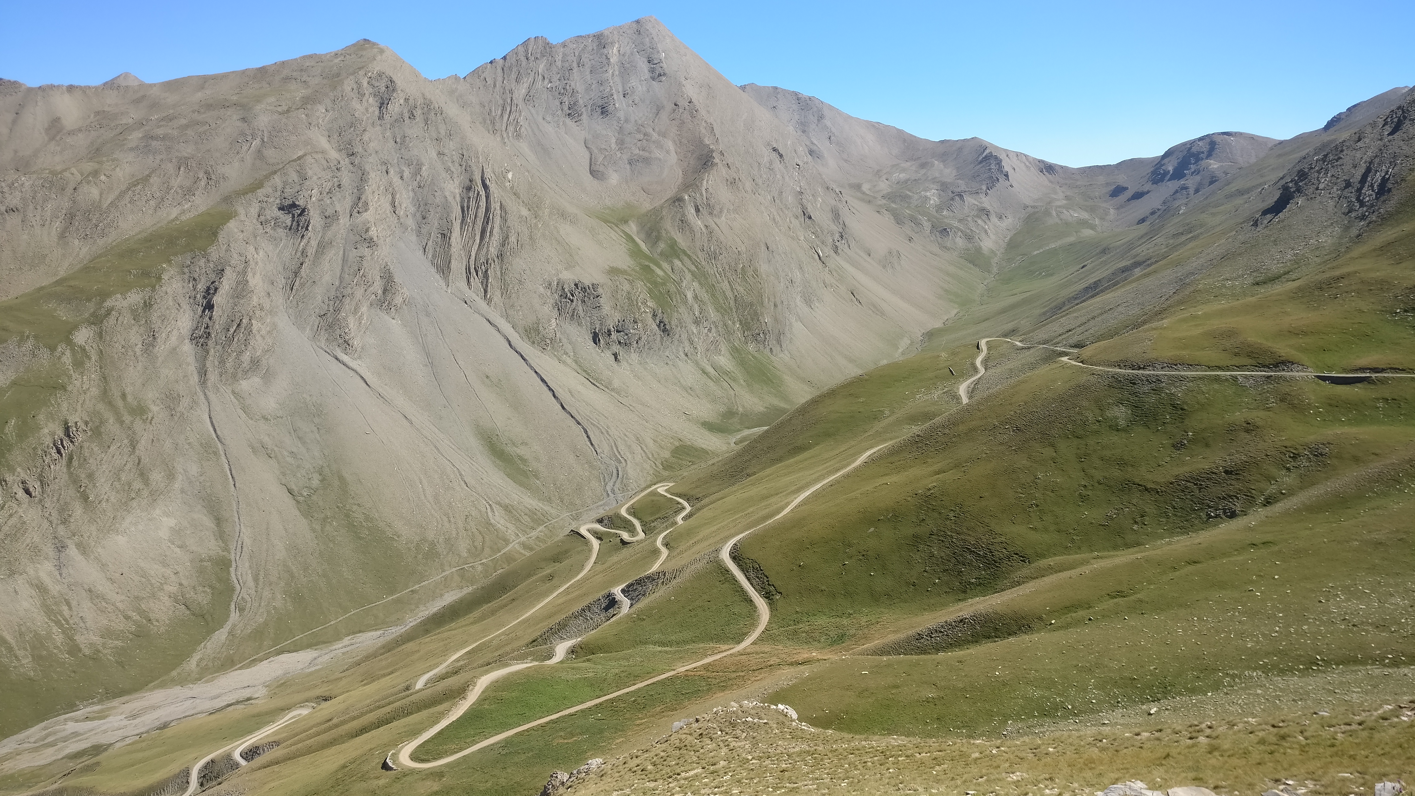
The route starts at the same point as the Fréjus tunnel, just past the town of Bardonecchia. The first section leading up to the hamlet of Rochemolles is paved, but that does not make it any easier. It is an extremely narrow road through the forest with some of the tightest and steepest hairpins I have ever seen. Past Rochemolles the gravel section starts, and for the most part it is not a difficult road – there are a few tight hairpins, but the surface is good enough for all kinds of cars to be able to drive it. The forest starts clearing by the time the road reaches the Lago di Rochemolles, a dam halfway up the valley. The section of the road that goes to the end valley is the easiest, gaining altitude very gently until it reaches a car park and a small wooden hut that marks the beginning of the complicated part.

A girl in the hut told me that you have to pay a five-euro toll to access the remainder of the route, a measure I found reasonable to keep traffic in check and the road maintained and open as a tourist road. She also made sure that not unsuitable vehicles made it past that point, as this was where things start to get complicated – the first section are a series of very tight hairpins with some loose rocks and the occasional rut right where you don’t want it. After that, there is a long plateau where the road levels off and the surface becomes smoother, and the first patches of snow make their appearance.

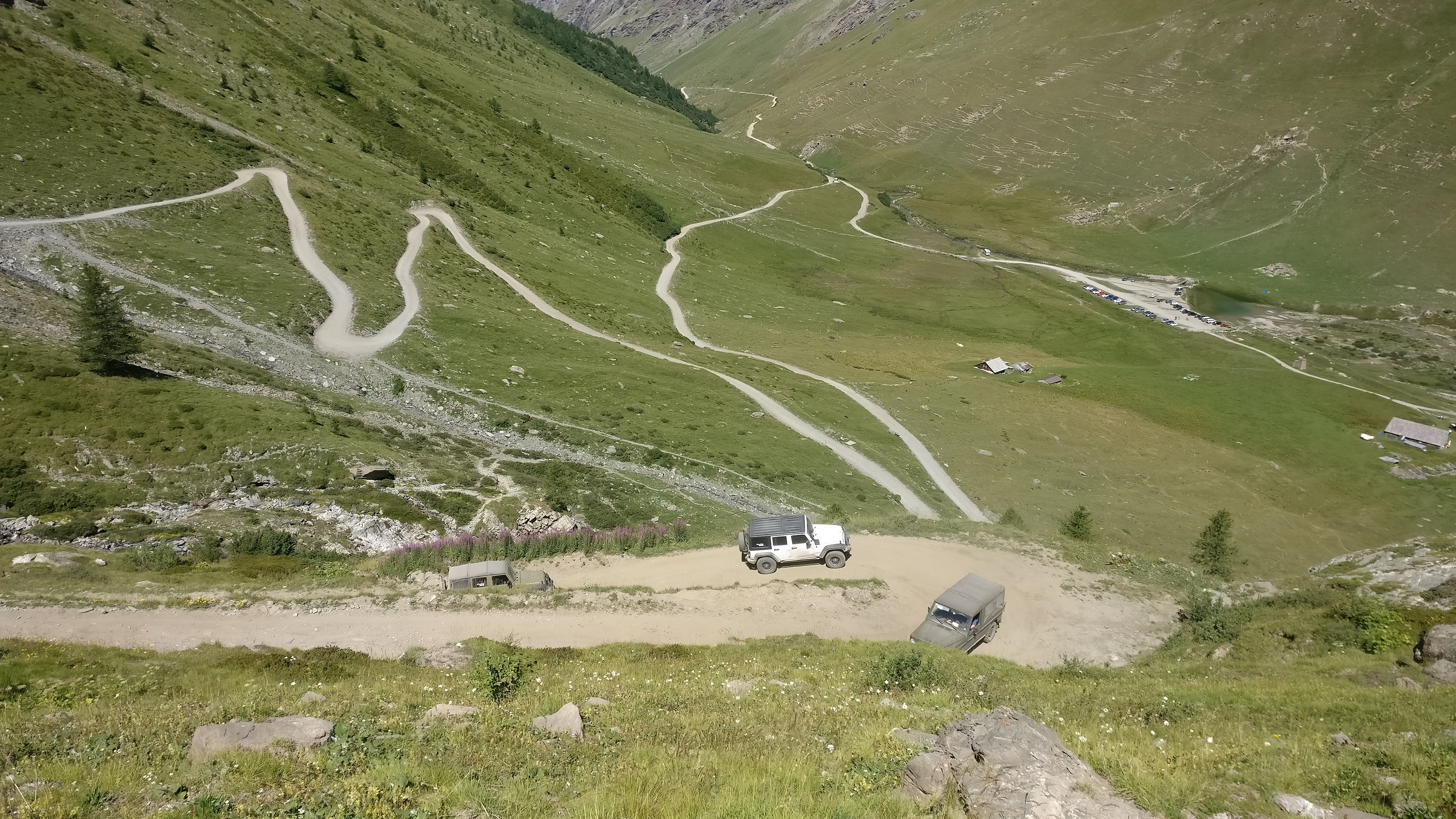
At the end of the plateau, things get complicated again. The road climbs the last few hundred metres on very rocky terrain, which made my bike jump around like crazy. I remembered some advice from the German riders I had met the day before at Forte Jafferau and stopped to let some air out of the tires. It made a world of difference – the bike was now a lot more controllable, going exactly where I wanted it to go and not jumping at all.

A couple of hairpins later I reached the end of the road, a flat empty space that a wooden fence separated from the lake at the top of the pass. To my right, Glacier du Sommellier, which supplied the water to the lake.

I walked past the wooden fence and found a guy on a GS by the lake who was packing up his things. I approached him and he told me that he had spent the night up there, an amazing experience!

The only other vehicles at the top were hardcore 4x4s, but there was one that drew my attention. Against all odds, a Dutch family had made it all the way up there in a California campervan! Mind you, it was a 4WD Syncro version and they had fitted it with BF Goodrich offroad tires, but it was still surprising to see that up there.

The way down was easier than I anticipated, or maybe I was just feeling more confident after the white-knuckle descent from Forte Jafferau through the ski slopes the day before. In any case, the only real difficulty was that by the time I was going down there was more traffic coming up, so I had to be careful, as there was not a lot of space on the road. Halfway down the hairpins on the last section I saw a long line of Jeep Wranglers coming up, so I pulled over to have a rest and let them pass while I took some pictures rather than risk running into them in some tight corner.

Once at the bottom of the valley the rest of the descent offered little to no difficulty, the main risk here being the number of people who drive up this easy part of the road to the mountain hut, some of them a bit too fast and taking up all the space on the road.

When I finished, I took out my compressor and inflated the tires back to their road pressures before heading for the second route of the day – the Tunnel du Parpillon.

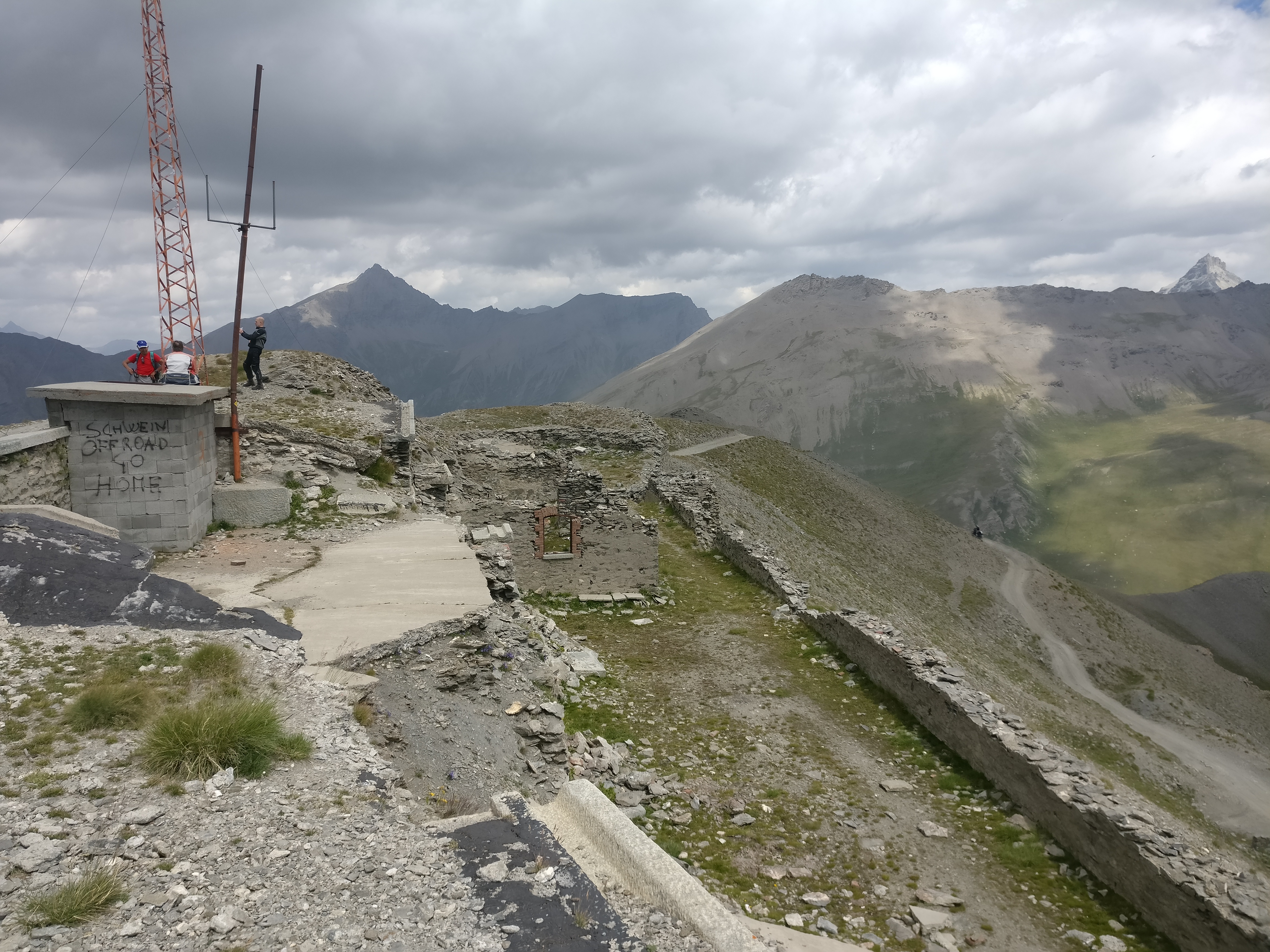
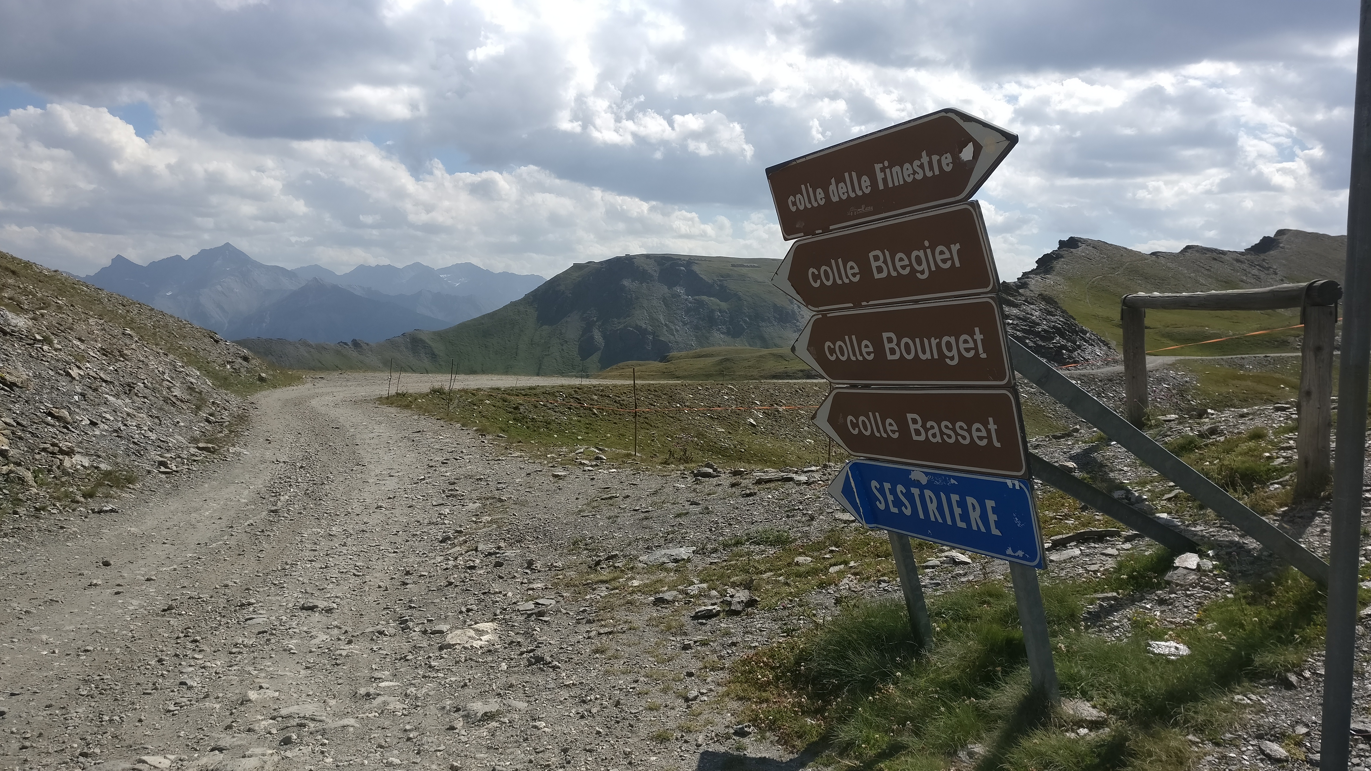
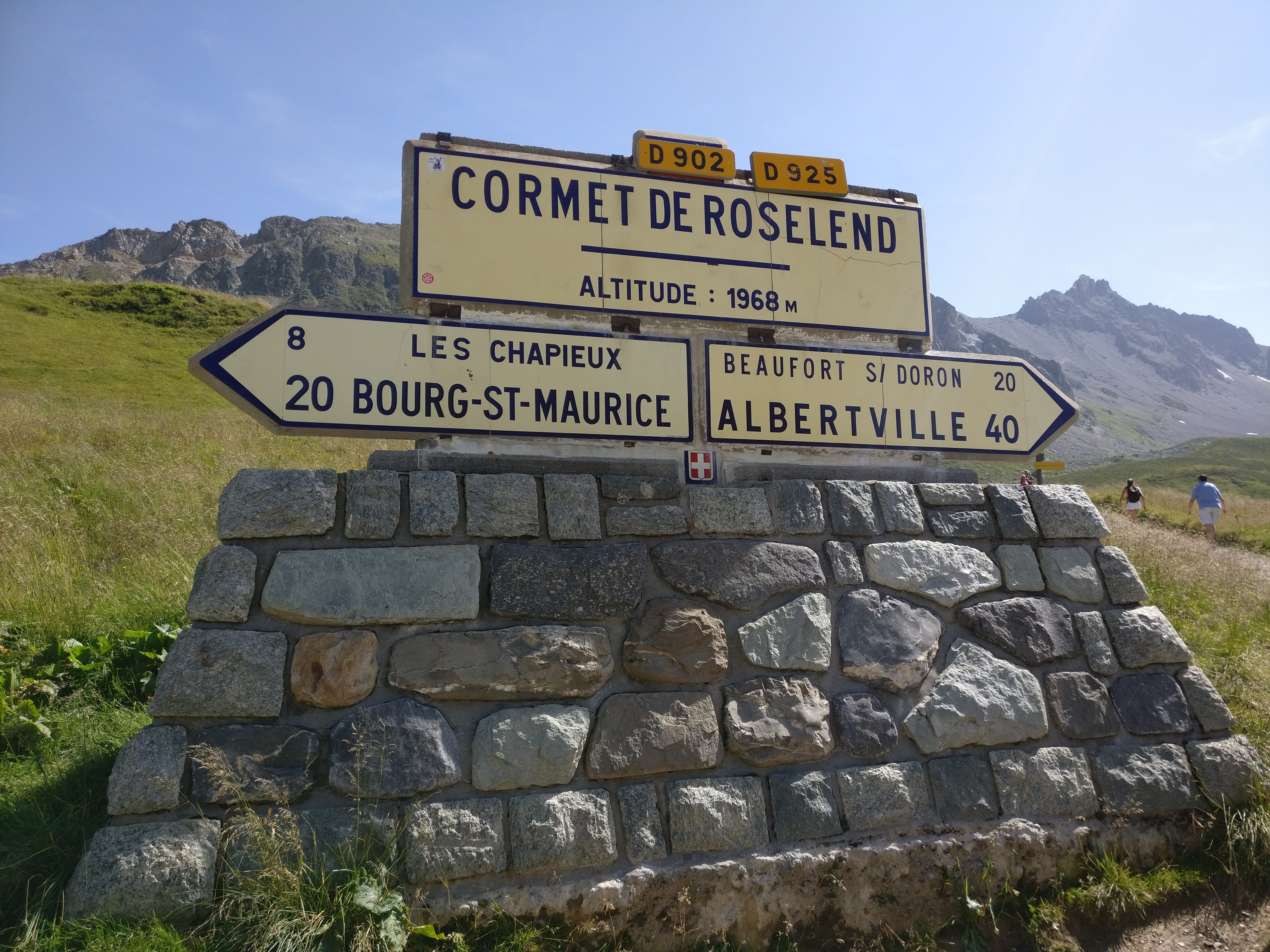
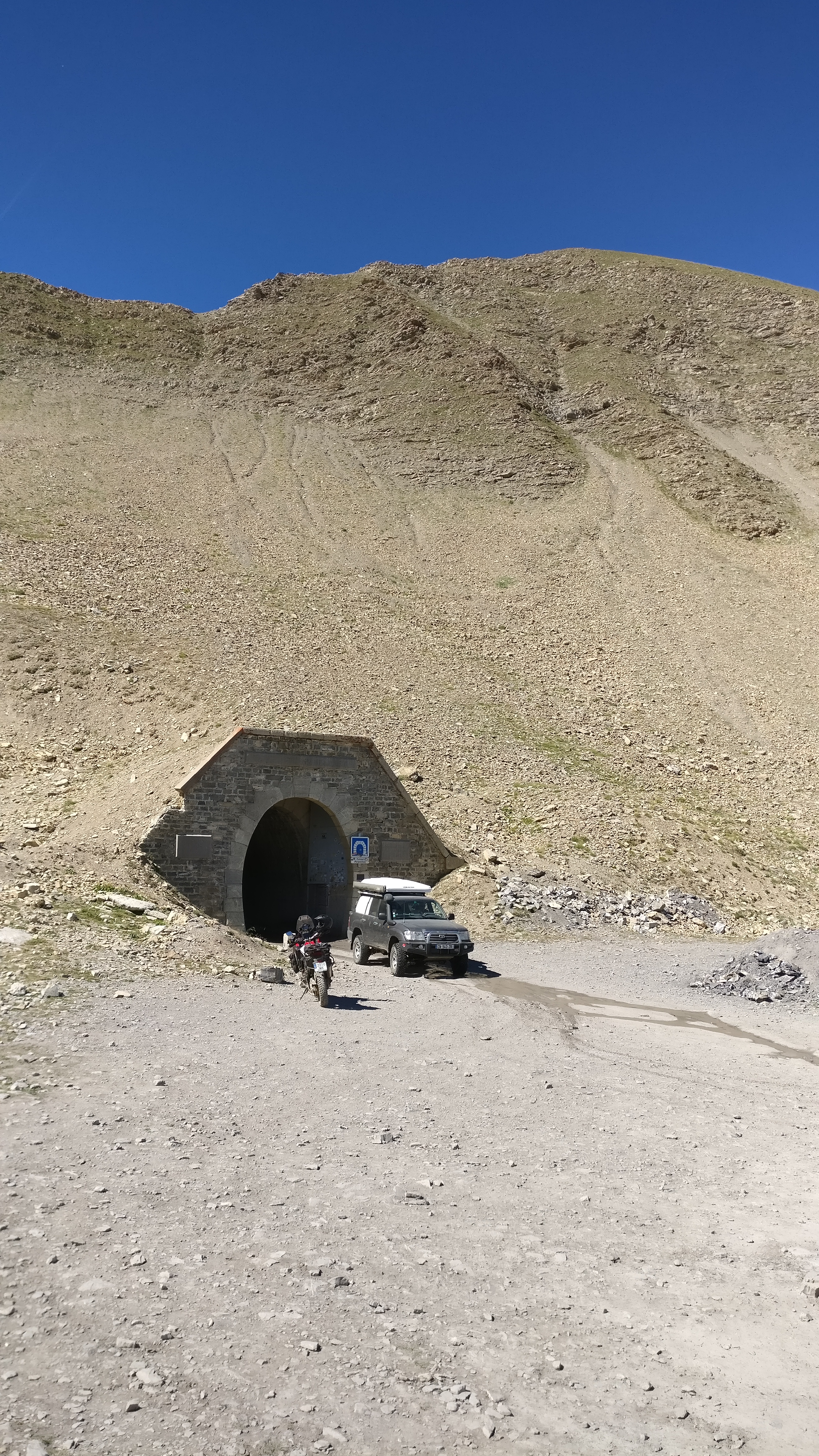
I had to make it back to Briançon and then south on the main road to the village of Mountdaufin, where a smaller road leads past the village of Guillestre and up the col de Vars, a route that I was also going to take the following day as part of the Route des Grandes Alpes. At the bottom of the valley on the other side of the pass the village of La Condamine-Châtelard marks the beginning of the D29 alpine road, the track that goes all the way up to tunnel du Parpillon, at 2,637m.


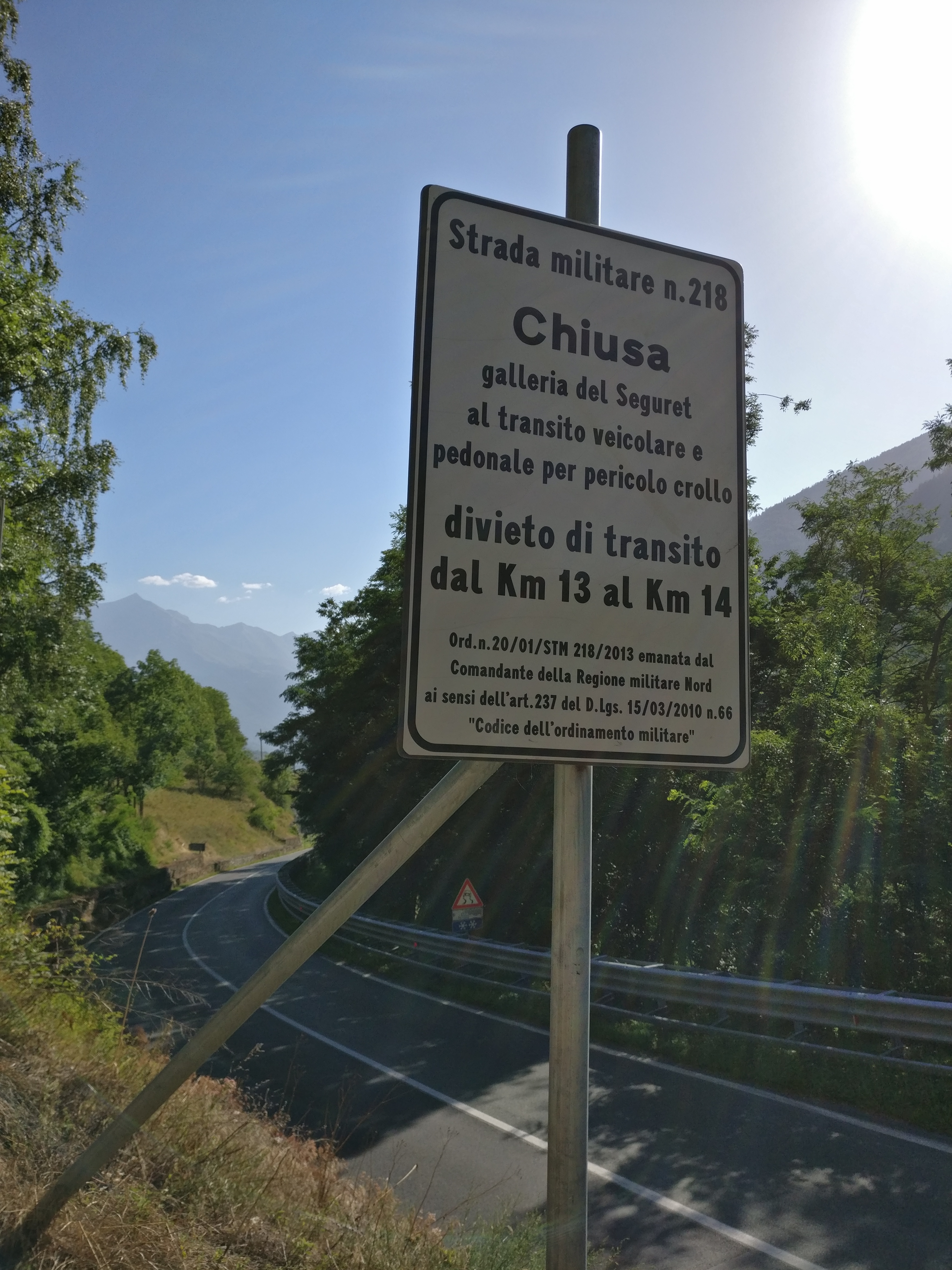
The road and the tunnel connect the valley of Ubaye with Embrun and it was built by the French army in 1891, as the pass was considered of strategic importance. It has been closed to traffic several times over the years, but some of the people I had met in forte Jafferau the day before had just ridden through it, so I did not think I would have any problems. The route I was taking, more or less from south to north was the route that most bikers recommended as the ascent from this side was more challenging, meaning that there would be no traffic other than mountain bikers and the odd motorbike or 4×4 – like the last section of the Sommeiller, this was not a route anybody should attempt in a regular car.

When I turned off the main road I saw a sign reading ‘Tunnel du Parpillon FERMÉ’. My French is much better than my Italian, so I got this one without problems, but since I had recent reports that it was open, I just ignored it and went on. There was at least one more sign like that before the road turned to a dirt track, so I stopped when I saw a group of cyclists putting their bikes back into their cars and asked them about the tunnel. It was open, they confirmed, they had just ridden through it. They also told me that it was very wet. Well, well…

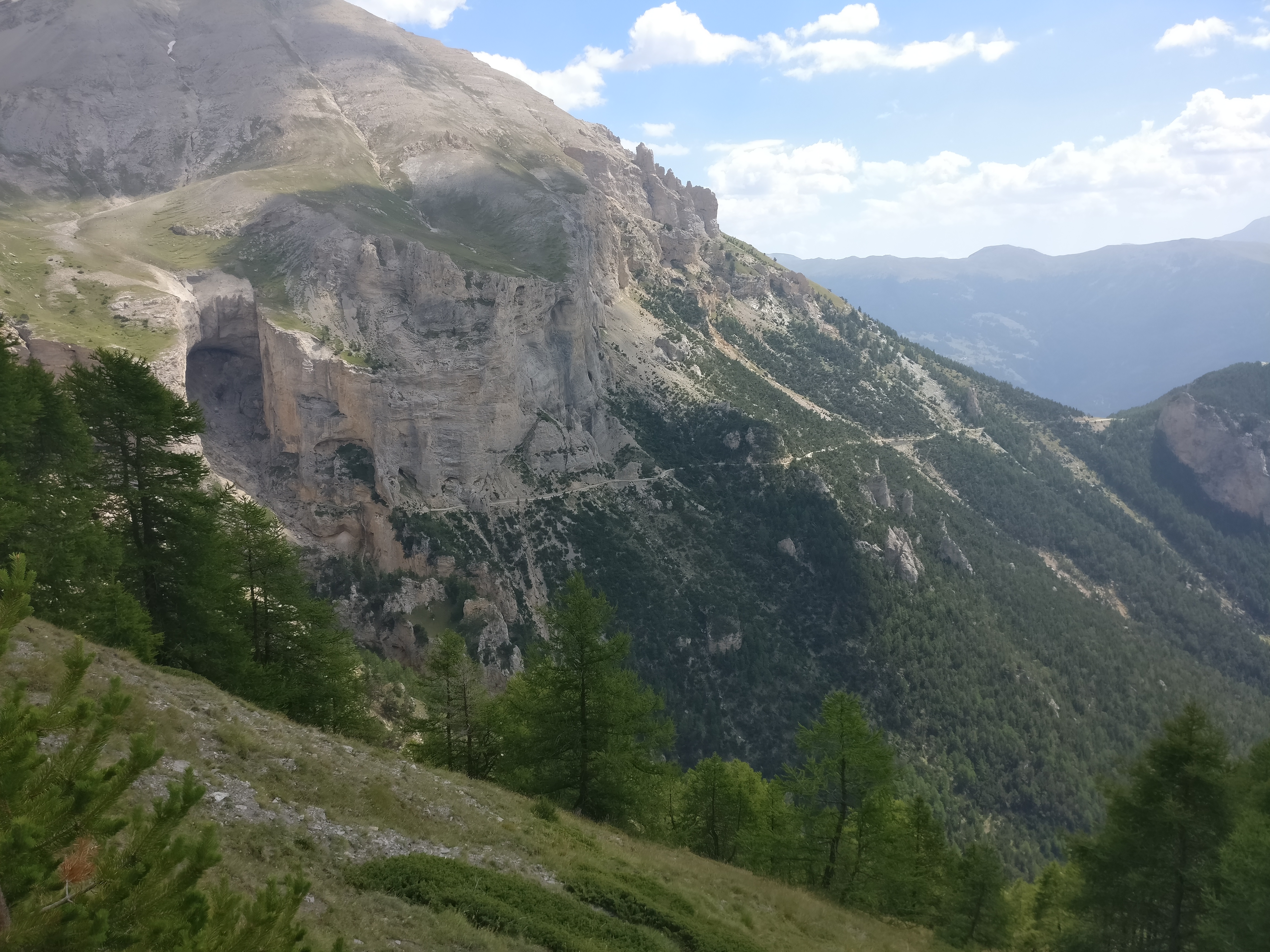
The way up was at some points comparable to the Pointe Sommeiller – very rocky, steep, with tight hairpins. Good thing that there were signs at the bottom warning that the road was not suitable for cars.

Halfway up I spotted a vehicle coming down. It has C-shaped DRLs on the bumper, so at first I thought it was a facelifted Renault Captur and thought to myself that it was one brave driver to take a front wheel drive SUV on road tires on a road like that, but when I got closer I realised, to my surprise, that it was a Passat GTE! A sports hybrid with very low ground clearance. If that were my own car, there would be no way on Earth I would put it to such punishment. I guessed they must have come up the other side, which was supposed to be much easier, crossed the tunnel and decided to continue down this valley. Bad idea.

A few corners later I reached the tunnel entrance. It was a narrow tunnel, with some old metal doors to close the entrance covered in old painting that read ‘circulation interdite’. It did not seem to be very ‘interdite’, as in a few minutes several 4x4s and motorbikes came out of it.

One of them, a Dutch guy on a GS1200 Adventure, stopped to take some pictures and I approached him to ask about the state of the tunnel and we started talking. He was travelling with his wife and they were staying in a house in Creveux, the first village down the valley. He left her there and come up to see if the road was easy enough to come up again with her as a passenger. It was the first GS1200 I had seen on the trip shod with proper offroad tires (TKC 80s) and going offroad. The guy was really nice, and since we were going in the same direction, he declared me his ‘friend for the next hour’ and offered to ride down together.

The tunnel was wide enough for just one car, so we waited to make sure nobody was coming the other way and rode into it. It was half a kilometre of very wet and muddy ground and total darkness, but my tires performed admirably and I had no problems.

Once out the other side and on the way down, I understood why the Catalans I had met the day before had insisted on doing the route this way – the views were much nicer on the way down on this side, with some imposing cliffs in front of us.

When we found tarmac again we stopped to exchange contacts so that we could send each other the videos we had shot while riding down, and he called his wife to tell her to get ready to ride up the tunnel with him and to order a couple of cold cokes for us, then invited me to follow him. I couldn’t refuse!

We relaxed and chatted for half an hour in the terrace of their guesthouse in the tiny village of Creveux, and as I was leaving for Briançon, they headed back up the tunnel.

Col counter:

29. Col de l’Echelle 1762m

30. Col du Sommeiller (off) 2993m

31. Col du Parpillon (off) 2637m

Advertisement

Forte Jafferau and Strada dell’Assietta

Day 5 – Friday 4th August – Offroad routes and back to Briançon (259km)


I did not really fancy going offroad today. I was travelling alone, which always entails an extra risk and in less than two weeks I was going on holiday with my girlfriend, a trip she had been planning for a long time and was really looking forward to, so I knew for a fact that if I happened to fall in the middle of nowhere in the Alps and get injured, my biggest problem would not be getting help there, but having to face her wrath when she found out our Asian adventure had to be cancelled. By four in the afternoon, however, I was blasting along the best trail I have ever ridden, breathtaking views to both sides of me, and thinking that going offroad was the absolute best thing you can do on a motorbike.

Most of the offroad routes I had found were located in the same area in Italy just across the border from Briançon, all of them well-known to the offroading community. In fact, a couple of Germans I met on the mountain later confirmed that this is the only area where you can go offroad on a motorbike, the rest of the Alps are choke full of restrictions.

My thorough online research (about half an hour on ADVrider forums while my summer course students were writing their exams) had turned out six interesting routes. I thought I could do three that were close to each other in the morning and then two more in a different area in the afternoon, maybe even the third one if I was inspired.

Once again, as the guys from Top Gear would put it (the good ones, not their replacements) I was ambitious but rubbish.

The first route I picked was the ascent to Forte Jafferau. The fort is an impressive construction perched atop a 2775-high metre mountain, Mont Jafferau, built by the Italians in 1896 and operative until the end of WWII, when it was destroyed by the French as part of the peace treaty conditions. The cable car that brought supplies to it from the valley is long gone, but the military road that leads up to it is still there and still belongs to the Italian army. Open to general traffic, it makes for a compelling offroad ride to one of the highest points you can reach on a motor vehicle.

There are three different ways to get to the fort: two start from the town of Millaures – one through the service roads of a skiing resort and the other one the old military road, the Strada militare n.218. The other one is the other end of the strada militare, starting in the town of Moncellier. I wanted to take the latter because it had an element that made it particularly interesting – shortly before joining the road coming up from Millaures this route burrowed under some cliffs in what was known as Galleria del Siguret, an unpaved tunnel with a steep uphill section that was always wet and slippery and which had a fearsome reputation.

I rode to the town of Moncellier first thing in the morning to try and avoid the heat that seemed to have set all over the Alps, and right at the junction that marked the start of the military road I found this sign:

My Italian is pretty limited, but I understood that the tunnel was closed to all kinds of traffic, including pedestrians, due to risk of collapse. I was not so clear about the ‘divieto di transito’ bit between kilometres 13 and 14. Did that refer to the section that was closed? Did it mean that there was a diversion bypassing the tunnel? I had no phone signal, so I could not Google-translate it nor text my sister, who is fluent in Italian. I thought that, since I was already there, I might just as well ride up and find by myself whether the road was passable or not.

As with any sport, I find that I need quite a while to warm up and be comfortable with offroading. I disconnected the ABS and the traction control and started riding up the track, feeling that it was a bit complicated for my liking. It was narrow, some parts were steep and there were loose stones here and there. But that was just because I was cold and needed some stretching.

After a while I grew more comfortable and started to enjoy it. Most of the road went through the forest, so there were no views to talk about, but from time to time I would catch a glimpse of the valley below and realise what a sheer drop there was to the bottom. Good thing that the forest was thick! My mind was already in full offroad mode when I reached a small col and found a line of rocks blocking the road and yet another sign announcing that the road was cut (this was the third one, in case I had not got the message), so, feeling brave, I decided to ignore the signs and the rocks, risk a fine from the Italian army (the signs said that it was an army decision to close the road), and ride on to see if the tunnel was passable.

I rode past the rocks and immediately found that the road had not been maintained from that point onwards. There were more ruts and rocks and some fallen trees, most likely downed by avalanches, intruded onto the road every now and then. I made my way as far as I could, but a small landslide stopped my progress a few hundred metres before the tunnel entrance. If I had been riding with more people we could have probably helped each other over the pile of rubble blocking the road. I tried on my own, but was too close to the edge for my comfort, a small mistake would see me fall down the side of the mountain, and with no phone signal and not a single soul on this route (people probably paid more mind to the signs than I did) that was a thought I did not relish. So I laboriously turned the bike around and gave up on that route, making my way down to the main road much faster now that I was already confident offroad.

Less than an hour later, I was at a road junction past Millaures looking at the same sign – Galleria del Siguret chiusa, pericolo crollo, blah, blah… but the route on this side reached the fort without having to go through the tunnel, so up I went. A good sign was that there was a lot more activity on this side of the road – mountain bikers, a few 4x4s parked by the road, a road maintenance crew working… The first section was a bit daunting – a series of very steep sharp corners that, while not a problem on the way up, could be difficult to negotiate on the way down, and as far as I knew at that point, with the tunnel closed there was no other way down. Just where the forest started to clear there was a small fort overlooking the valley, and I stopped to take some pictures. While I was busy exploring the place, a guy in a series 1 Africa Twin came down the road, turned into the fort, rode up some impossible path up the hill behind it, down an even more ridiculous rut and off again down the road I had come up by. I felt like a complete noob.

I went on and soon found a group of four guys – two Germans and two Italians – who were stopped at the intersection where the road went down to the tunnel. From there I had a perfect view of the col I had ridden to earlier in the morning, the road cutting across the mountain side to the tunnel and the tunnel entrance, with a big pile of rubble blocking the access. So, even if I had made it past the landslide, I would not have been able to ride through the tunnel. I joined that group for the rest of the way up to the fort, which was easier than the first bit through the forest.

The top of the mountain was busy – several 4x4s, lots of mountain bikers and a herd of sheep whose enormous shepherd dogs tried to bite my leg off as I rode past. The last stretch up the fort had been paved with stones once but was now so broken that it was horrible to ride, the bike shaking so violently that it felt as if something or other was going to fall off. The AT held together like a champ, though, and I made it to the col just below the fort without a hitch.

Being a mountaineer as well as a biker I thought that it was only decent to do the last hundred metres to the top on foot, so I left the bike there at the col and reached the fort and the summit of Mont Jafferau walking.

From the top, it was easy to see why the Italians had built a fort there. It offered a commanding 360 view, and its eight cannons must have reached far into French territory. As I was enjoying the view, a KTM and a new Africa Twin arrived and I overheard the riders speaking Catalan. If there is one thing you can be sure of, is that wherever you go in the world, you are likely to find a Catalan tourist. I was just not expecting to find some up here! It turns out they were from Tarragona, and had been already doing some tracks on the area for a few days. They had also tried to get to the tunnel but from this side, with no more success than I had had.

As I was saying goodbye, a big group arrived on quads from the other side of the fort. They had come up through a skiing resort on that side of the mountain, a route that I was thinking of taking not to repeat the same way down. I asked them about the state of the track, as the Germans I had met earlier had told me that they remembered it steep and rocky from past years, but these guys told me that it had just been redone by excavator, so there was no problem to ride it.

Well, redone it might have been, meaning that there were no big rocks on the way, but that did not make it any less steep. Not only that, the terrain was loose because of the ATVs and 4x4s, so it made for a very, very scary way down. I used first gear, trail braked with the back wheel, went as easy as possible with the front brake, and sweated and swore a lot for most of the way. I am by no means a talented offroad rider, rather the opposite, and I am sure that all credit for me making it safely down that track has to go to the bike and the Mitas tires, both of which performed admirably on those conditions.

I found a picnic table in the shade just outside Millaures and studied the list of offroad routes I had compiled while I was having lunch. My legs, arms, and back were sore from the way down, and for a second I was tempted to call it a day, but I felt that I still had time and it would be a pity not to do at least one more route, so I choose one that was not too far and did not seem too complicated from what I had read: the Strada dell’Assietta, a track along mountain crests between the Val Chisone and Val di Susa, also built by the military. More or less opposite where I had just been, it was supposed to have some of the best views in the area.


I rode to the skiing resort of Sestriere and, right where the road began, I saw another road sign announcing that the road was closed. Damn! I read the small print (only in Italian), and I guessed that what it said was that the road was closed on Wednesdays and Saturdays. Or was it from Wednesday to Saturday? Anyway, there was nothing blocking the access, so I went for it.

The ride reports I had found about this road put it at a similar level of difficuty as the route to Forte Jafferau but it was far from it. Maybe I was already fully into an offroad mindset, but this was a very easy track to ride with some of the best views you can find in the Alps. At just over 30km long, there is also plenty of time to enjoy it, and enjoy it I did. I stopped often to admire the views, had lots of fun riding the faster sections, and by the time it was over, there was no one in the world happier than me.

I joined the road again in Pourrieres, rode back to Sestriere and from there to France through the Col de Monegenèvre again. Riding down to Briançon I was stuck behind a very, very slow driver in an Audi A4 Allroad, and got so bored that I had these idea – I should start a charity that rescues good cars from shitty drivers. It is a shame that so many nice cars end up in the hands of lousy drivers than never drive them as they were meant to, so this organisation would take the cars away from them, find them new houses with keen drivers that would make sure they are driven properly and taken care of, and replace them with something more in line with their level of skill behind the wheel, such as a small Korean hatchback, a Kia Turd or a Daweoo Larvae. What do you think?

Back at the campsite there was one last surprise to round off a perfect day. Just as I sat at the terrace of the bar, ready to order a well-deserved beer, I spotted Harald, the German guy that I had met in Séez and who had recommended this place. He joined me at my table and we had a few beers together and talked about motorbikes and travels.

Col counter:

21.Col de Montegenèvre 1850m

22. Colle Basset (off) 2424m

23. Colle Bourget (off) 2299m

24. Colle Costa Plana (off) 2313m

25. Colle Blegier (off) 2381m

26. Colle Lauson (off) 2497m

27. Colle della Assietta (off) 2474m

The highest pass in the Alps

Day 4 – Thursday 3rd August – Séez to Briançon (227km)


Taking things easier is definitely worth it. Today I rode the second half of the route to Briançon, which I wanted to do in one day. Is it doable? Sure. Is it worth it? Definitely not. You might easily cover the distance in one day, particularly if you want to enjoy a good blast up the cols, but then there is no time to stop at the top of each one, take pictures, enjoy the view, chat to other bikers, have a drink, check the map, stretch your legs and rest for a while…

So take it easy I did. Even though I only covered 227km today, I got to the campsite in Briançon at about the same time as the previous days but a lot more relaxed, having enjoyed each and every one of the cols on my route today.

I set off an hour later than usual because I wanted the tent to dry up a bit – I hate to put it away damp – and used that time to enjoy a chat with a German biker who had camped next to me. We talked about the heat, riding routes in the region, motorbikes and so on, and he recommended a good campsite in Briançon.

Out of Séez, the D902 was full of traffic. I almost immediately run into a long, slow moving line of cars, vans, lorries, etc. which I started to overtake one by one as soon as there was a bit of straight road. It turned out that the reason for the hold-up was heavy lorry carrying an excavator – once past it, the road was mine and I enjoyed it to the fullest… until I heard the GoPro give its dying beeps, signaling the moment to replace the battery. ‘Not now!’ I thought. The ascent to Col d’Iseran, the highest in the route, was about to begin and I did not want the lorry and the dozen cars behind it to pass me. I pushed harder, hoping to open a gap big enough to be able to do a quick pit stop and keep my rivals behind me, F1 style. I pulled over when I reached Lac du Chevril, but then the views were so nice that I had to take a few pictures, completely neutralizing the advantage I had.

Sure enough, the lorry emerged from a tunnel down the road, it’s engine grumbling with the effort of carrying so much metal up the mountain and, to my surprise, it stopped where I was. He was letting cars pass, I imagined, a courtesy I had seen other trucks show towards the rest of road users, and a gesture many motorhome drivers should learn a lesson from. For the first time in the journey, it was getting quite cold, especially with all the vents in the suit open, so seeing that it would not get any warmer further up, I decided to take the chance and set about securing fasteners and closing zips. I was about to finish when I heard the air brakes of the lorry hiss, I turned around and saw it jerk into motion again and pull out in front of me while I gaped at it like an idiot with my jacket half done. Damn! The good news is that once I reached Val d’Isère, the famous ski resort, most of the traffic, including the lorry, disappeared, leaving the road clear for the guys in two wheels.

Col de l’Iseran, at 2,764m (the sign there reads 2,770m), is the highest paved pass in the Alps and offers impressive views over the Vanoise national park.

A lot of bikers had congregated there, but among all the machinery what drew my attention was a couple of 125cc motorbikes who had bravely made it all the way to the top, as well as a couple on a BMW who were travelling with a dog! Sporting a pair of Doggles, of course.

On the way down the road crosses the village of Bonneval-sur-Arc, a quaint cluster of typical alpine wooden houses that is as representative of the area architecture as it gets. Past the village the valley opens wide and the road travels through pine forests, gently losing altitude. So gently, in fact, that I almost missed the next col, one I was curious about. According to the map, it was called Col de la Madeleine, but I had already crossed a col with that name two days ago. Being a complete ignorant in Tour de France matters, I did not know which was the famous one and I wanted to compare them.  This one was nothing more than a slight bump at the end of the valley before the road went down to Lanslevillard, a rather flat affair with just a road sign indicating its existence. I guess the other one is the famous one, then.

Past Lanslevillard I took a small detour to the right. I had time and there was a col on one of the alternatives to the main route that I wanted to see, Col du Mont St-Cenis. I don’t know why I had decided that it was worth a detour, I did not know anything about it, maybe it was just instinct but it is definitely worth the time. The road was nice and empty, gaining altitude through a forest with some skiing slopes in it, and the col had beautiful views over the valley I had just left below but the best part was beyond the col – there is a beautiful lake with several forts along its shores. I decided to ride down to the dam and have lunch near some ruins overlooking the water, and that was how I ended up doing some unexpected bit of offroading.

A dirt track turned off the road above the ruins and I could see cars down by the water, so I figured it would be easy to get there and turned into it. The first few hundred meters were fine, but then I found a section with some ruts – that would not have normally been a problem, but I was going down and I had a fully loaded bike, so I was not entirely comfortable. However, there was no space to turn around, so down I went. To my relief, it was only a short bit, and then the track became easy again by the ruins. I stopped and had lunch enjoying the view and congratulating myself for my offroad prowess.

I took the same way back to the main road, which was rather unremarkable for a while. I stopped for supplies in Modane (cheese and wine, bien sûr!) and then headed for the next two cols of the day – Col du Télegraphe and one called simpy ‘Le Col’.

Feeling a bit drowsy after lunch, I decided to take a break in the bar at the top of Col du Télegraphe and order a coke. While a was there, three rather big old guys in Suzuki Intruders 250 pulled up, sat at the bar and ordered three beers. Way to go! I left and reached the town of Valloire without seeing the oddly named ‘Le Col’.

Two more passes to go only before the end of the day – Col du Galibier and Col du Lauteret. The ride up the first one was serious stuff – very tight hairpins, steep sections and sharp drops with no protection whatsoever but you know, no risk no rewards, and this was my favourite so far. It may not be the tallest, but it only lags about 100m behind Col de l’Iseran and has amazing views to both sides of the col, with a last section so steep that there is a tunnel to bypass it a few hundred meters below the top. Not that the tunnel helps much, mind you. With heavy wooden doors at its entrance, it is so narrow it only has one lane so traffic is regulated by a set of traffic lights. Oh, and caravans, vehicles taller than 4m and/or heavier than 19 tonnes cannot use it, meaning they have to negotiate the heart stopping last section at the top. A legendary pass.

The roads then leads down to Col du Lauteret, which I had crossed in 2013 on my way to conquer (or fail to conquer) the road to Mongolia. It was the only pass I crossed on my way east and I found it amazing. Coming down from the Galibier, however, it was rather underwhelming.

All that was left to do for the day was coast down the main road to Briançon and find the campsite that Harald, the German biker I had met in Séez, had recommended. Oh, and find a workshop where I could borrow some pliers. My stove was running out of fuel and with all the going up and down high passes the pressure differential had made it completely impossible to unscrew the filler cap.

I stopped at a petrol station in La Salle-les-Alpes, filled the tank, squirted some petrol into a plastic bottle for the stove and went over to the garage next door to ask if I could use their pliers. Only when I was going back to the bike did I notice that the place looked familiar. I had stopped to fill up in this very same place in 2013!

The campsite was just outside Briançon, but I had to cross it first, and it was hell. Temperature was over 30ºC even at this height, and there was a never-ending traffic jam in the centre. The campsite was nice, though, and I put up my tent ready to spend more than one night in the same place since the beginning of my trip. The following day I was going to remove the panniers and head to some of the offroad trails I wanted to do.

Col counter:

14. Col de l’Iseran 2764m

15. Col de la Madeleine 1746m

16. Col du Mt-Cenis 2081m

17. Col du Télégraphe 1566m

18. Le Col 1530m

19. Col du Galibier 2642m

20. Col du Lautaret 2058m

La Route des Grandes Alpes

Day 3 – Wednesday 2nd August – Bellecombe-en-Bauges to Séez (292km)


The campsite, called Les Framboisiers (hence the name of the dog), was wonderfully quiet and sleeping on mushy grass was a lot more comfortable than the hard, dry ground of the night before, so I woke up feeling refreshed and ready for a very long day of riding.

First, I had to make the remaining 90km to Thonon-les-Bains, where the route proper started. After leaving the campsite I crossed the second pass on the area, Col de Leschaux, and then rode down to Annecy. The city was beautiful (once again my GPS opted for the sightseeing route across the centre), but the ride from there to Thonon-les-Bains was rather forgettable – mostly motorway and a slow drive along a route nationale packed with delivery lorries, slow moving caravans and elderly people in small Peugeots.

This time the GPS did the right thing and took me to the starting point of the route, in the D902, instead of some neighbourhood in Thonon-les-Bains (maybe I am programming it wrong?)

I was very excited to finally be on the route, but compared to the roads I had been riding so far, the beginning was a bit of a disappointment – the D902 is a fairly important thoroughfare and, at least until Montriond, there was a lot of traffic. But don’t despair if you come to ride this route, things get better soon. Be patient and be careful, there are a lot of local people using this road and some of them are in a hurry – I saw some pretty on the limit overtaking in just a few kilometres, so do not take risks.

This bit of road passes through the Col des Gets, the first one in the route, but it is quite an unremarkable one (I actually did not realise I was there until I had passed it, so there are no pictures of it). The road then goes down to Cluses, where most of the traffic disappears onto the A40 heading for Geneva or Chamonix. From there on, the route takes a much smaller road, the D4, up to Col de la Colombière. Once more, this was the cyclists and bikers’ territory, the odd car quickly overtaken with a burst of acceleration as soon as there were a few metres of clear road ahead. In such narrow roads it is important to make sure the cars know that you are behind them and have the intention to overtake, as there is not much space, there are usually sharp drops with no protection whatsoever and the driver is usually distracted gazing at the amazing views, so you could be easily pushed off the road while overtaking. Always use the indicators, flash your lights or even sound the horn before starting the manoeuvre, use the shortest gear possible and watch out for cyclists coming the other way.

The col was rather narrow and there were a lot of cars parked at the top, as it is the starting point of many hiking routes. I stopped to have a rest, had some fruit while enjoying the views and went on my way down the other side.

The next one was Col des Aravis. A lot of hiking routes started from this one too, and in the distance, covered in snow, the Mont Blanc rose majestic, a sight to behold.

The descent down the other side of the col was gentle, across vast open fields of grass dotted with barns and wooden houses that seemed to have come out of a postcard. At the bottom of the valley I crossed the town of Notre-Dame-de-Bellecombe and started the ascent towards le Col des Saisies.

This one was flat and open, and had a skiing resort that, unlike some others that were closed in summer, was bustling with activity. I stopped, sat under a tree and took out the map to study the situation. It was well past midday and I was already getting tired – these roads were taking their toll, riding close to 500km day in day out was not an option here. I had been considering the idea of splitting the way to Briançon in two, and I thought that it would make for more relaxed riding, as well as giving me more time to write at the end of the day, so I decided to ride one more pass and then look for a campsite.

On the way down from Col des Saisies I noticed that I only had one bar left on the fuel gauge, so I thought that I would look for a petrol station once I reached the town at the bottom of the valley. Once there, however, there was no petrol station to be found, at least not in the direction I was heading, so I decided to take the risk and ride up the last col with the fuel I had left. To my surprise, I made it past the beautiful Lac de Roseland, across the Cormet de Roseland pass and down to Bourg-St-Maurice with fuel to spare. I was expecting the fuel light to come on on the way down, as I was past 300km, but it didn’t. Not only that, but when I filled up the tank only took a bit over 14 litres, meaning that there were still more than four left.

It was mid-afternoon as I left Bourg-St-Maurice, but it was tremendously hot down in the valley, and coming up next was Col de l’Iseran, the highest one on the route, and one that I wanted to enjoy, so I decided to call it a day and stopped at a campsite in Séez. It was quite a big place, the first with a bar, so I treated myself to the first beer on the trip, which did not help with the writing.

Col counter:

8. Col de Leschaux 897m

9. Col des Gets 1170m

10. Col de la Colombière 1613m

11. Col des Aravis 1486m

12. Col des Saisies 1650m

13. Cormet de Roseland 1967m

I am from Barcelona

It’s well past two in the morning halfway round the world and for the last four hours I have been glued to the screen of my phone following the news. Barely an hour before hearing about the terrorist attack in my city I was chatting with a Japanese I had just met and he mentioned the ISIS attacks in Europe. I told him Barcelona had been spared so far. So far.

I am deeply saddened by this meaningless act of violence but proud to see the solidarity that the people of Barcelona have shown in these hard moments, and I am even prouder to see messages of support coming in from all over the world. I have yet to visit a place where the mention of the name of my city did not elicit a friendly smile. That spirit will not be broken. The world is welcome at Barcelona and Barcelona is welcome in the world.

Framboise

Day 2 – Tuesday 1st August – Sahune to Bellecombe-en-Bauges (404km)

A short ride to lake Leman?

Nope. Not at all. In fact, as I write these lines before going to bed, I am still almost 100km from it, but I don’t regret a single thing, today’s route has been just marvellous.

My Exped mattress died and by the time I decided to do this trip it was too late to get a new one, so I took one of those self-inflatable mats. I takes up twice as much space as the Exped and is about five times thinner, so if you sleep on your side, like I do, it is very uncomfortable. Add to that a very hard ground on the campsite and heat that did not give up all night, and you can imagine how much sleep I got. At 8:00 I had already packed everything up, eaten breakfast and was ready to go.

The night before I had been studying the map and saw that even though it claims that the route has 21 mountain passes, in fact it is not possible to ride them all without having to double back, as there are alternative routes besides the main one that take you through those other passes. While planning the route the night before I thought that it would be a pity to miss some of the legendary ones, like the Col de la Madeleine, so I decided to plan a bit of a scenic route.

The ride to Gap was as good as it gets – just past Sahune the road was amazing, the air cool and the music on my iPod spot on. This stretch of the D94 between Sahune and Serres is a blast. When I reached Gap the GPS sent me through the ring road to avoid the centre, only there isn’t one, so it creatively made one up through some residential neighbourhoods. I ignored it as soon as I realised what it was doing and took the proper route (which does indeed cross the centre). I left northbound on the legendary Route Napoleon – yes, the same one as in the Bond movies, but not the bit in Cannes – which goes all the way to Grenoble, but I left it shortly after, in Corps, to take a smaller road to Sainte-Luce and the first pass of the day – the Col de l’Holme.

A very narrow mountain road took me up and down thick forests and I crossed two more passes – Col de Parquetout and Col d’Ornon – before joining the main route in Allemond and heading to the first two serious passes – Col du Glandon and Col de la Croix de Fer.

Right after Allemond it was clear I was in hairpin paradise. The road up the valley past the impressive Lac de Grand Maison was the exclusive preserve of cyclists and bikers.

There was the odd car here and there, but never had I seen a car look so out of place on a road. At the top of both passes, dozens of exhausted but thrilled cyclists were taking pictures next to the road signs. I too took a picture but, seeing them, I almost felt as if I did not deserve it. I must say that I have the utmost admiration for all the people I saw today cycling their way up those roads.

From the top of the Col de la Croix de Fer I could see thick clouds gathering ahead, so I hurried down the other side, hoping to outrun the rain that looked certain to come. The way down to St-Jean-de-Maurienne was, if anything, even more impressive than the ascent – narrow, steep, with impossibly deep gorges. There were far fewer cyclists attempting the pass from this side, but those doing so must have been superhumans.

Back at the bottom of the valley, I could have taken the A43 and ride north to my final destination, as it was getting late, the sky was growing darker and I was tired. On top of that, the muscles on the left of my chest were aching, possibly from the night before but my scenic route for the day was not done, there were three more passes to go, among them one that has become a household name – the Col de la Madeleine. I left the A43 and started the ascent on a winding road through a thick forest. The hairpins were tight, but the road was not as narrow as the one I had taken to the first passes in the morning. Then, it opened into a vast lush green valley and wound its way to the top with amazing views. The storm clouds were still looming behind me but, so far, I had managed to stay ahead of them.

As I was taking pictures at the top of the pass I saw two couples from Spain on two Super Ténérés, one of them a blue First Edition just like the one I got stolen. I approached them and as we got talking and I told them the story the guy on the blue one said it sounded familiar. It turns out he got his from the same dealer that was selling mine, and he had told him my story! The world is indeed a small place.

Riding the Madeleine meant a detour to Albertville and then having to ride southwest before going north to Annecy. As I was riding down I saw curtains of water in front of me – the rain I had so far been escaping was right there on my way, waiting for me. The tarmac was soaking wet, showing that this was a classic summer downpour which would get me wet in a matter of seconds. Fortunately, just before I reached the rain, the GPS told me to turn right into another valley where the sky was not so dark. It was the way up the last two passes of the day – Col de Frêne and Col de Leechau. These are part of another one of the detours on the Route des Grandes Alpes and they are on a small road with no traffic at all. After passing the Col the Frêne I stopped for petrol in a village called Le Châtelard, and no sooner had I finished filling up and was ready to leave than the skies opened and the rain that had been chasing me for the last few hours finally caught me. I took refuge under the marquee of the Carrefour supermarket next to the petrol station and waited for the rain to pass as I checked the weather radar on my mobile.

The rain clouds were moving fast behind my position, and I could see that the sky was clear in the direction to the next col, so as soon as the rain stopped I left. Shortly after the village the road started climbing in and out of the forest, and then, on a long sweeping corner across a steep field of grass I saw a small campsite above me. I still had about 90km to go before reaching lake Leman, but I usually trust my instinct when it comes to choosing a place to spend the night. I often pass several ones just because they don’t feel right, and this place seemed just perfect. Besides, it was already 18:00 and I was tired, so I turned around and headed up the lane to the entrance.

It was a tiny campsite, with only a handful of lots, perched at the top of a hill overlooking the valleys of the Massif de Bauges natural park. I planted my tent near the bottom, with great views, had a shower and went to enjoy the luxuries the campsite afforded.

By luxuries I mean that, unlike the previous one, this one had a picnic table where I could have dinner, a socket to charge the camera batteries, wifi and a sort of reading room where I could sit down to write a bit.

As I was cutting the first slice of sausage I was going to have for dinner I felt a presence nearby. I turned around, the bit of sausage still in my hand, and saw this:

It wanted to become my new best friend since I had meat and cheese, and did not take its eyes off me for a second. Hypnotised, I couldn’t help but give it some, which only made things worst. A little girl came to get the dog, but she (it was a she, the girl told, me, and was called Framboise) refused to leave. Only when I had given her some more, finished eating and packed away the food did she answer the insistent calls of her owner.

Col counter:

1. Col de l’Holme 1207m

2. Col de Parquetout 1382m

3. Col de l’0rnon 1371m

4. Col du Glandon 1924m

5. Col de la Croix de Fer 2064m

6. Col de la Madeleine 1993m

7. Col du Frêne 950m

Hot stuff

Day 1 – Monday 31st July – Barcelona to Sahune (555km)


Travelling my motorbike attracts good vibrations. I have found that it is certainly one of the best ways of meeting new and interesting people, and as I was loading the bike, parked in front of my apartment, I was looking forward to the next few days on the road. What I was not expecting, though, was the first meeting to happen even before getting on it.

“You live here, right?” I heard someone ask me. I turned around, surprised, as most people enquired about the bike, and saw a tall young guy holding a helmet. He pointed at a KTM 1150 Adventure R parked across the street and said “That one is mine”. I had seen that bike lots of times and wondered who the owner might be. It had knobbly tires and mud splattered here and there, showing it had been put to its intended use. He introduced himself as Marc and told me that we were neighbours. We chatted for a while and promised to go out for a ride after the holidays.

I refused to pay tolls on the motorway here, so I headed to Ripoll to cross the border in Prats de Motlló, which is a much nicer route that the one all holidaymakers take along the A7. For the first few miles I followed the exact same route I take to work every day, leaving the city amidst the tide of early Monday morning commuters, but instead of being just another anonymous road user, I noticed that people were looking at me and the bike, noticing that I was going someplace else. Once away from the big city the sun came out and I thought the weather was perfect – clear sky, getting warmer but not too much as I was gaining altitude towards the Pyrennees… I was lost in thought when I noticed a black Alfa that had pulled alongside with two beautiful girls inside. The passenger smiled at me, took a picture with her phone and gave me the thumbs up. Hell yeah!

I stopped for petrol just before starting the ride up to coll d’Ares, the mountain pass that thousands of people desperately crossed in the winter of 1939, fleeing from the advance of the fascist troops in the last months of the civil war. Opposite the petrol station, there was a police patrol fining a French biker that had been caught by a speed camera in a hidden car a couple of kilometres down the road. Fortunately, a van coming the other way had warned me and I had slowed down just in time.

I rode down into France through the gorges of the river Tech, always a nice route. When I reached Ceret I turned north into a small country road because I wanted to go a bit further before taking the autorute, and I discovered a few beautiful villages. After lunch in one of them (Llauro) with great views over the plains opening to the Mediterranean, it got too hot to enjoy riding, so I took the motorway near Perpignan. The plan was to reach Grenoble, find a place to sleep and do mountain roads the rest of the way to Thonon-les-Bains on the shore of lake Leman, where the Route des Grandes Alps begins.

Near Nîmes, however, I was not so sure I would get that far. The temperature had been creeping up and for a while now it had been a constant 40ºC, I run into a traffic jam where the motorway splits to Marseille, and it did not get any cooler when I joined the A7 towards the north. By Bolène I had had enough and decided to cut east heading to Gap on country roads. I would find a place to sleep near there and complete the journey to Thonon-les-Bains the following day.

Soon after leaving the autoroute things changed radically. I entered the area of the Baronnies Provençales natural park, the temperature dropped, the traffic disappeared and the wonderful French countryside opened before me. I usually say that I don’t like having to travel through France to get to other further destinations, but that is only because I have to do it on the motorway. Riding through these small, quintessentially French villages I remembered what a beautiful and varied country France is.

I passed a few campsites before I found what I was looking for: a small municipal campsite by the river in Sahune. Quiet, cheap and next to a swimming spot. Gap was still a while away, but I was sweaty and tired, so I decided to camp there.


Route des Grandes Alpes 2017 – Intro

After an unusually busy and long month of July at work, the holidays were finally here, and I found myself with two weeks to spend on my own before my girlfriend started hers. I had not had time to plan anything, but I had a vague idea on the back of my mind about a project that I had been wanting to do for a long time – a sort of ride and documentary about a train line that was never completed in the south of Aragón and that I had been exploring. I thought that I had enough time to go and record it now, but two things stopped me – one, I could not find anyone to come help me and, two, a heatwave was passing through all southern Europe, making that already hot area even hotter. Not the best time to find my way along abandoned railroads, then.

I decided to put that off for the moment and look for a cooler destination. The Pyrenees were tempting, but it is a place I can go to any weekend and I have already ridden them from coast to coast, so I decided to go further north – the Alps.

I looked for a nice route that I could do in about a week and discovered the Route des Grandes Alpes – a route that travels through all the high Alpine mountain passes in France from lake Leman to the French Riviera. I also wanted to find some offroad routes in the Alps, and discovered that most tracks are closed to traffic, except for a handful of legendary routes near Briançon, so it was decided – I would ride the route and add a few days of offroad excursions to make things more interesting.