Fog, lightning and Le Tour de France

Day 3 – Monday 28th of July – From Refugi de Conangles to Refugio Casa de Piedra (302km)

There were two dirt track variants to my main route that I had planned to do for the day before, but it had been such a long day that I had not had time to do the second one, another long arch to the north of Vielha starting in the village of Baguerge. The previous evening I had been planning the route and I thought I had time today, but the day was grey and the clouds threatened with rain, so I was not so sure about it. I had breakfast in the terrace and as I was getting everything packed and ready on the bike, a light drizzle started to fall.

DSC_0023

I did not want to get out the rain suit, firstly because I was too lazy, and secondly because according to the weather service there was no rain on the other side of the tunnel, which is where I was headed. I got on the bike and rode fast towards the entrance of the tunnel, as the drizzle turned into more serious rain. On the other side there was no rain but it was still cloudy, so it was time to make a decision. Turn right and go back a few kilometers the way I had come the day before to take the dirt road and risk a downpour turning the track to nasty mud in the middle of nowhere, or turn left and go on with the rest of the route planned for that day, all on tarmac?

I had had great fun in the dirt the day before, and I wanted more. Unlike the tracks I had not found at the beginning of the journey, this area was further away from home, so I would not come back here some other day just to do that bit. On the other hand, I did not fancy having to deal with technical riding in the mud with a heavy bike, all by myself.

‘Man up, Kilian!’ I told myself. ‘You’ve got a beard, and a beard is not just something that grows on your face, you have to earn it!’ So as you can see, I made the sensible decision and headed for the dirt track.

IMG_1237

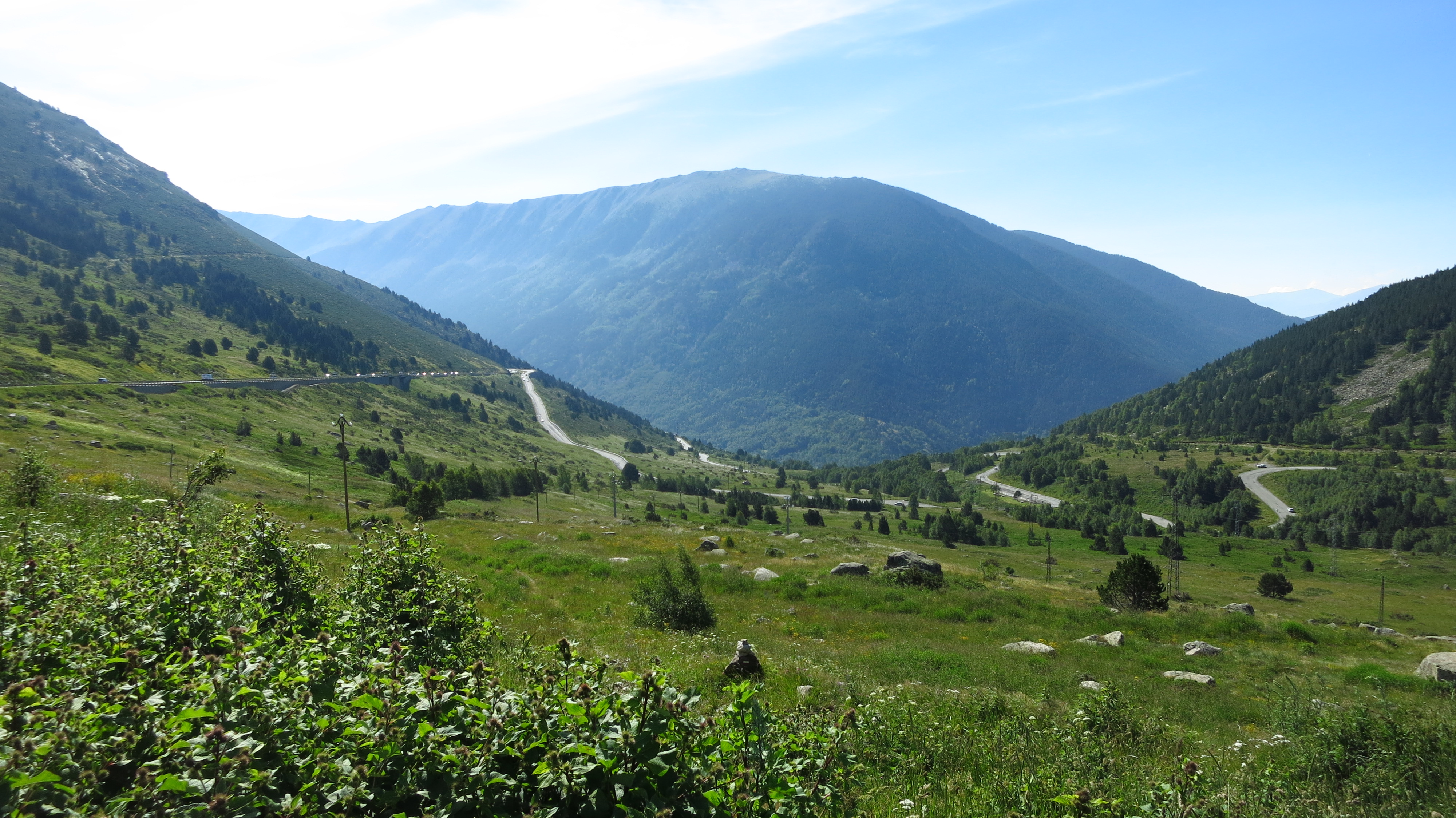
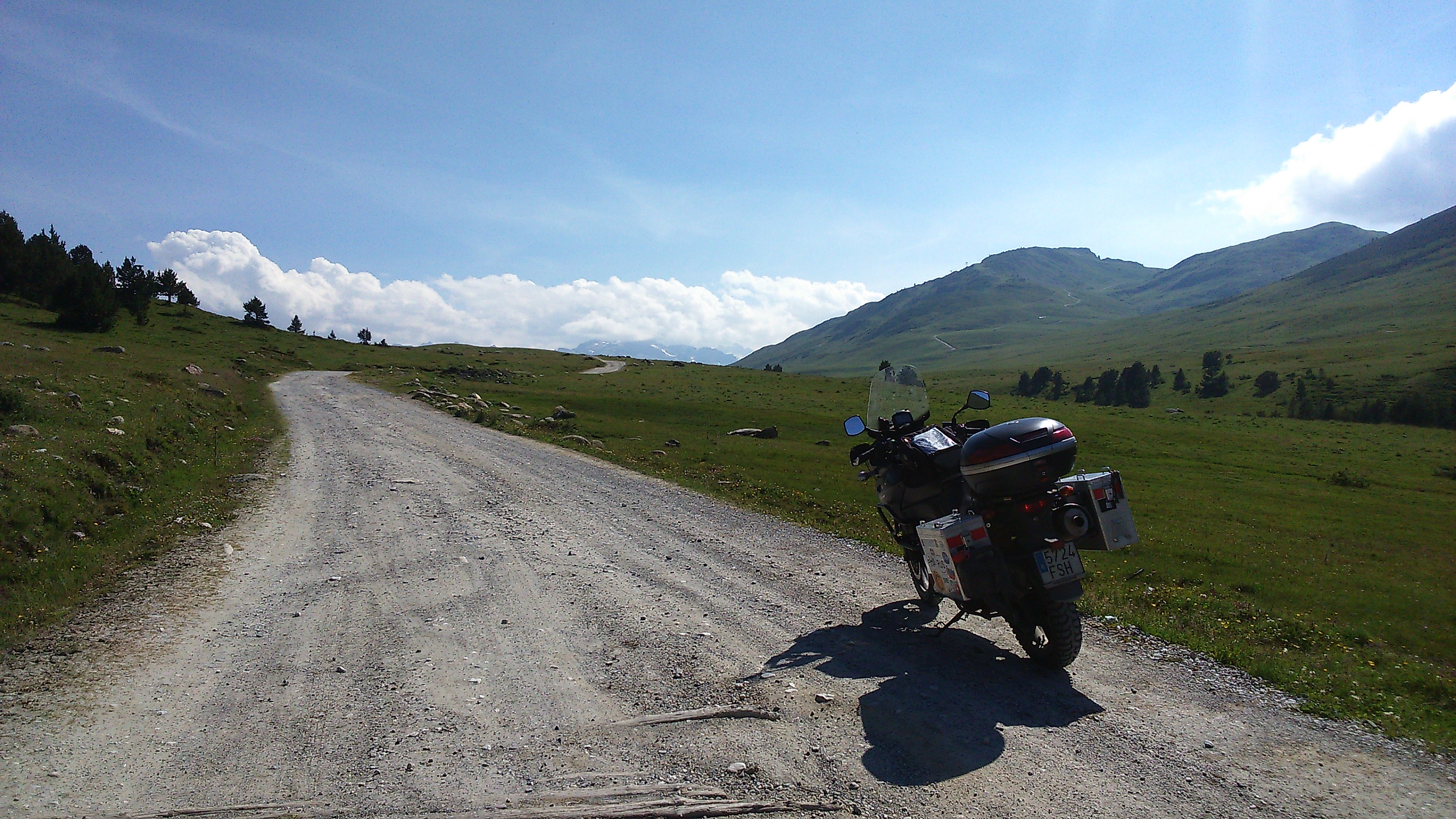
By the time I reached Baguergue, the village where the tarmac ended, it was damp foggy higher up in the mountain, but there was no rain yet. I rode across the village and found a very good unpaved road along the right bank of a river. Past some farmhouses, a small bridge cut across the river and the road turned narrower, steeper, and rocky as it started climbing closer and closer to the fog in a series of tight hairpins, and I had to stand on the bike to negotiate some trickier sections. There was a lot of water coming down the mountain in streams and small waterfalls, and I had to ride across several parts where the streams flowed across the road.

IMG_1239

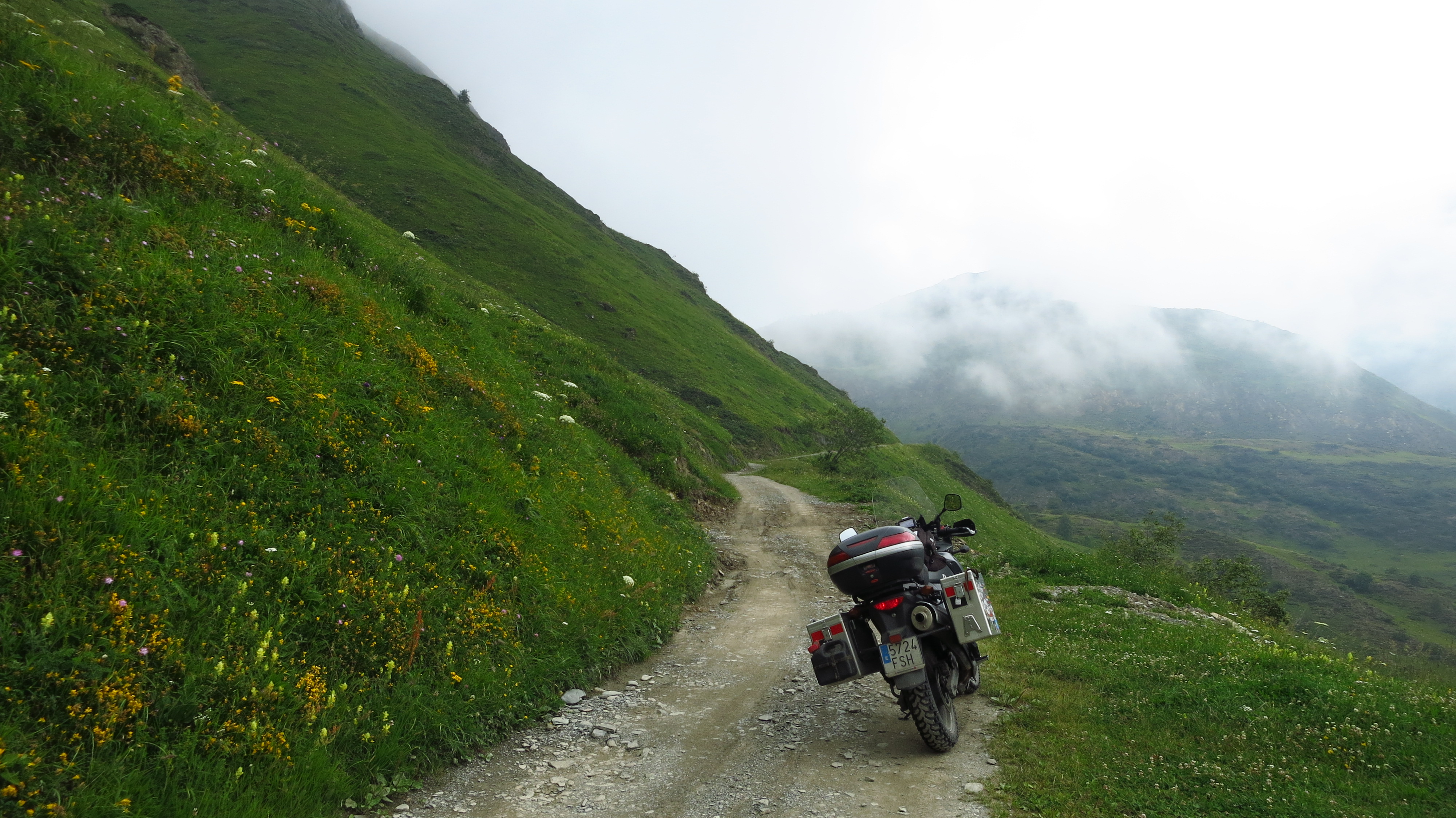
The steep climb turned to a gentle incline that disappeared into the fog further ahead, and I stopped to have one last look behind me – from where I was standing I had a stunning view of the lush green valley below. It had been well worth coming this way.

IMG_1240

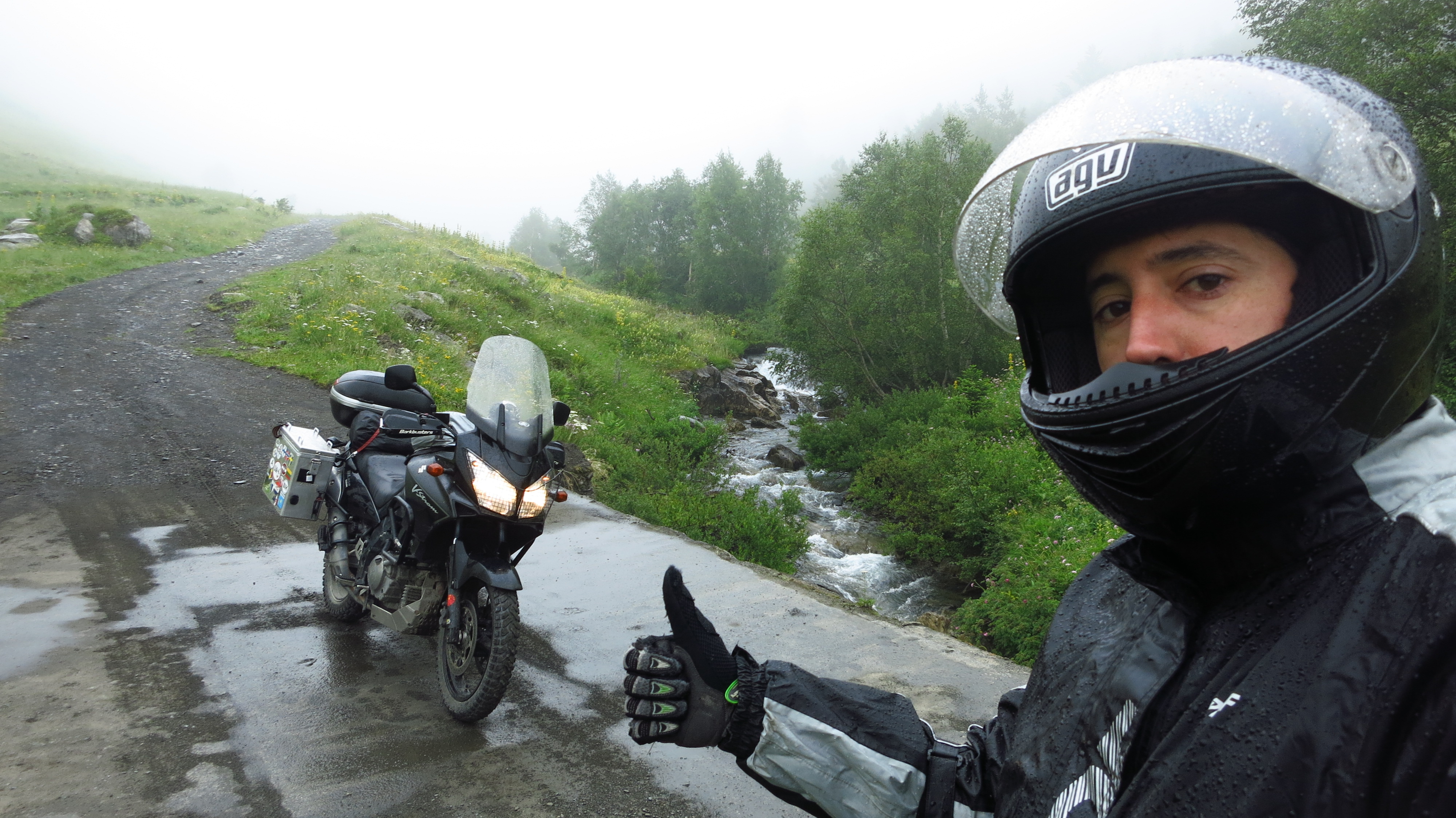
I rode on, and what had been light fog turned thicker and thicker in a matter of minutes, and soon I had completely lost sight of the valley below and the pass ahead. Then a few drops of rain started to fall, and seeing that the weather was definitely not going to improve this time, I looked for a place to stop by the road to take out the rain suit. As I did, it started to pour down, and while I was struggling to get on the suit, there was a flash of light and a deafening thunder. A bolt of lightning had struck somewhere in the fog, and judging from the delay between lightning and thunder, which was virtually non-existent, I guessed it must have been really damn close. I had no idea how far from the top I was, but I feared I was probably there already, and then I realized that I was wet and standing next to over 200kg of the only metallic thing up there. I had never put on the rain suit so fast in my life and I swear that record is going to stick for a long time. I jumped on the bike and got the hell out of there hoping that the road down was not far ahead.

IMG_1243

By now the track was soaking wet, but fortunately it was quite rocky, not the mud I had been fearing, and to my immense relief, the road started to go down almost immediately. I did hear some more thunder, but it did not sound anywhere near as close as the first one, so I imagined the storm was on the other side of the mountain. On this side my problem now was fog – it had turned so thick that I could only see a few meters ahead of me, so I had to slow down to almost a crawl.

IMG_1244

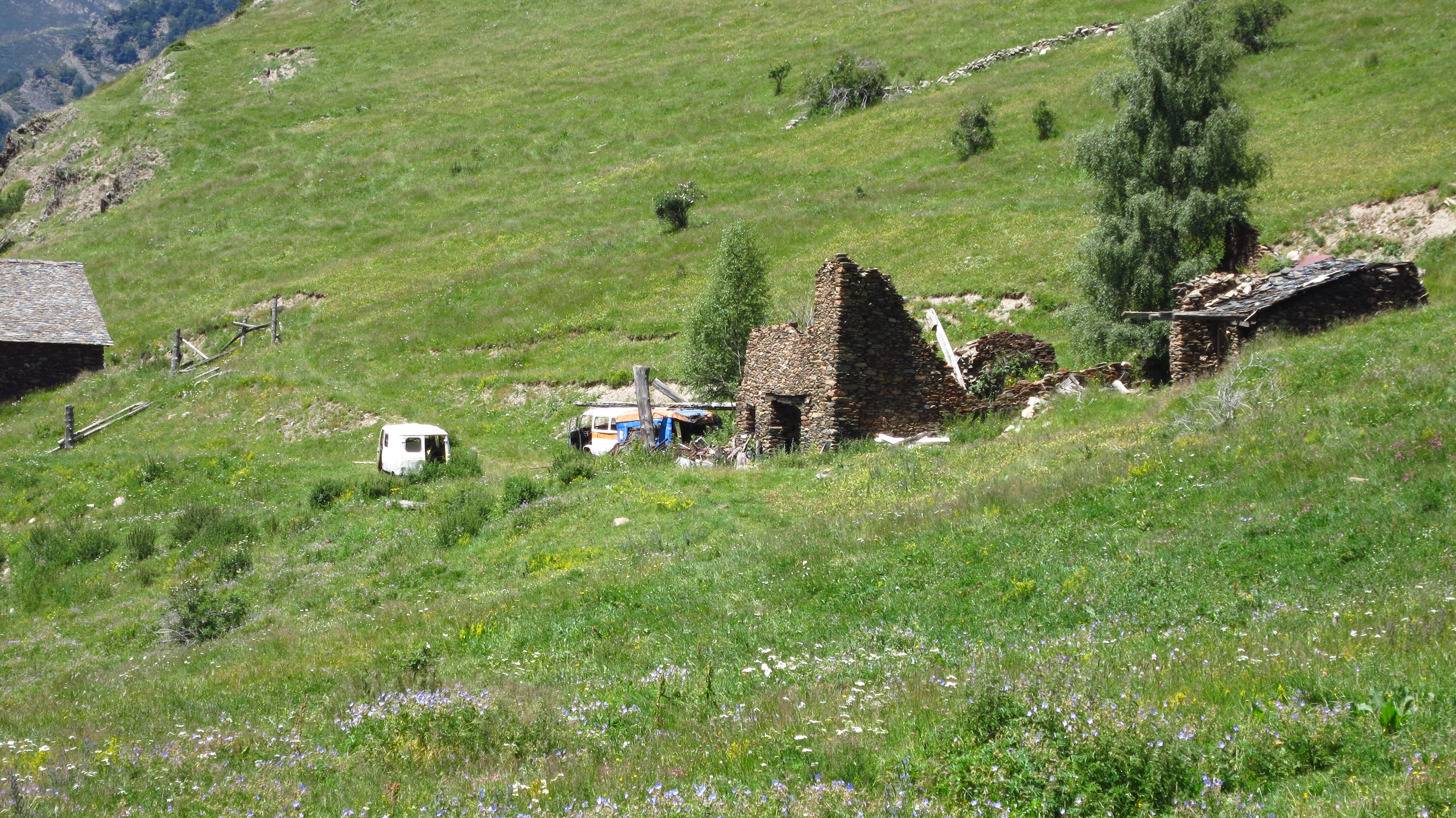
I had just negotiated a couple of hairpins when I thought I heard something ahead. I had seen an old pickup truck parked some way behind which probably belonged to a shepherd or a hunter, and I thought another one might be coming up the road, so I slowed down even more and tried to make something out in the fog. Suddenly, a bulking yellow monster appeared in front of me. A backhoe was planted in the middle of the track digging a draining ditch, and it had made a pile of earth half a meter high right across the road. I stopped, glad I had been as slow as the bike would go without stalling. Funny how the fog distorts perception, especially sound. The guy pushed some rocks and earth down the mountain to make room for me to ride through, and I nervously made my way over irregular soggy earth and a drop to a stream below. I thanked him and went on my way down, thinking that had I been on a 4×4, that would have meant turning back the way I had come. (It would have also meant that I would have been dry, warm and not worrying about lightning, but hey, where is the fun in that?)

IMG_1249

A while later the track led me to a small bridge across a gushing river and then it leveled out until I saw a mountain hut and the tarmac started again. The road led me into a thick forest, and the combination of lush green vegetation, the rain and a valley that became very narrow and deep at a point made me think of the infamous Yuncas Road in Bolivia. Now, that is something that must be interesting to ride…

IMG_1250

Back on the main road, I only did a few kilometers before turning left to exit Catalonia to the west via the Col du Portillon, the first of a series of legendary passes on the French side of the Pyrenees. The rain had stopped, and even though it was still a bit cloudy I took the rain suit off, but the fog was still there, sometime thinner sometimes thicker, but always enough for the sun to be completely hidden and for me to have no idea whether I was facing north, south, east or west. It is really a shame, for even though I really enjoyed the roads themselves from this point on, I can not say the same about the views.

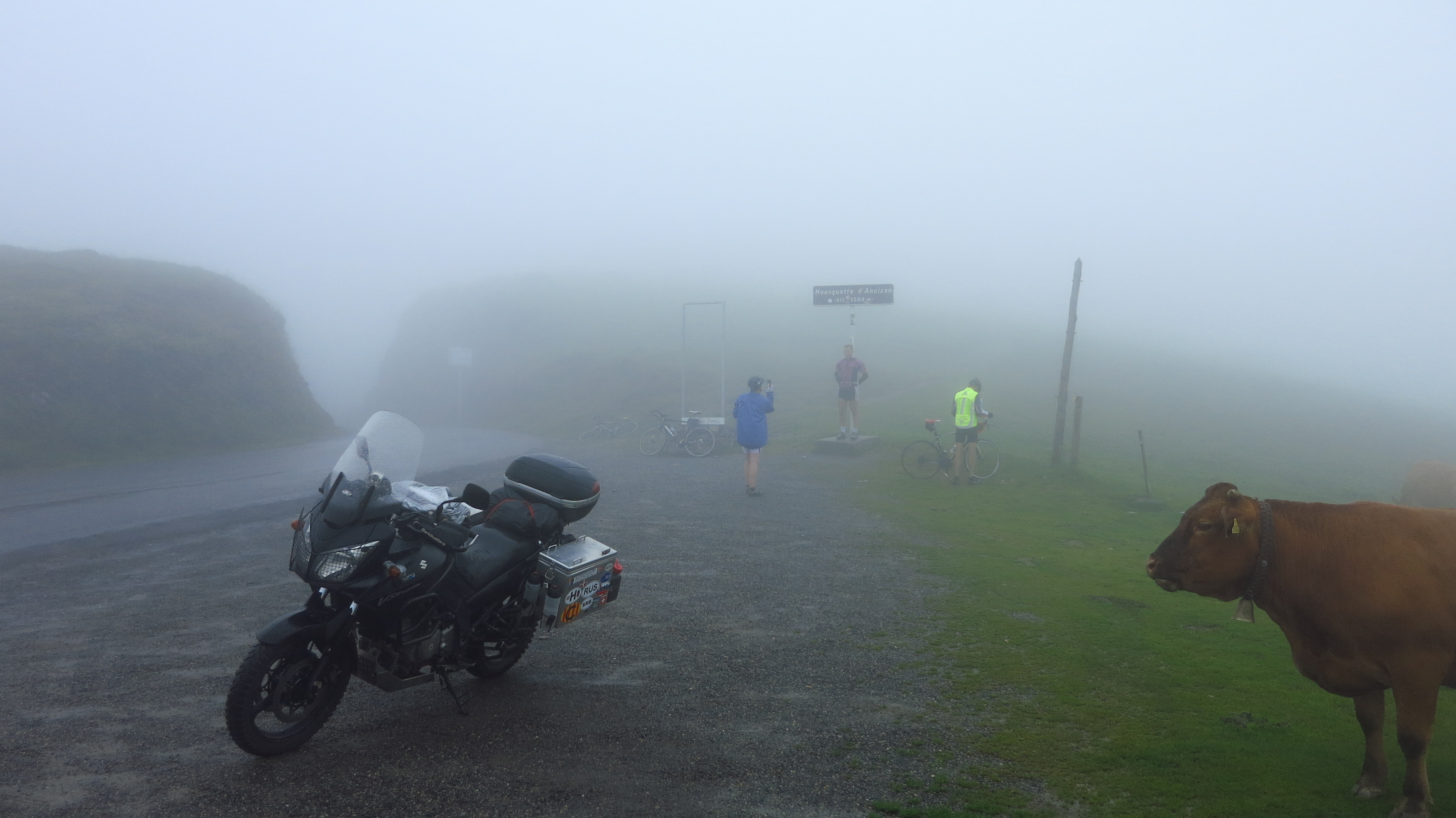
From the Col du Portillon the route continued through the Col de Peyresourde and down to Arreau, but instead of going all the way there, I cut through some backroads between Bordères-Louron and Ancizan, as I wanted to take the D113 and ride up the Hourquette d’Ancizan rather than the Col d’Aspin. When I reached the top I found a couple of brave cyclists emulating their Tour de France idols and a cow and the optimist in me thought that if I could not enjoy the views, at least the bad weather had kept most cyclists at home, allowing me to enjoy the road. I took a picture of them, the cow, and my bike (no pedals on that one).

IMG_1252

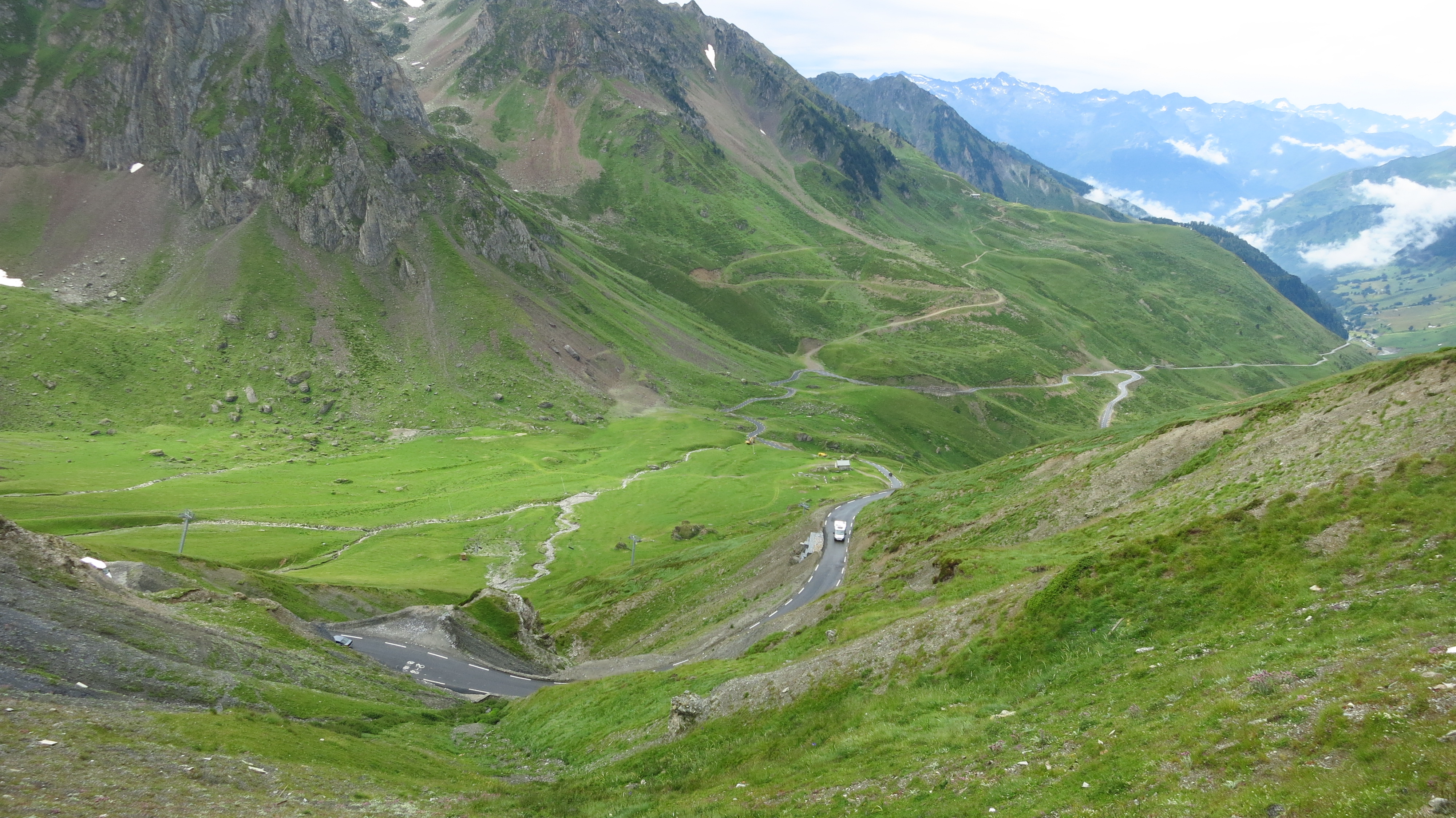
Down to the valley again, and the fog finally cleared, even though the clouds did not. At least that would give me the chance to admire the views from the top of THE pass – the Col du Tourmalet.

I know I am on a motorbike and I have no right to say this, but approaching the Tourmalet from the east (even though the fog and the clouds had me convinced that I was heading north) it did not seem to be all that hard, nor pretty, from that matter. There were some ski slopes that were closed and had that sad air that these places have in summer, only made worse by the fact that the weather was wintery, the road cut across a small town with some closed ski rental shops and a few corners later, voilà, the top. I rode past a statue depicting a naked guy riding a bike (must have been some kind of ancient Greek Olympic cyclist) and looked for a spot to park the bike and have a rest. I saw one next to two other bikes overlooking the other side of the past, parked there and then I saw it. The other side of the Tourmalet was simply spectacular. A vast valley with a narrow, steep, twisting road that seemed to be the Southern European version of the Stelvio and the Transfagarasan. No wonder it was hard cycling up from that side!1

IMG_1253

IMG_1256

IMG_1257

I had a blast on the way down to Luz-Saint-Sauveur, which was a very beautiful town, and up north into the Gorge de Luz (I had got my bearings now and I knew I was going north). Some kilometers later, the road took a turning west again in Argelès-Gazost and just as it happened with the Stelvio, which in my own humble opinion lost its “Best Road in the Wooooorld” crown to the Transfagarasan, what awaited ahead was going to steal the Tourmalet’s crown as my favorite mountain pass in this area – the combination Col du Soulor/Col d’Aubisque.

I must confess that it may well be that the weather had improved and maybe, just maybe, that affected my perception of the ride, but these two passes were just fantastic. I stopped on top of the second one and while I was having a snack I saw a German guy pull up on a KTM 990 Adventure. As you may now, I have a soft spot for that bike, so naturally, I went over to have a chat. His English was a bit limited, but apparently he had been in the Canary Islands, ferried to Africa and was on his way back home now. I asked him what he thought of the bike as a long distance touring machine, as it eats fuel and rear tires at a frightening pace, and he looked at me and with a huge smile on his face he said ‘vest vike I’f everrr had!”

The road on the other side of the pass was just as spectacular as the way up – a few corners leading to narrow line cut in a near vertical wall. Amazing.

IMG_1260

The last big town I rode through on the French side was Laruns, and from there I followed the stunning Vallée d’Osseau up to the Col de Portalet, where I stopped to decided what to do for the rest of the day. It was still cloudy, so I could not see the Midi d’Osseau, a spectacular peak that my father took me and my sister to when we were kids. Happy memories!

It was not very late, but I was cold and the weather on the Spanish side of the border looked worse, so I decided to call it a day and spend the night in another mountain hut instead of a campsite. There was a very nice one at the end of a beautiful gorge not far down the valley called Casa de Piedra, so I headed there and booked a bed and for the first time since I started, a full meal for dinner.

IMG_1265

It did not rain anymore that afternoon, so I just sat at a table in the terrace in front of the hut and enjoyed a couple of beers while planning the following day. Dinner was plentiful and delicious, and we had a couple of bottles of red wine to share among the six people sitting at my table. I met a couple of German guys and a Catalan one who were walking the GR-11 path, all the way from one end of the Pyrenees to the other, kind of like what I was doing on the motorbike but a bit longer. The Catalan one was planning on doing it all in one go, about 40 days, while the Germans had split it over several holidays and were on an 8-day journey in their second year. I had a great time and enjoyed the company over dinner, we stayed up until late and had some more beer, which would turn out to be not such a great idea the following morning…

(1) I actually have no idea which side the Tourmalet is climbed from on the Tour, or even if it is still part of it… sorry for any inaccuracies

Advertisement

Tor, the cursed mountain

Day 2 – Sunday 27th of July – Saillagouse to Refugi de Conangles (203km)

I woke up with the first rays of sunshine a long while before the time I had set in my alarm clock, and a bright morning and clear blue sky greeted me when I crawled out of the tent, announcing a great riding day ahead.

I was very excited about the route I had planned for several reasons: I was looking forward to two very nice mountain passes – Col de Puymorens and Pas de la Casa/Port d’Envalira on my way to Andorra, but most interestingly, on my way out of Andorra I had decided not to take the main road south to La Seu d’Urgell, but to leave the country via the only other way a vehicle can cross to Catalunya – the Port de Cabús, a road that led to a badly maintained dirt track down the mountain and through the infamous village of Tor.

I left Saillagouse and rode leisurely towards the border enjoying the landscape. I already knew this area well as I had been here countless times before both for hiking and for skiing, but for those who have never been in the French Cerdanya, it is a place I recommend, especially in spring-summer on a motorbike. There are lots of small mountain roads to explore and the views are stunning. In addition, the fact that there are no big cities near the region on the French side has kept tourist numbers reasonably low here, and villages still maintain that unmistakeable Gallic look in most places, with their quaint houses and corner shops unlike the Catalan side, where thousands of apartments have been build everywhere for holidaymakers coming from Barcelona and Girona, which are much closer to the Pyrenees.

I turned right in Bourg-Madame, just before the crossing into Puigcerdà, and rode along the border to Latour-de-Carol, which can be reached from Catalonia via a railway that penetrates French territory for a few kilometres, and where passengers can change trains and get on Le Petit Train Jaune, a tourist panoramic railway that winds its way all across the region to Villefranche-de-Conflent. Past the village I stopped to take a few pictures of the medieval towers that give the village its name and then started riding up the Col de Puymorens.

IMG_1200

This pass is 1,920m high and it overlooks the ski slopes, which were now closed and looked a bit decadent compared to the winter season, when they are in full activity. The pass is far from the ones in Switzerland, the top is reached after only a few hairpins, but the great views more than make up for that. At the top there were a few other motorbikes and a bus full of foreign cyclists waiting for their bicycles to arrive in a van, so I took some pictures and left before they swarmed he road.

IMG_1203

After a short descent into a deep valley where the road splits north towards France and south towards Andorra, I started gaining altitude again, this time heading for Pas de la Casa. There were a lot more motorbikes on the road now, and as I was nearing the town of Pas de la Casa, already in Andorra, I saw a fair number of tourist coaches as well. I decided not to stop at the petrol station there, as there were long queues of French cars filling up with cheaper petrol before crossing back into their country, and instead continued to climb towards the top of Port d’Envalira, to find  quieter petrol station where I filled up next to a group of three German bikers (riding GSs, of course).

IMG_1205

It was getting a bit cold (I was at 2,408m now) but I decided to wait a bit before putting on more clothes – I was going back now into Andorra now and the sun was climbing higher in the sky, so temperatures were bound to rise.

The way down was also very interesting, and in a short while I had left behind the ski slopes and was riding into bigger towns. It is always interesting to see the contrast between summer and winter in Andorra. It is a small country and there is only one main road cutting across it as there is no room to build another one, the towns expand up the slopes and new buildings are feats of vertical engineering that cling to the steep sides of the valley. This means that during the ski season thousands of people have to drive through these towns to get to the slopes, and the whole country turns into a nightmarish traffic jam. Visit in the off-season, however, and you’ll find the time to appreciate what a beautiful place it is.

IMG_1212

I left the main road when I reached Canillo and took a steep road that took me away from the main valley. Now, that main valley is the only thing that most people ever get to know in Andorra, and believe me, they have no idea what they are missing. Take any road up and out of there, and you will be rewarded with some of the most impressive mountain landscapes in the Pyrenees, and a lot less people too.

It was not the case this time, though, as I kept finding a lot of cars on the pass from Canillo to La Massana, and as I was wondering why that could be as there are normally some hikers in this area, but far from that many, I ran into the answer: they were holding one of the famous sheep dog competitions in a field by the road.

The rest of the road to la Massana was quiet, and from there I rode up to Pal and to Coll de la Botella and Port de Cabús. This last bit of road was a dream – high above the country, with panoramic views and very little traffic other than the odd cyclist that was brave enough to tackle the formidable ascent to 2,300m.

IMG_1213

The reason that there is virtually no traffic on this road becomes clear once you reach the top: the road leads nowhere. Most people coming up here might wonder why would the Andorrans spend so much money building a road this high for nothing, but I knew the answer, and it was the reason I was here. Allow me to take a break from my ride report to tell you the story of the village of Tor.

IMG_1216

The tiny village of Tor lays on the Catalan side of the mountains and it is one of the most isolated places in the country, only accessible through a long dirt track from Alins, which in turn is connected to Llavorsí via a narrow one-lane country road through a deep gorge, it is cut off the rest of the world by snow most of the winter. At the end of the 1800s, thirteen families lived there, and in 1896, they signed a document establishing a community of co-owners of the mountain where the village is located, which extends to the border with Andorra. It was this strategic location that would prove to be a curse to its inhabitants.

During the 40s, the isolated location of the village made it a good place for maquis to hide, and in 1944, a confrontation between some maquis and the Guardia Civil ended up with three houses being burned down. It seems that there were some accusation in the village as to who had tipped the police of the presence of maquis and who was harbouring them, and this was the beginning of a long-standing feud between two families that was fuelled over decades by isolation and ambition.

The three families whose houses had been destroyed left the village, and the harsh winter and living conditions (there was no electricity, telephone or running water) led to a small exodus over the decades which meant the by the 70s there were few people who still lived in the town all year round.

The document that established the co-ownership of the mountain stated that the inhabitants of the village were those in whose houses there was a fire in the hearth all year round, which meant that the few people left in the village regarded themselves as the only legitimate owners. By this time, two men – Josep Montané, ‘Sansa’ and Jordi Riba, ‘El Palanca’ – were in bitter confrontation over the use of the mountain. Both of them had build dirt roads up the mountain to connect with Andorra, and they were making a big profit with smuggling. There was (and still is) only one road connecting Andorra to Catalonia which meant smugglers had to resort to walking across the mountains or using mules, so having a dirt road on which 4×4 trucks could drive was of great benefit to them. Sansa and El Palanca blocked and controlled access to their roads and demanded money, goods or vehicles in exchange.

Their feud continued, and the fight over ownership of the mountain and the isolation they lived in made them grow paranoid of each other. Both to ‘protect’ themselves and to make sure that their properties were always occupied (and thus securing ownership under the provisions of the ancient law), they surrounded themselves of shady characters that had found in the village a way to escape their past. Sansa set up a kind of hippie camp on his land, and El Palanca hired two gypsies as bodyguards.

By the end of the decade Sansa, seeing the development of tourism on the other side of the border and having been repeatedly and insistently contacted by several developers, had grown more ambitious and started envisioning building a winter resort in the mountain. Sansa was contacted by an Andorran lawyer and developer with a background in doubtful activities (brothels, strip clubs, smuggling…) who put him in touch with British investors and convinced him and three other of the original owners to sign a 99-year lease on the mountain. The rest of the co-owners, and especially El Palanca, who wanted to protect his interests in the mountain, were fiercely opposed to the project, and the situation degenerated quickly. The project stalled for a while, as the investors were wary of the community of co-owners and wanted to clarify the legal situation of the land, and at some point during this time, the paved road was build from the Andorran side to the border, probably with hopes that the winter resort would be built (and making the smugglers’ life easier).

The situation had grown so tense that when the lawyer visited Tor to arrange paperwork with Sansa, he too was accompanied by bodyguards, a couple of retired policemen. It was during one of those visits when they run into El Palanca and his two gypsies, and a heated argument started. Both parties carried guns, and in the confrontation that ensued, the two ex-policemen shot the two gypsies dead. They were later arrested and sentenced to 8 years in prison.

At the beginning of the 80s, the remaining inhabitants started a legal battle for the ownership of the mountain that dragged on for years, putting off the potential investors and an end to the winter resort project. El Palanca and Sansa continued extorting money from the smugglers until 1995, when the Court made a decision and awarded ownership of the mountain to Sansa, on the basis that he was the only real all-year resident in the village. His victory was short-lived, though. Five months later he was found dead in his house.

At first, fingers pointed to the hippies he put up in his ‘Camp Sansa’, but shortly after an eyewitness, Antonio Gil, accused Josep Mont and Merli Pinto a pair of smugglers to whom Sansa allegedly owed money. They were arrested, but later on the judge dismissed Gil’s account on the basis that he had psychological problems and there were several contradictions on his declaration. Mont and Pinto walked free and the case is still unsolved today.

In 2002 and then in 2005, the Court determined that the ownership of the mountain belonged to the heirs of all 13 original families, ending a long bloody conflict. El Palanca still lives in the village, although not all year round, and still exploits the woods in the mountain and breeds horses, and both roads up to Andorra are still open and presumably kept in good condition by him.

TV3 broadcasted a documentary about this story and Carles Porta, the journalist who made it, became so fascinated that he ended up writing a book.

I wanted to do some forest roads, and the story of the town fascinated me, so after having lunch by a fountain on the way up to Port de Cabús, I found myself looking down a rutted rocky track where the road ended, marked by a sign that, having read the story, was a bit intimidating.

IMG_1234

(The owners of the Mountain of Tor are not responsible for any physical and/or material damage that may occur to people transiting inside the property and private track)

The ride down the road was difficult, and I made slow progress to make sure I did not drop the bike, as I was all alone and it would have been hard to pick up, and stopped from time to time to take some pictures. The valley was gorgeous, an unspoilt haven in the heart of the Pyrenees that thanks to its dark history has escaped ambitious development, which I guess is a good thing despite the high price that was paid for it.

IMG_1215

The first part of the descent was quite steep, with a few hairpins going into the forest, and after a while a reached a plateau where the road split in two: the one on the left belonged to El Palanca, the one on the right to Sansa. I knew that they became one again near Tor, and the left one had a river crossing if I remembered correctly what I had read, so I took the right one, and a little further down the road a found a surprise waiting for me: the remains of the camp where Sansa put up his hippies; because of its difficult access and its background, hardly anyone ventures into the valley, so it was still almost intact. I stopped the bike, crossed a small stream and wandered among the remains of huts and tents, trying to imagine what life had been like and what kind of people had lived there.

IMG_1226

IMG_1221

IMG_1219

Just before the two roads met again I saw some abandoned farms that presumably belonged to Sansa as well, since he was known to ask the smugglers for Land Rovers and then drive them until they broke down and abandon them there and then, and there were some littering the fields in front of the farm.

IMG_1231

The roads meet at a bridge and shortly after I arrived in the village, which was little more than three houses and a church.

IMG_1232

Some houses were taken care of and there was people (it was summer) and as I rode through the town I was excited to spot El Palanca in the garden of one of them playing with some kids, probably grandchildren, and across the street, sitting with a few other man in front of an improvised bar, Lázaro Moreno a thug El Palanca had hired as a farmhand and who had ended up marrying one of the heirs in the village.

IMG_1233

After leaving Tor behind, the road remained unpaved and in bad condition for a while, in fact a normal car would have difficulty trying to reach the village (I read a story about a group of students who ripped of the sump of a rental car trying to get there, and the only cars in the village where true 4x4s, not SUVs). Upon reaching the village of Alins, tarmac begins, but it is still a very narrow road that nobody clears in winter all the way down to the main road in Llavorsí.

I rode on to Esterri d’Àneu, now feeling a bit weird sitting down on the bike after such a long while on the footpegs, but I was about to stand up again. The road I was on lead to the Port de la Bonaigua, another famous pass, but I already knew this one and was looking for a more adventurous route, so I turned right towards Isil, a small village on a valley of the Nogera Pallaresa river, where the road ended. From there on, another dirt track started, following the river at first and then going up the mountain – it was the old mountain pass, the one used before the road across Port de la Bonaigua was built.

DSC_0008

DSC_0013

The track got worse (and more interesting) as it gained altitude and left the river behind, and by now I was very confident on the bike and especially on the new tires, which provided very good traction and control in these circumstances and which also worked very well on tarmac, at least for me – I like riding at a good pace, but I do not tend to scrap the footpegs in corners, so I was not missing road-biased tires.

DSC_0012

The road levelled out after a while and I enjoyed a ride through thick pine forests until I came to the Refugi de Montgarri, which I left to my right. Shortly after I found some parked cars and a few families hiking, and then the forest opened and I rode up a gentle slope to find the top of the ski lifts that belonged to Baqueira, one of the most exclusive ski resorts in the country. From there, a tarmac road started that, again, was not unlike something found in the Alps, and I had a great time all the way down to Vielha.

DSC_0019

By the time I got there what had been a sunny and warm day had quickly deteriorated and it was now cloudy and so cold that I had to stop and put on the inner layer on the jacket. What was more, there were rain clouds rolling in and it looked as if it was going to rain soon. I did not want to use the tent if it was raining, as I hate to pack it wet unless I am heading home the following day and can dry it when I get there, so I headed for the tunnel to spend the night in a mountain hut I knew on the other side which was accessible by bike.

It still was not raining yet when I got there, so I parked the bike by the river and walked up to the hut to see if they had bed available. They did, and the guard, being a biker himself, was keen to hear about my trip and allowed me to take the bike up the service road and park it behind the hut instead of leaving it in the car park by the river, which was a short walk down the hill.

I ordered a beer and sat down in the front terrace hoping the weather would hold long enough to allow me to finish it and plan the route for the following day.