Route – On/Off: Cingles de Tavertet, Sau i Susqueda, Les Guilleries, Montseny (152km)

The Route

It’s ten to eight on a frosty Saturday morning when I meet my riding buddy for the day at an industrial state run-down petrol station infamous for being the place that witnessed the end of a 492-day long kidnapping in 1994. There is not a single person in sight except for the lone silhouette of my friend and his Ténéré standing in the morning mist.

We are still 50km away from the starting point of the route, half an hour of intense cold and thick fog that makes the road ahead look like a scene straight out of Fargo.

20151212_085028

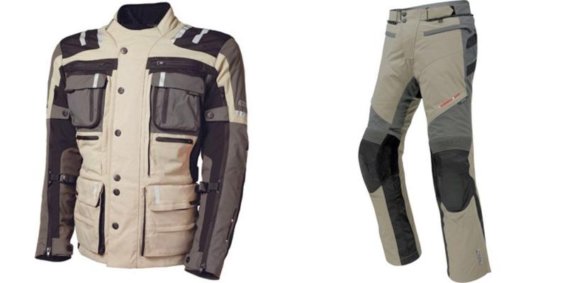
The route we have planned for the day starts just off exit 183 on the C-25 road that connects Cervera and Girona. Despite having heated grips on both motorbikes, our fingertips are painfully cold by the time we turn off the motorway, the hand guards being very good at protecting the brake and clutch levers in case of a fall but not so good at aerodynamic protection for our hands.

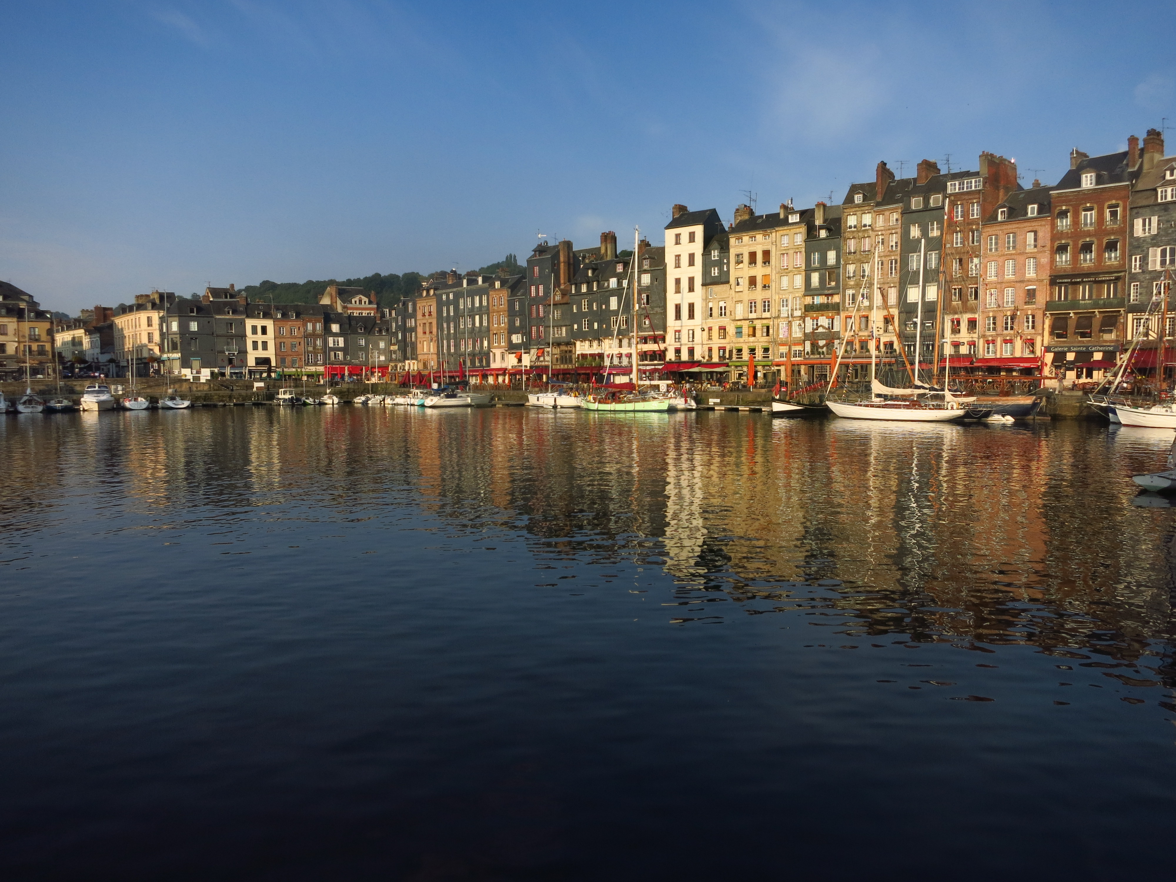
On the C-153 road, we ride across Roda de Ter as the sun struggles to break through the mist, making it hard to get any decent pictures of the old Roman bridge that crosses the river Ter. A few kilometres later, the road starts climbing up the hills through grazing fields, a much more interesting ride after the relatively long motorway slog to get here, but we have to take it easy, as the tarmac is wet and slippery.

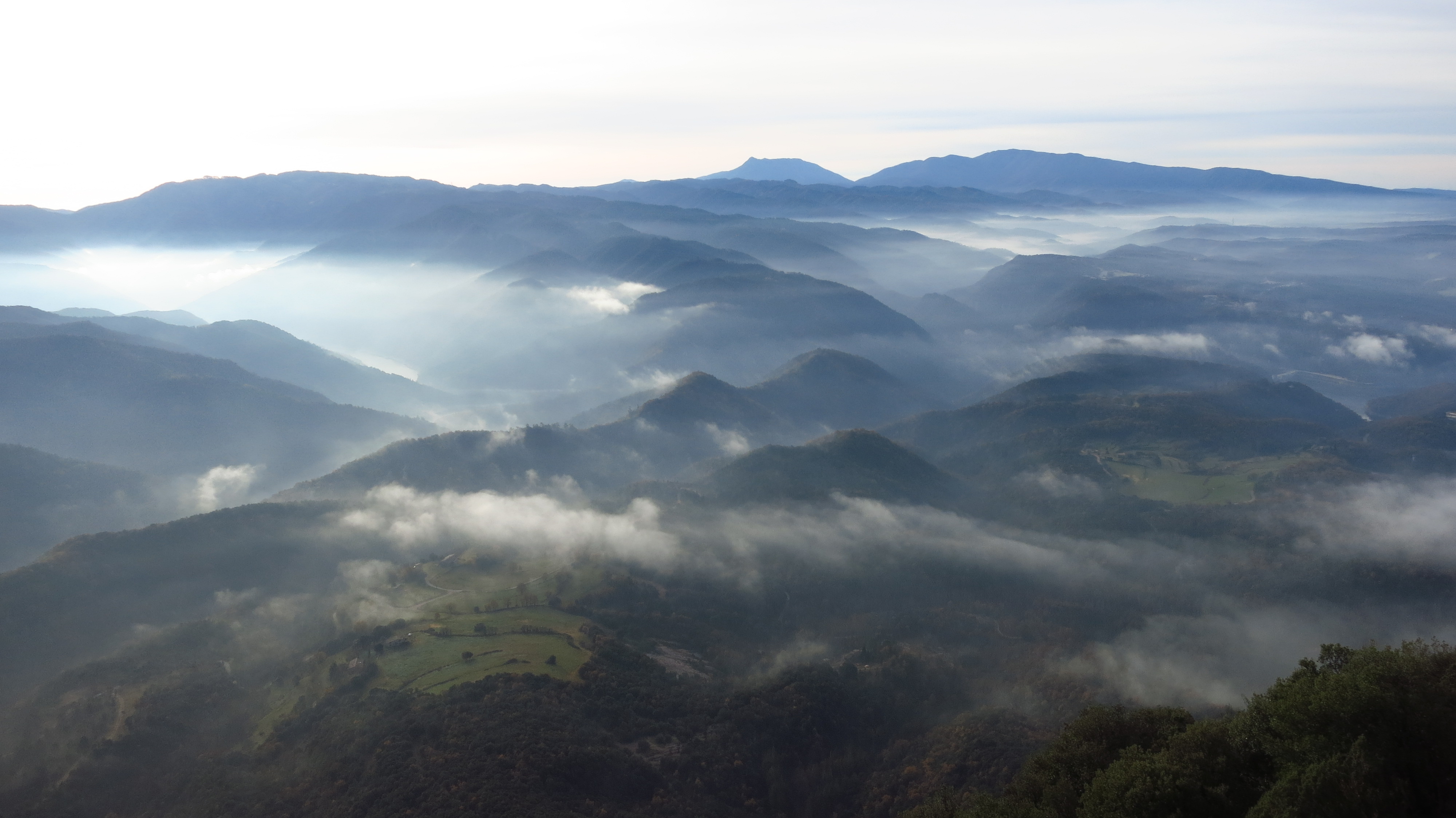
In the nearby village of l’Esquirol we turn right off the main road and take one of my all-time favourite roads – the BV-5207 leading to Tavertet. Even though the road ends there, in good weather there are quite a lot of tourists driving it to get to the quaint village perched atop the cliffs overlooking the Ter valley and the Guilleries mountains beyond, but this early on a winter morning the road is ours. It is half past nine now, we have gained enough height to leave the morning mist behind and the sun shines gloriously over the stunning landscape.

IMG_6504

A few corners before Tavertet we stop at a viewpoint overlooking a valley where a wild boar hunt is taking place and meet an old man who is following it on his walkie-talkie.

20151212_092956

He tells us that there each year there are more and more wild boars in the area and they have to organize these hunting parties to keep the population under control. His knees are too old for him to join them as he did when he was younger, but he still takes pleasure in checking the progress of the hunting. He points at an orange spot in the thick forest below us – a hunter in a high-visibility vest, and a few seconds later we hear some shots that resonate against the cliffs and sounds like a hundred shotguns being fired at once.

IMG_6500

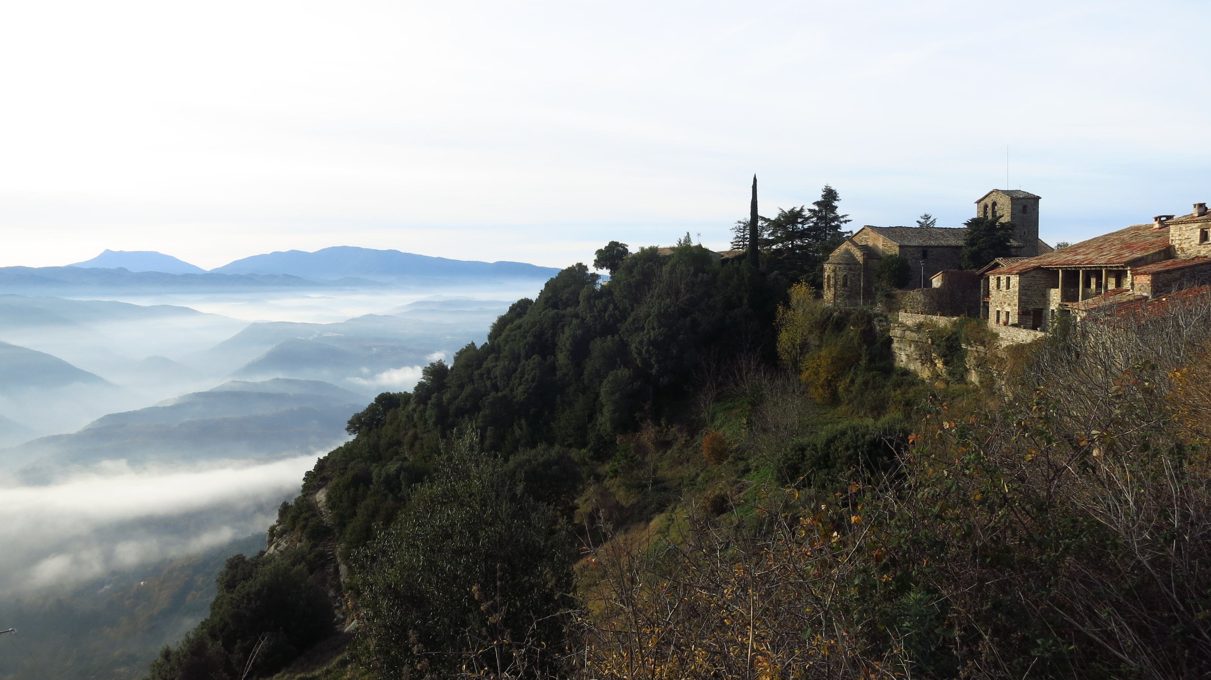
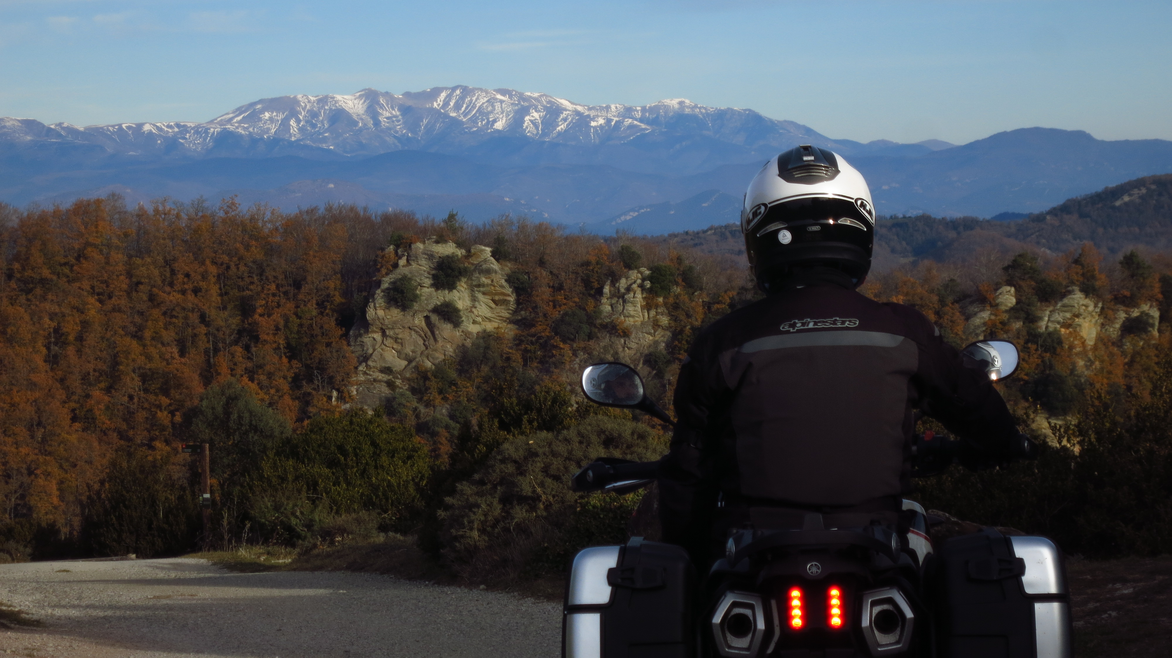
At the entrance of Tavertet we find a boom gate partially blocking the road. It is there only to prevent the numerous tourists who drive up here to enjoy a meal at one of the restaurants from parking inside the tiny village, you can drive around them and keep going to the east side, where a small sealed forest road keeps climbing along the edge of the cliffs to a plain from which the Pyrenees are visible in the distance. The views from up here are magnificent, in a few hundred meters of road one can enjoy an almost 360º panorama of the main mountains in Catalonia – Pedraforca, Guilleries, Montseny, Pyrenees…

IMG_6509

From there the road descends through a beech forest with the ground covered in a carpet of reddish brown fallen leaves to end back in the C-153 road leading to our next waypoint – Rupit.

IMG_6511

There is a dirt road from Rupit to the Sau reservoir along the foot of Tavertet cliffs. I have used that road twice before – on a mountain bike trip when I was twelve and driving a Fiat Punto when I was at university with my girlfriend at the time. I remembered a dirt road in good condition, and to my surprise we find that it has been paved all the way. It is a very nice ride through forest and across grazing fields, with views to the rocky cliffs on top of which we were less than an hour ago.

IMG_6512

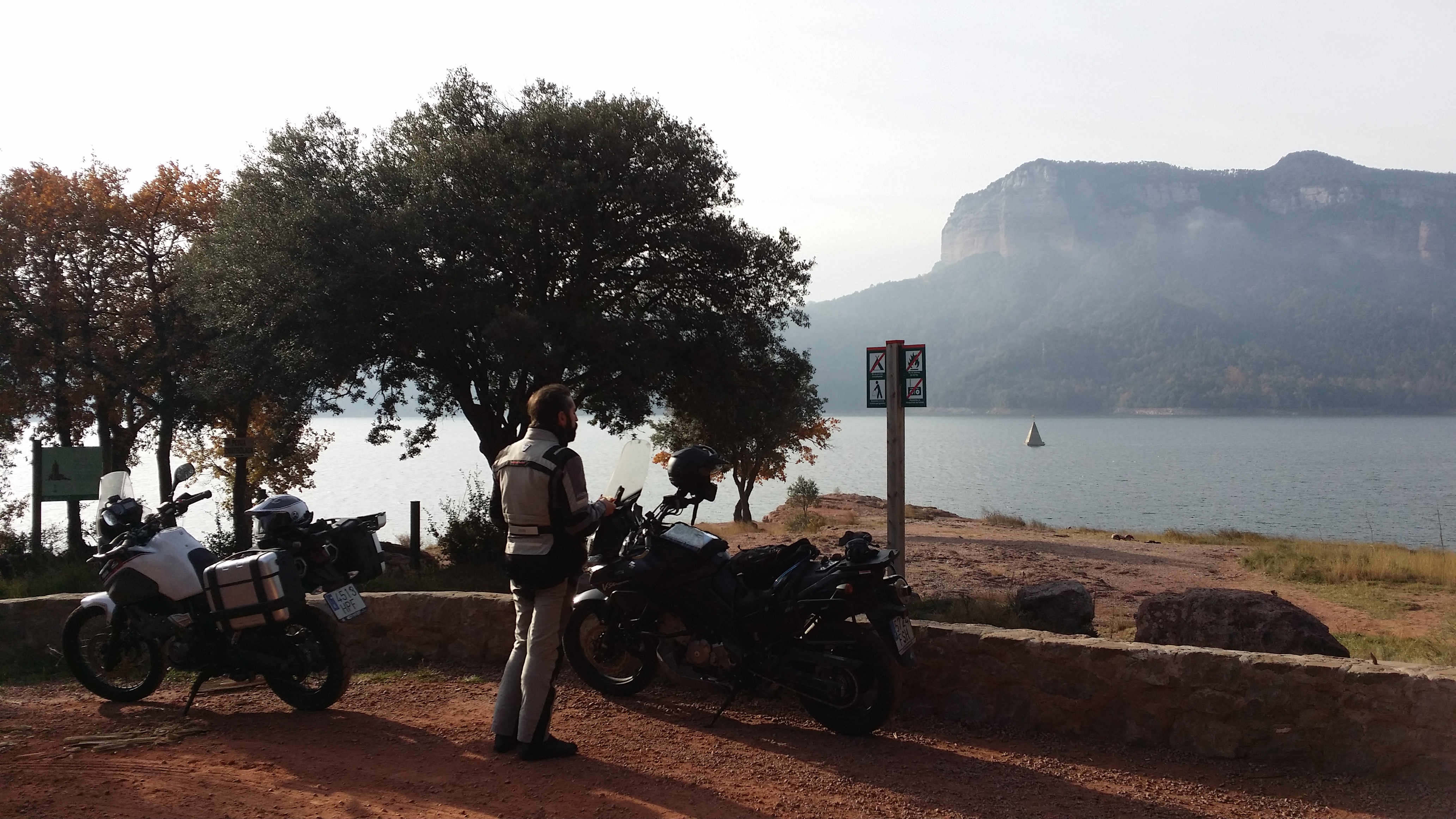
Once at the bottom, we take a short detour from our main route to ride to the shore of the reservoir and have a snack with a view of the church spire of the village of Sau, which is all that remains visible after the dam was built. With full bellies but hands still very cold, we ride the few kilometers left to the dam itself to explore the only part of the route I have never ridden before.

20151212_105722

Looking at maps and satellite images, there seemed to be a road along the south shore of the Susqueda reservoir leading to its dam and then to the C-63 road, but I was not sure it was accessible. It could be a service road for the reservoir or it could be a forest road in bad condition, and I am not particularly keen to venture into difficult terrain as my bike is shod with (worn out) road tires. We cross the dam to where there seems to be a road, but it is blocked and it looks it has been so for a long time. Falling rocks and landslides. We cross back to the northern shore and ride down another road that seems to lead to the power station at the bottom of the dam. It does. It ends in front of a gate, but on the way up we find a dirt road that seems to go further down. It looks steep, at least the first meters, but I notice regular car tracks on the sand, so we think “how hard can it be?” and ride on.

IMG_6517

The road seems to be in good condition and a bridge at the bottom of the gorge takes us to the southern bank of the river Ter. From there, we follow a narrow dirt road that puts my poor bike to the test. Rocks, sand, mud and leaves make it clear that road tires, short suspension travel, and hard springs are definitely not the best combination here. God, I miss the Super Ténéré…

20151212_114022

IMG_6520

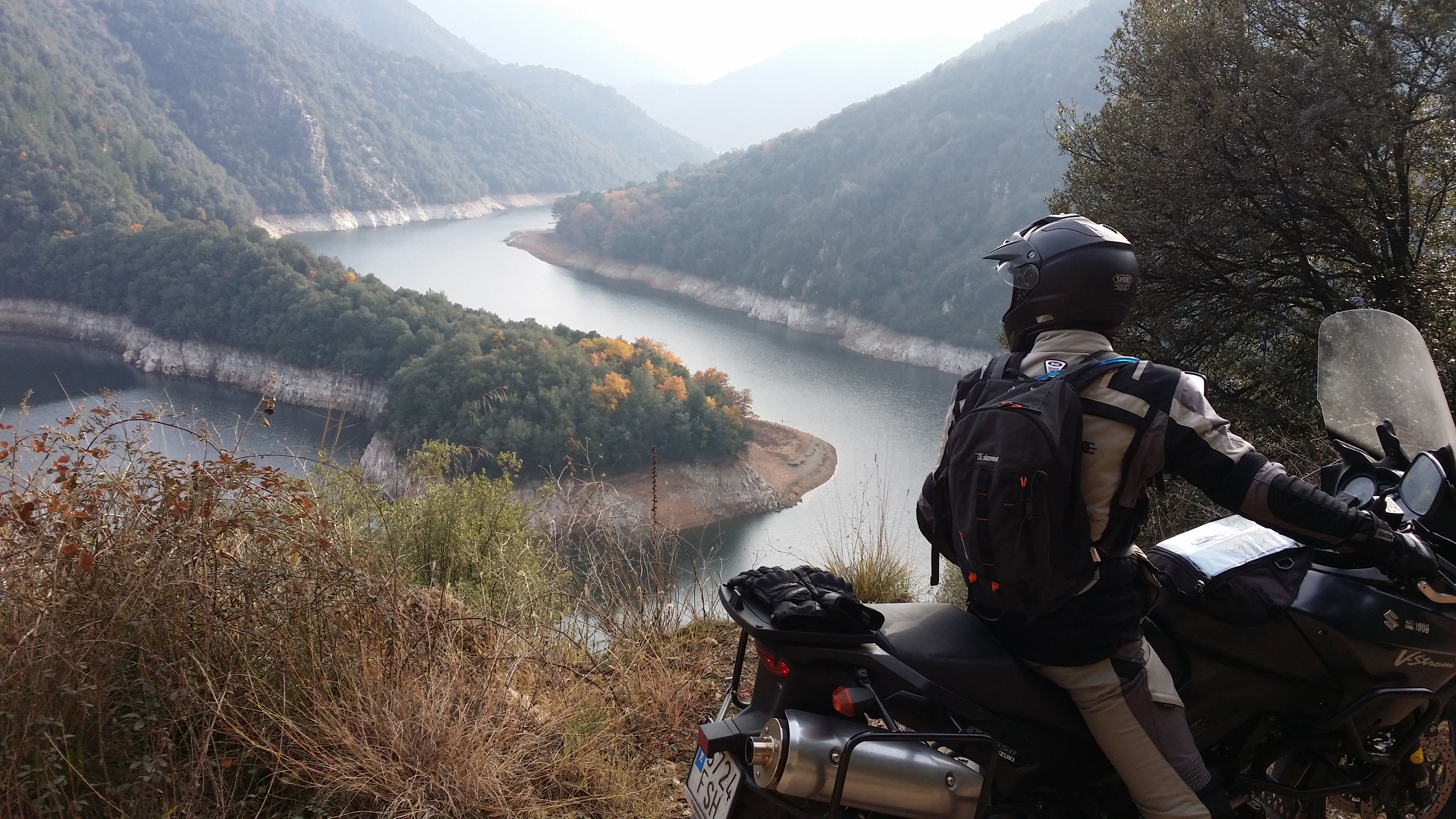
An hour later the Susqueda dam comes into view out of the last corner. We are sweaty and my wrists and back hurt from the bad position standing on the footpegs, but I also have a big smile on my face. We have made it.

IMG_6523

A good road leads to the C-63, which we take for a short while before reaching Anglès and turning into the GI-542 for the last part of our route. This road winds its way up the Guilleries mountains past the village of Osor and to Sant Hilari de Sacalm, famous for its many springs that produce much of the bottled water sold in the country. From there we are going to take a smaller road to the Montseny mountains. This one is a bit more difficult to find at first, as it is not indicated anywhere, but then we find out that it is as easy as to follow the signs pointing to “Fontvella”, the main bottling plant in the area, from where the road starts. It is well past midday now and the road is completely dry, so we can ride faster and enjoy a wonderful road – perfect tarmac, no traffic, great views.

IMG_6526

Shortly after we cross the C-25 again, and take the GI-543 and BV-5303 along the northern edge of the Montseny natural park to end our route back on the C-17 main road to Barcelona.

Map

Mapa

What to see

Roda de Ter – Old Bridge: dating back from Roman times, it was part of the Strata Franciscana, the road that led to France.

Tavertet – A quaint, tiny cluster of stone houses built on the edge of the cliffs of the same name. Well worth a visit and a hike in the surrounding area, with breathtaking views of the whole region at your feet.

Rupit – A XII Century village of narrow steep cobbled streets, with a hanging wooden bridge and the remains of a medieval castle.

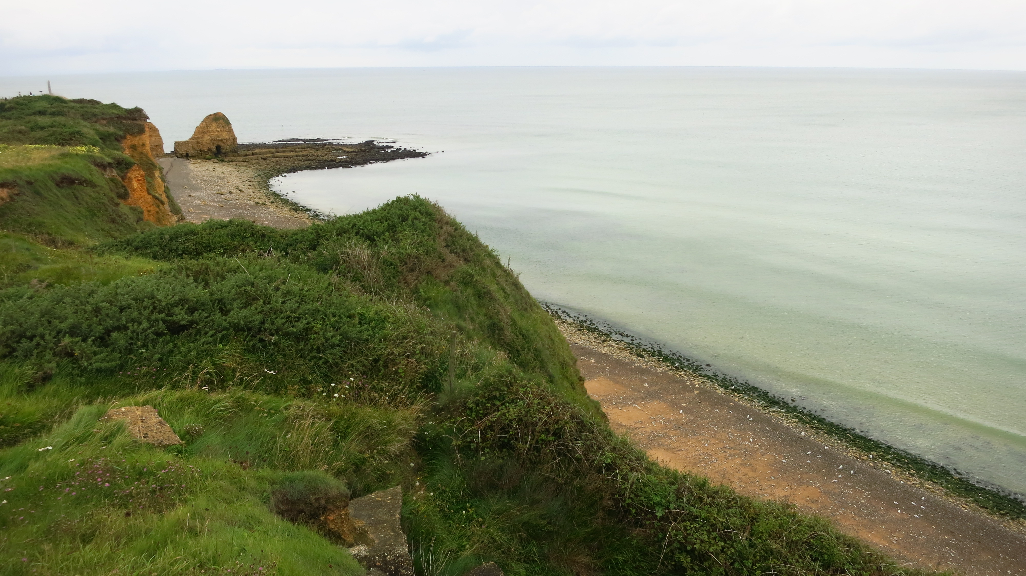
Pantà de Sau – The spire of the bell tower is all that remains visible of the village of Sant Romà de Sau, which was submerged after the construction of the dam in 1962. When the water level is low enough during summer draughts the church emerges an can be accessed on foot from the shore.

Where to eat

Once you reach Seva, practically at the end of the route, a seven-kilometre detour up the BV-5301 takes you to two excellent restaurants that serve traditional home-made Catalan food in the hamlet of El Brull – Can Pasqual and Castell del Brull.

Review – Kawasaki J300

The Kawasaki J300, the first scooter from the japanese maker. Honda, Yamaha and Suzuki, the other three big Japanese makers, have long had presence in this market with numerous products, and Kawasaki did not want to be left out of such a lucrative market as Europe. Nevertheless, the launch of this supposedly sporty scooter has come under some criticism.

Whoa… wait a second. A scooter? Isn’t this supposed to be a blog about bikes? Or at least adventure travel?

Well, yes, it is. The thing is that my V-Strom needed a new chain and steering bearings, so I had to leave in the workshop. Since I need it daily, I dropped by Hamamatsu motor one morning to see whether I could arrange a day in advance so I could get the job done on the same day, but Fabio, the owner, helpful as usual, told me to bring the bike anytime I wanted because they could lend me a replacement bike. Great. We arranged it for a couple of days later.

On the agreed day, I leave the bike in the hands of their mechanic and they lend me a Burgman 125, but with my work bag already under the seat (it fit perfectly, plus points for that model) we realize that the seat won’t lock in place. After fiddling with the key and trying to adjust the mounting points of the seat to make it fit better, the mechanic concludes that I can’t ride around a bike that can’t be locked and they roll out another one – the Kawasaki J300 they use as demo bike.

DSC_0028

Well, look at that, an extra 175cc to run all the errand I have to run this morning, and on top of that, a new model. Take the chance and write something for the blog, I though.

So, let’s see what all this scooter craze is all about (they sell like hot cakes in Barcelona). As this is a bit of an improvised test I do not have the right gear for it: no Bikkembergs shoes, no down jacket with a hood and zero crash protection, no open helmet with a loosely fastened strap, no iPhone 6 to check my social media at each set of lights. Well nevermind, I’ll have to make do with a pair of motorbike boots and a motorbike jacket.

DSC_0009

After realizing that the space under the seat is much smaller than in the Burgman, I sling my bag over my shoulder, sat on the thing and hit the start button. The 300cc single-cylinder engine fires up instantly and I join the flow of Barcelona traffic passing by the dealer’s gate. The first impression is that it brakes a lot, but when you put it in perspective, even a good mountain bike with hydraulic brakes is more efficient than my old V…

DSC_0013

I gradually get acquainted with the brakes, I was making the ABS system work constantly on the back wheel as I am used to grabbing without hesitation a lever that to me is the clutch, and with the forward position, with the handlebars much closer. The mirrors don’t help to make me feel comfortable in traffic, either, too small and too close together. A bit more familiar with the bike when I reach Meridiana Avenue, I stop ahead of the cars at a set of lights ready to go for a usual scooter start. Around me, other similar weaponry, most of them with smaller engines. The lights turn green and, to my surprise, I am left behind by all the scooters waiting with me behind the zebra crossing. What is wrong with this? It’s a 300, it should easily have all those mopeds for breakfast…. At the next set of lights I find out what the problem is – I am riding this things as if it were a motorbike. Bit of gas, release the clutch, accelerate progressively once on the move and ride the torque. It seems that is not the way to go with a scooter, it is much more dual. Lights turn green, twist the throttle all the way with zero sympathy for the oily bits and brake hard 20 meters down the street at the next set of lights. Ridden like this, it makes its way more than swiftly among the traffic, but I would never, ever buy one of these things secondhand. What hard life they have…

Once outside Barcelona, on the motorway, it is time to test how it rides on fast roads. Now that I don’t have to put my foot down at every set of lights, I get myself comfortable and examine the riding position. Leg protection is clearly better than on a bike, but the screen is too low and offers little wind protection for the upper body and head, it is impossible to ride with the visor up. There is no foot rest behind the front bodywork to stretch your legs à la T-Max, and with the feet on the platform my toes point slightly inwards, making the position a bit uncomfortable.

DSC_0015DSC_0018

Aside from these gripes, the J300 reaches 140km/h without difficulty and feels quite stable. To go back to the criticism mentioned at the beginning, aside from the obvious complaints about Kawasaki, a brand known for its sports bikes, received for launching a scooter, it also came under harsh criticism for launching what is essentially a restyled Kymco 300. While it is true that it enters a very competitive market and they did not want to run the risk of investing lots of money and time designing a product from scratch and risk getting it wrong, it does not help the brand’s sporty image. The suspension settings are supposed to be different to give it its own personality, and it really does corner well, but then you pay the price in city, where it will mostly be used, with a damping that is a bit on the hard side.

Once in Sabadell I park to run an errand and realize that the helmet doesn’t fit under the seat either… OK, it is a dual sports Shoei, the ones with sun visor, maybe a regular full-face helmet might fit, but it looked a bit tight. I have to drag the bag and the helmet with me. When I lock the seat, I notice a small fit and finish problem – it has two hooks, but only one locks. For both to lock properly, I have to slam the seat decisively. On a more positive side, the J300 is incredibly easy to get on and off the centerstand and to maneuver when stopped.

Next stint – back home for lunch; after a bit of city and motorway, it is now time to take it to a winding road to get a final opinion. Here the suspensions work great again, the scooter behaves well, it is agile and the engine has enough power to even have a bit of fun. The main problem for me is that at the end of the day, it is still a scooter, with everything that implies regarding dynamics. The CVT has a bit of lag before sending the power I’m dialing with my hand to the floor; when leaning into a corner or a roundabout that slight power gap is not very confidence-inspiring. The other big problem is the riding position. On spirited riding or motorway speed, sitting in the same position as if I were on the toilet gives me zero feeling of control. I can’t use the feet or the legs to help steer the thing, and I keep having the feeling that I am going to fly off the side of the seat at any moment.

DSC_0014

Before riding back to the city again I stop to take a few pictures and assess the looks of the scooter. With sharp and edgy lines and a front headlamp that reminds a bit of her Z bigger sisters, the J300 does live up to its sporty pretensions, although this is a highly subjective matter, so look at the pictures and form your own opinion.

DSC_0026

Back in Barcelona the advantages of not having to constantly shift gears are clear, but I am still not used to some things, like not being able to hold the brake with my foot and have both hands free without rolling back or forward.

After getting my bike back the following morning, the most honest verdict I can return is that I did not miss the scooter for one second. It is a great machine, with a good engine, nice, comfortable, agile and well built, and to ride around exclusively in the city, it might be a very good option, but I did not like it on the road compared to a proper motorbike, which leads me to wonder: to get around in the city, 125cc are more than enough, and to ride on the open road, any motorbike is better than a scooter. Then, why do people buy big scooters? Especially when for the same money they could get a good motorbike? Unless you can afford to keep more than one machine in your garage and you really, really want a scooter, I still don’t get big scooters.

More pictures here

Review – IXS Montevideo jacket & IXS Caracas trousers

I have been thinking that I would like to have a more varied range of content on this blog, and a gear review section sounds like a good idea. Through this new section I would like to share with you firsthand experiences, opinions and impressions of the gear I use in my travels, and offer some advice to those shopping around to equip themselves or their motorbikes.

We’ll start with a review of one of my most valued pieces of kit: my IXS riding suit. Prior to my first long trip, I had a pair of Dainese trousers (non-waterproof), a pair of cheap plastic waterproof trouser covers, a Dainese vented summer jacket, a Dainese waterproof winter jacket that can be worn over a suit (perfect to wear to work every day) and a Dainese waterproof winter jacket more suited to travelling. Not that I am a Dainese fan (or of any other brand in particular), but I bought a Dainese back protector insert for my first jacket and by sticking to the same brand I can swap it between them. And there is a Dainese store round the corner from where I live that offers very good deals on end-of-the-season products…

Anyway, while planning the route for the long trip I realised that this was not going to be the usual weekend ride and that I was going to encounter widely varying temperatures and weather conditions, but it was not realistic nor practical to carry two pairs of trousers and two jacket in the limited luggage space that a motorbike offers, so I decided to sell the trousers and winter road jacket and find a 4-season suit.

Most brands offer an all-season adventure jacket and some trousers to go with it in their catalogue, but I quickly realised that most of them are more of a 3-season option – while they all include waterproof and thermal layers that can be removed, very few offer the level of ventilation that is needed in really hot conditions. The only one that seemed to be modular enough to be a true 4-season riding suit was BMW’s Rally suit. I had read glowing reviews about it, but with all the money I had spent on other gear, I could hardly justify its price tag, which was easily twice what other suits cost.

While scouring the internet for a second-hand one that was my size, I found several references to a comparative test carried out by a German riding magazine that put one suit I had never heard about in first position above BMW’s offering arguing that it offered about everything BMW’s did but at half the price. It was the IXS.

IXS Montevideo Caracas

I had not heard of the brand before, but a quick search revealed that it is based in Switzerland and they are a big player in the biking world (at that time I was a relative newcomer…). I could not find a bad opinion about the jacket + trousers combo, and the price was very tempting, so I set about finding a shop where I could see and try one on.

It seemed that IXS is not such a popular brand in Spain, and Adventure Riding being a rather niche segment, there was only one shop in my region that had the suit in stock, 50 kilometres away. I went to try it on and it fit like a glove, so I bought it on the spot. Now, what do I think about after three years of use?

Adjustments:

The jacket is very adjustable, so it is very easy to make it fit comfortably – the sleeves have a strap with have three pop fasteners on the upper arm and an adjustable strap with a plastic locking buckle on the forearm; there is an adjustable strap around the back at kidney height and a little strap with three pop fasteners on either side at the bottom. The cuffs also have three pop rivets. The trousers have two Velcro straps to adjust the waist.

IMG_6073IMG_6071IMG_6072

Protections:

There are Powertector pads for the elbows-forearms, shoulders and knees. These are not just pieces of plastic or rubber as in cheaper suits, but special impact-absorbing material with CE certification. In addition to this there are a couple of foam inserts in the trousers to protect the hips and a larger, thicker one for the back, which is one of the very few complaints I have about the jacket. I know that some jackets do not include even that, but a proper back protector would be nice, even if it was as an extra cost option. As far as I know, IXS does not offer a specific one for this jacket.

Storage:

This is one of the strong suits of the jacket – it has so many pockets I have managed to lose stuff in it. At the front there are no less than 10 pockets: two small ones on the chest and two small ones below, on the ribs; these four have sealed zippers. Then there are two huge front pockets that close with a Velcro flap which in turn have two smaller pockets with zippers at the front and two big pockets with zippers to the side which are ideal for my gunner to put her hands in when she’s cold. I addition to all of these, different parts of the ventilation system can double as pockets when closed, taking the total count up to 14 front pockets. To that you can add a big pocket across the lower back of the jacket, one inner pocket next to the main zipper (no need to unzip the jacket to access it), and two inner pockets on the jacket, which are duplicated on the inner side of the thermal layer so you do not lose them in winter. All in all, 18 usable pockets in winter mode and 14, 12 or 10 in summer depending on how you set up the ventilation system.

Weather protection:

The jacket comes with a zipper that attaches to the trousers, offering extra comfort in cold weather as well as protection in case of a fall. It can unzip from the jacket and zip to the thermal layer, so it can always be used. The waterproof layer attaches to the jacket with a zipper on either side of the jacket’s zipper, three pop fasteners around the collar and two on either cuff. The thermal layer attaches to the waterproof layer, so it is not possible to wear only the jacket and the thermal layer without the waterproof layer. I have never found this to be a problem, when I need the thermal layer it is cold enough that the waterproof layer is not a bother. The attachment system is the same, two zippers at the front and two pop fasteners on each cuff but only one in the collar.

In the trousers, the story is exactly the same, except for the fact that at the bottom both layers attach using zippers, which I very much prefer to pop fasteners down there.

The thermal layers offer sufficient protection for the kinds of weather I have ridden in so far, including winter in snowy conditions, complemented by a thermal undershirt and a thin fleece in the coldest days. I have not needed to wear anything extra over the legs yet.

As for the waterproof layers, we need to take into account that when it comes to breathable stuff, nothing is truly waterproof, no matter what the manufacturer’s literature says. In this case, the waterproof membrane is detachable, not sewn into the jacket, which means that the jacket (and trousers) will get wet in the rain and even though the membrane underneath will keep you dry, a soaked jacket will feel cold and heavy. It takes a whole day in good weather or a in well heated room for a fully soaked suit to dry, which is something worth taking into account when going on multi-day trips. It is not the same to hang out the suit to dry at the end of a Sunday ride and forget about it, than to get out of a warm, cozy bed in a damp morning and slip on a wet suit. In any case, if it rains hard enough, water will eventually seep in sooner or later. How fast is that? Having had no alternative than to ride in heavy rain more than once, I can tell you that under a high-intensity deluge, it can happen in 30 minutes. In milder constant rain conditions you can ride for a couple of hours before water comes in. I usually carry a cheap plastic rain suit. It is truly waterproof and faster – you have to perform a striptease by the side of the road to put in the waterproof layers of the suit, and it takes a few minutes of fasteners and zippers, so under heavy rain, you are going to be soaked in your underwear almost instantly unless you find cover to do it.

Ventilation:

Everything described so far applies to mostly any other decent 4-season suit in the market, but here is where the IXS Montevideo truly shines. Step by step, it can turn into the closest thing to a summer mesh jacket you can find.

First, there are two small vents above the breast pockets.

IMG_6080

As the day gets warm, the breast pockets themselves can be removed, leaving two 100x130mm mesh apertures.

IMG_6083

To the sides of the breast pockets, and running all the way down to the front pockets, there are four zippers that can be undone for extra ventilation.

IMG_6084

Finally, with these zippers down, the whole front of the jacket detaches front the breast pocket flap using a Velcro strip and can be folded back and down into a space behind the front pockets, leaving two 200x140mm mesh openings in the front of the jacket.

IMG_6085

IMG_6086

The sleeves also have zippers running from 140mm above the cuffs to almost armpit level that open top to bottom, and for really hot days, undoing two zippers the whole back of the jacket detaches from the top in the same fashion as the front pieces and provides a huge 350×250 mesh vent.

IMG_6087

IMG_6088

The trousers have two small openings at the back, two longer ones diagonally across the upper part of the legs and finally two long vertical ones on the inside of the legs (which are also used to extract the protection pads). To have good ventilation on the legs on the hottest days I need to separate the legs from the bike, another couple of vertical openings on the outer side would have been nice, but I imagine that since IXS has not included them on the new version of the Caracas trousers, they could compromise the effectiveness of the knee pads in case of a fall. That said, they offer better air circulation than most other trousers.

I have ridden in +40ºC temperatures with this setup and as long as I am on the move, the airflow is enough to keep me reasonably cool. Stopping to visit something is another matter altogether…

Durability and fit and finish:

The suit is made of 600D Dynax and 500D Cordura and the trousers of 500D Airdura and 630D Dynax, although this info matters little. What is important is that after heavy use it has stood the test of time very well and looks very little worn out.

All fasteners and zips are of very high quality and after 3 years of use nothing has torn, come loose or fallen off. The only thing that seems to have worn out prematurely in my opinion is the soft fabric sewn around the jacket’s collar to make it nicer to the touch against the neck. Nothing serious, and I can probably get someone to sew a new one in, but still, it does not look good.

IMG_6094

Ok, so anything bad?

Just a few little things – the removable breast pockets are totally removable, so losing them is a possibility. I doubt IXS will supply them as a replacement part, so be careful. I lost mine for a couple of months after moving into a new apartment and it does get very cold without them in winter. Fortunately they turned up eventually.

As I said before, back protection is poor, and there is no specific back protector for the jacket, but this is something that affects most jackets, you can always buy a good strap-on protector.

I would like the jacket to have attachments for a water blade as the BMW Rally suit does, and having zippers under the armpits would be nice too. The Rally suit has detachable sleeves, which I personally see no use for on a riding jacket, but you can partially open the zipper for extra ventilation.

Other than that, it is a bit on the heavy side, but you do not notice that while wearing it.

This suit is not for sale anymore, but the second generation version is identical in all respects and has improved on two of the aspects mentioned above: it does offer a water blade as an optional extra and the breast pockets are attached to the suit, so it is a highly recommended purchase.

IXS-Montevideo-II-Jacke_b6

ixs-montevideo-ii

Conclusion:

A very well-designed and durable suit that offers true versatility all year round at a reasonable price. Mine looks and feels as if it is ready to take on several more years of use, and when the time comes I will probably replace it with another one.

The longest ride ever

Day 8 – Tuesday 1st of September – Brussels to Barcelona (1,352km)

I had done this journey before, when I lived in Belgium, but by car. It took about twelve hours, and other then being tremendously boring, there was no difficulty to it. On the motorway things are very different on a motorbike, however – no music, you can’t move much, you need to take breaks more often, wind and buffeting are an issue at high speeds (the legal limit is 130km/h on French motorways), etc. On the way up to Normandy I had divided the trip in two days, stopped past Bordeaux to spend the night, and that was the plan on the way back home as well.

I did not even set off particularly early, we got up, had a good breakfast and I left when my friend went to work, at around 9am. I had to deal with heavy commuter traffic riding out of Brussels, and even come congestion caused by a motorbike accident – I forgot to mention it was raining hard.

Once out of Brussels things went smoothly – no more rain, practically no traffic, no wind… So I started covering good distance without problems. The wind deflector I had fitted a few weeks before was doing its job, and for the first time ever I was using earplugs. This is something I have heard from a lot of bikers, but I had never felt the need for it. However, travelling for extended periods of time at high speeds, they make a world of a difference. Wind noise is greatly reduced and so is fatigue.

On the big Stroming The World trip I met a Czech guy in Volgograd with a GSA, Martin, he told me he had been doing 800km a day to get there, trying to get Europe out of the way quickly and save days for the interesting bits. At that time I was doing about 500km a day on my V-Strom, and was shocked at the distances he was covering. Fast forward to 2015 and sitting on the Yamaha I could see that it was very relaxed cruising at 130km/h (real, not indicated), and I was not getting tired. By lunchtime I was approaching Clermont-Ferrand, and I was still feeling fresh. It was at this point that I started considering pushing on to Barcelona on the same day. If I stopped for the night later on, I would already be near the border, and in that case I did not really fancy spending the cost of a hotel night so near home. In addition, the route from there became quite interesting for a motorway. My experience of previous trips through France so far had been mostly on the eastern route – Montpellier, Lyon, Dijon, Nancy, Metz… or the western one – Toulouse, Bordeaux, Nantes… both of which I had found tremendously boring. This time I had taken the middle route, going from Brussels to Paris on the A2 and A1 and then the A6 and A77 to Clermont-Ferrand. There is a bit between Magny-Cours and Nevers that is not motorway, and after Clermont-Ferrand the A75 travels through mountainous terrain, passing near the Auvergne volcanos and crossing the Cévennes national park. It is a mountain motorway, with corners, steep gradients and great landscape, and best of all, the Millau viaduct, an amazing feat of engineering and a sight to behold. All in all, it was a much more entertaining journey than I anticipated, and cheap too, there are long sections that are toll-free. Oh, and one more sign that the French are super nice towards bikers, motorbikes pay a reduced fare on tolls, almost 50% less in some cases. No wonder this is the favourite route for holidaymakers heading from the capital to Spain.

I got to the border at 8pm, and crossed it in reserve – fuel is cheaper in Spain. The sun set as I was filling up, and by 9:30pm I was already in Barcelona. It had taken 12 hours and 31 minutes, stops included. This made me realise that what Martin had been doing was perfectly feasible on my new bike, and that when the day comes to go back to Russia, Kazakhstan, etc. I can cut through western Europe faster.

Well, it had been a very interesting week, and given the time and the money, I would have spend at least another week exploring the coast of Normandy, there is so much to see there. If anybody is thinking about taking a trip there, do not think twice, do it. Obviously, my advice is to do it by motorbike, as it is the best way to enjoy the roads, and you will save a lot of money on tolls and parking fees, but if you are not a rider, a very good alternative (I cannot believe I am going to say this) is a motorhome. There are lots of specially prepared places where you can park and spend the night for free, saving lots of money in accommodation, which is not cheap up there, you have your own means of transport to get around and visit things, and if you do not have one or do not want to drive one all the way to Normandy, there are lots of campsites that rent them at very reasonable rates. I would definitely not recommend a car, as it has zero advantages over the motorbike – you have to pay to park it everywhere, and while it is just as boring to drive as a motorhome, at least this last one gives you a cheap place to sleep in. Go visit Normandy.

See you on the road.

Lunch at the Council and a visit to Leuven

Day 7 – Monday 31st of August – Brussels to Leuven to Brussels (44km)

We stayed up until late after the mitraillette, drinking some beer and discussing politics, so I did not get up really early the following morning. I spent some time writing and then went for a walk to the Parc du Cinquantenaire, near my friend’s apartment, to make some time until lunch, when I was to meet him at work, at the Council of the European Union.

IMG_5901

I had the afternoon to myself but having lived here between 2003 and 2004, I had already visited most of what there is to see in Brussels and around, the only place I had not time to see at that time was Leuven, which was only a 20-minute drive from the capital.

IMG_5903

I left the bike near the cathedral and went for a walk around the old town. It is a beautiful city, with a vibrant student community. The skies were getting very dark and there was thunder, so I hurried back to Brussels in time for a shower and to meet my friend for dinner. We went to the neighbourhood of Schaerbeek, where we had what must be the best Turkish pizza in the city. After that, it was off to bed early, the long way back to Barcelona started the following day.

More pictures here.

Monet, the battle of the Somme and a mitraillette

Day 6 – Sunday 30th of August – Caen to Brussels (560km)

Aside from my main objective of visiting the sites of the D-day landings, there are other places to visit in Normandy, among them a route that follows the path of the famous impressionist painter and many WWI sites. In addition to all of this, one of my best friends works in Brussels, and I thought it would be a shame to be so close and not pay him a visit.

So, with only a few days left of holidays (two of which had to be used for the ride back to Barcelona), I set out to plan the perfect route to visit the best of Monet landscapes, WWI battle sites and reach Brussels in the evening.

I got up at 6am, and set off before 7. It was still quite dark, and a thick fog covered Caen. The sun did not break through until almost 8, just before I reached Honfleur, and what a beautiful sight it was. I was riding on small country roads, and out of a corner the sun beams suddenly pierced the fog almost horizontally and shone through the trees to light up the road ahead. Breathtaking.

IMG_5826

They say that if you want to take good pictures the best times are at sunset and at sunrise, and visiting Honfleur early in the morning I can say this is totally true.

IMG_5850

From there I headed to the famous cliffs in Étretat. This is the landscape highlight of the Normandy coast, and as such attracts large amounts of tourists, but two things played in my favour – one, it was still early when I got there and two, I was on a motorbike, not a car. The village of Étretat is quite small, so there are lots of car parks in the surroundings to prevent tourists from clogging the narrow streets with their cars and motorhomes, but the French being generally very nice towards motorbikes, there were special spots for us right next to the beach. Cool.

IMG_5853

There was fog rolling in from the sea when I walked onto the promenade and I was just in time to see the impressive cliff arches at the end of the beach and snap a quick picture before they disappeared. To the other end of the beach there was a smaller arch which was not covered in fog, and the pebble beach was wide enough to walk near it at high tide. I took a long walk to stretch my legs a bit, today was going to be a long day on the bike, and I thought that a hike along the beach and back would be good exercise.

IMG_5857

I could not get to the arch itself because of the tide, but when I was about to turn back I saw a short metal ladder leading to a tunnel that had been cut on the cliff wall. I had seen another tunnel on the way here and peeked into it, it seemed to gently slope down into the cliff. Not having my flashlight with me, and not wanting to risk getting into a tunnel that might flood with the flowing tide, I did not explore it any further. However, a family was coming out of this one, so I thought I would take a look. I climbed the ladder and saw light at the other end of the tunnel, not far. It was a relatively big tunnel, I could almost stand (I am 6 feet tall) and it led to the other side of the arch, where I found stairs climbing up the cliff face.

IMG_5861

Nice, I did not need to walk back to the town along the beach, time to do some exploring. They led up to the top of the promontory called Le Chaudron, from where a path that is part of the GR-21 led back down to the town. The fog was closing in here as well, and with no protections other than a few handrails on the stairs to get a hold while climbing or descending and the number of tourists that visit the place, I was surprised that it did not appear in the news more often because a tourist had fallen off the cliff.

IMG_5874

Before coming down I visited a small church overlooking the town and a monument called ‘L’Oiseau Blanc’, a memorial to WWI pilots Charles Nungesser and François Coli, who disappeared while attempting to cross the Atlantic on a white Levasseur PL.8 biplane. Two weeks later Charles Lindberg managed the feat on his Spirit of St. Louis.

IMG_5879

When I came back to the motorbike the tourist hordes had already begun to invade the town, and most of them seemed to have not understood what the car parks at the entrance were for. There was an enormous traffic jam in the narrow streets leading to and from the beach, clogged with cars full of tourists sheepishly looking for place to park their car right next to the beach that just did not exist. I got the hell out of there and hit the road for a long stint to the next stop – the Thiepval Memorial.

This is the largest British war memorial in the world. It consists of two intersecting arcs du triomphe which are 43 metres tall, built on high ground that was controlled by the German army and that took a lot of lives to conquer. It is a memorial to all the British and South African soldiers who died in the Battle of the Somme and have no known grave, a total of 72.195 missing men.

Visible from a long distance in all directions, I thought it looked a bit strange as I approached it. When I arrived I found out why… it was being restored. A big scaffolding covered the memorial, and the grounds around it were closed to the public. The positive side was that to compensate for that, the museum at the interpretation centre did not charge visitors, so at least I got an interesting lesson on WWI and the Battle of the Somme for free.

From there I rode along the lanes that gently roll up and down the countryside to the nearby site of the Lochnagar Crater, a 67-metre diameter whole created by the detonation of an underground mine by the British. They had been digging tunnels from their trenches to place mines under the German lines in preparation for an attack, and placed 27,000 kg of ammonal in the Lochnagar mine. At 7:28 of the 1st of July 1916, the first day of the Battle of the Somme, they detonated the charges, eliminating between 90 and 120 metres of German trenches.

IMG_5891

It was already mid-afternoon, but there was one more place I wanted to visit before heading for Brussels – the Somme American Cemetery. Unfortunately, it closed at 5pm, just 15 minutes before I got there.

Well, never mind, the countryside was dotted with smaller Commonwealth cemeteries, and I had visited some of them, including a memorial with a Welsh dragon in the woods near the village of Memetz. I did my Erasmus in Swansea, where one of the battalions who fought here came from. They were the 14th Service Battalion, which lost 400 of their 676 men trying to take these woods.

IMG_5894

I got on the road for the ride to Brussels and it was not long before I reached the border, all traces of which have now disappeared, only a small sign by the side of the motorway indicating that I was in a different country. In fact, it was not the sign, but the driving of the other motorway users that warned me that I had changed countries.

In this respect, the Belgians are very much like the Spanish. That is, they seem to have great difficulty in understanding the use of fast and slow lanes on the motorway. Unlike them, the French master this dark art – they always drive on the right until they encounter a slower vehicle, at which point they indicate, change to the fast lane, overtake, and go back to the slow lane. If there is another slow vehicle ahead, they wait until they are at a reasonable distance from it, and then repeat the manoeuvre. The Belgians behave just like the Spaniards – they come up to a slower-moving vehicle, change lanes, and then happily stay on the fast lane because there is a lorry or something other on the slow lane a few kilometres down the road. They do not care that there is faster moving traffic behind. It does not matter that the right lane is unoccupied. They are happy sitting smack in the middle of the fast lane, blocking everyone behind them. They are, like the Spaniards, very skilled at creating traffic jams.

In spite of this, I managed to get Brussels, make my way through one of the most congested cities in Europe and find my friend’s apartment in time for dinner, which of course consisted of a good old mitraillette.

Now, for those of you who do not know what a mitraillette is, think of your regular two-course meal – some salad, fries, some kind of meat, some bread. Now put all of that together into one single thing and you get one of the most wonderful dishes in the world, the Belgian contribution to Europe’s multicultural diet. The mitraillette consists of half a baguette (or more) cut open lengthways, filled with meat (you can choose different kinds), crudités, fries, and on top of that, spoonfuls of a sauce of your choice. Here’s a picture:

mitraillette

More pictures here.

D-day beaches – Part 3: The Mulberry Harbour

Day 5 – Saturday 29th of August – Arromanches to Caen (60km)

I got up at sunrise, made some breakfast while I waited for the night’s condensation to dry off the tent before packing it and rode up to the cinema again in time for the 10am showing.

Most museums have displays and information in French, English and German, which might be a problem if you do not speak or at least understand a bit of any of the three languages. There is a lot to see and learn, and it is a shame to miss most of it because of the language barrier. That is why a visit to the 360º cinema in Arromanches is highly recommended. As the name indicates, it is a circular room with no seats (you have to stand to be able to keep turning around to see all the screens) and a film is projected on a series of screens surrounding you. It is a 100% visual experience, with the most extensive collection of period films I have ever seen and very good graphic explanations of the landings. As there are no recorded explanations, this is a perfect visit for those who do not speak any of those three languages.

After the film I went down into Arromanches again to visit the museum there, which focuses on the Mulberry Harbour. I had already mentioned it two posts ago, but since I learned a lot about it with the visit to this museum, I had decided to save the full explanation for this post.

The Nazis had invaded most of Europe, and in the west what they had not was neutral, on their side, or not directly connected to the continent, which meant that conquering it from their hands would mean moving troops by sea. A harbour was needed to offload the enormous number of troops needed for such operation, but the Nazis were not stupid, and knowing this they had built what is known as the Atlantic Wall, a line of fortifications from the south of France to the north of Norway which initially focused on defending harbours, but in 1943 were expanded to cover all the coastline. The allies needed to take control of a harbour to invade France, and with that idea in mind, a raid was planned that would test whether it was possible to seize and hold a major harbour for a short period of time. The chosen location was Dieppe, and a raid was launched by mostly Canadian troops in August 1943. It was a complete disaster – the allied forces failed to take the port and more than half of the men were lost, either as casualties or prisoners of war. This made the allies realise that it would not be possible to seize Le Havre or Cherbourg and the plans for Neptune, the D-day landings, were started. If a harbour could not be taken, the war would start from the beaches.

But what to do once the Atlantic wall was breached? An army that size needed lots of supplies – food, ammunition, medical supplies, fuel, vehicles, weapons, and a very long etcetera. For the first wave of the invasion, this meant between 8,000 and 12,000 tonnes per day, later on these numbers would grow by between 1,000 and 2,000 extra tonnes per day. The only way to get all of those to France was to build a harbour, but that would take too long. As an example, the port of Douvres, with a surface of 310 ha, could unload 6,000 tonnes and 1,250 vehicles per day, a similar capacity to what was needed, but it took seven years to build it! Because time was of essence, instead of building one, the allies built not one, but two in Britain and took them across the Channel. Two whole harbours. Made of concrete. Nothing like it had been done before, and such a feat has not been replicated ever since.

IMG_5942

The harbours were the combination of four main elements:

One: An initial floating breakwater, made of pieces known as Bombardons, was the first line of protection against the waves. This consisted of floating steel structures with a cross section, each 60 metres long and 8 metres high, anchored to the seabed at a depth of 20 metres and tethered to each other at a distance of 15 metres.

Two: Behind this initial line and closer to the coast, there was a breakwater, known as Gooseberries, to protect the landing area from the waves, built using old ships that reached their destination under their own power or were towed and then partially sunk to form a structure in combination with concrete blocks.

IMG_5939

These were built in all five landing beaches, not only those with harbours, to help the landing of amphibious craft and flat-bottomed craft that landed directly on the beach.

IMG_5946

The most important part of this structure were the concrete blocks, called Phoenix, enormous reinforced caissons that were built by several different companies in Britain. 212 were made of different sizes depending on the location where they were going to be sunk – the biggest were 60 metres longs, 17 wide and 18 high, weighing 6,044 tonnes. Special docks were dug in the river Thames to finish them, since all the shipyards in the country were already working at full capacity building the landing craft.

IMG_5937

Once built, these huge structures were assembled in ports in the south of England and sunk below the surface to hide them from the Germans. When the time came, they were refloated and towed across the channel by two powerful tug boats each at a painfully slow speed of 4 knots. As they were empty, divided into compartments, they were also used to carry supplies during the crossing, and many of them had a tower with an anti-aircraft Bofors gun to protect them while travelling and to act as a permanent defence to the harbour once in place. When they reached their intended position the crew, which had been travelling inside them, would open a series of valves and flood them, sinking them onto the seabed one by one and thus creating a harbour.

IMG_5940

Three: Floating docks called Loebnitz docks, which were steel and concrete pontoons with four square pillars on their corners. Once in position, the 30-metre high, 40-tonne steel pillars were released, anchoring themselves onto the seabed.

IMG_5941

A system of pulleys ensured smooth vertical movement of the dock with the tides, meaning that now ships were not dependant on tides anymore and could dock at all times. Each pontoon had 18 rooms inside for storage and accommodation of the crew. To increase the harbour capacity, floating concrete pontoons were placed between the Loebnitz docks.

IMG_5943

Four: The piers that connected the docks to the beach, which were made of 24-metre long units called Whale that attached to form a floating road that ended on the part of the beach where the tide did not reach. These sections were mounted on floats that were supposed to be made of steel, but due to a shortage of this material, many of them were made of concrete. The road was designed to float up and down with the tide, the sections closer to the beach resting on the sand at low tide, and to be torsional, meaning that they could move with tide currents in a controlled fashion but without breaking.

IMG_5945

The two harbours were built in Gold and Omaha beach, and were partially operational only three days after D-day. The one at Omaha beach was destroyed by one of the fiercest storms that Normandy had seen in decades, leaving only Mulberry B in Gold operational.

IMG_5944

It had been designed to last only for 80 days in summer, but in 10 months two and a half million men, half a million vehicles and 4 million tons of supplies reached France thanks to it. It is considered one of the most important feats of military engineering ever.

The taking of important ports such as Cherbourg, Brest, Antwerpen or Le Havre together with the damage that the heavy traffic had done to the roads around Arromanches meant that by Christmas 1944, the dismantling of the harbour, named Port Winston after Winston Churchill, began. The remains of some of the Phoenix caissons can still be found at Arromanches, the best place to see them is the hill overlooking the town, where the 360º cinema is located. I rode up after visiting the museum – from there I could get a good view of the arc that the breakwater had formed. At the car park, two of the whales could be seen. Apparently, once the harbour was not in use anymore, these whales were taken away and used to replace destroyed bridges everywhere, and some can still be seen in place today.

IMG_5785

The tide was ebbing, so I rode down to Arromanches once again to take a walk on the beach and get closer the only structures left that are accessible in the low tide – a few of the concrete floats that supported the whales, left on the beach as spare parts.

IMG_5807

It was already lunchtime, so I rode up to the cinema again, had something to eat there with a beautiful view of the sea and then rode straight to Caen to spend the rest of the afternoon at the Caen Memorial Museum.

Word of warning – if you plan to visit this museum, do it with plenty of time. At 19€ for a full ticket (no discounts for a working, able-bodied, white male in his mid-30s…) it might seem expensive, but it is a huge museum. It starts with an overview of Europe before WWI, the events that triggered that war, how it changed the map of Europe and how it was pivotal in starting WWII, there is a full explanation of WWII and of the specifics of Operation Overlord, and a whole third section dedicated to post-war Europe and the Cold War. It is extensive, very exhaustive and it takes a lot of time to visit. There is also a bunker where the German army had the command post for the region, and the American, Canadian and British gardens.

More pictures here.

(Except for the last two ones, all pictures in this post are taken from the book Arromaches, histoire d’un port from OREP Editions).

D-day beaches – Part 2: In the sun

Day 4 – Friday 28th of August – Cherbourg-Octeville to Arromanches (165km)

The hostel at Cherbourg was wonderful. To start with, the building itself is interesting, it belonged to the French Navy, the staff were friendly and helpful, they let me park the motorbike right at the door, breakfast was included in the price and I got a four-bed dorm all to myself, so I had space to hang all my gear to dry (which took the whole room). After a good night’s sleep and a hearty breakfast, I was ready to go and visit everything I had to skip yesterday.

It was a glorious day, nice, warm, not a cloud in sight, perfect for riding. My plan was to see the beaches again and reach Caen by early afternoon in time to visit the big war museum there, but it was not to be. To start with, I was more tired than I realised, and I had not heard the alarm clock, so the intended 7am departure had turned into a 10am one. On top of that, in such good weather, I was going to get easily distracted constantly by dozens of interesting things.

I headed to Ravenoville, where I wanted to turn left, take the small road that runs right next to the sea and ride along Utah beach to the memorial and the museum, but just past Fontenay-sur-Mer I saw a sign indicating ‘Crisbecq Battery’, so I had to turn off and see what it was.

IMG_5651

It was one of the many batteries that formed the Atlantic Wall, with three canons, two of them in casemates, that could fire at a distance of about 30 km, covering the beach between Pointe du Hoc and Saint-Vaast-la-Hougue. One of the casemates is partially destroyed, but the other one, as well as a network of trenches, have been preserved and are now part of a museum. This position fired upon Utah beach during the landings, and was not taken until 8 days later.

IMG_5647

Instead of going back to the main road, I followed this one and it lead me straight to the beach, where I found the road that led directly to the museum, 12 km of gorgeous road right along the sea.

IMG_5653

On the way there I found several other ‘distractions’ – first, the predecessor of the Atlantic Wall, an old 17th century fort build as part of a 25-kilometre long line of defence against English attacks on the coast that consisted of 15 forts.

IMG_5654

Then, more remains of the German Atlantic Wall, several bunkers in different states of conservation along the beach, and finally, a memorial with a Sherman tank, but this one was special.

IMG_5660

The US 4th Infantry Division landed here, 2,5km south of their intended position, a navigation mistake that saved a lot of lives. The fortifications at this point had been effectively destroyed by accurate RAF bombings, leaving this area outside the firing range of Crisbecq and Azeville batteries. The beach was taken in an hour and the engineers cleared paths to land more troops. Among them, General Leclerc’s 2e Division blindée. Belonging to the Free French army, this division had been successfully fighting against axis forces in Libya, and after sailing back to the UK they were attached to the US army and sent to Utah beach, making them the first French forces to start fighting inland to retake their country. They would then go on to liberate Paris.

IMG_5667

During all these visits, a slight feeling of shame had been lurking at the back of my mind. In WWII soldiers from the UK, the USA, Canada, France, Poland, Australia, Belgium, New Zealand, The Netherlands, Norway, Czechoslovakia and Greece fought here to turn the war around, and what was the army in my country doing? Supporting a fascist dictatorship that was friendly to the Nazis and would last 40 years. Not only that, they were so vile, gutless, cowardly and opportunistic, that the moment things started to look grim for the Germans, Franco quickly ran to get chummy with the Americans. At least I found some consolation here, when I discovered that between 300 and 350 Spanish Republican soldiers had been part of Leclerc’s 2e Division.

The Musée du Débarquement in Utah beach is located next to a German fortification that, once taken, was used as headquarters for the 1st Engineer Special Brigade, from which all landing operations from then on were directed. Thanks to their work, all the troops, weapons, vehicles, munitions, fuel, and a long list of supplies needed to take Europe landed on these beaches. The museum offers a very good explanation of the landings on D-day and has a very interesting collection of vehicles, including an amphibious truck, a landing craft and a B26 bomber.

IMG_5685

After visiting the museum I headed to Sainte-Mère-Église to visit the Airborne Museum, with a short stop at Sainte-Marie-du-Mont on the way there. The surroundings of this village were the scene of the famous Brécourt Manor Assault on D-day. A statue of Richard Winters, commander of the Easy Company can be seen here. I went on to the museum to find out more about him and his troops.

IMG_5701

Sainte-Mère-Église holds the honour of being the very first town in France liberated on D-day. Here is where it all started. The museum is right in the town centre, opposite the church, and the first thing you notice when you arrive, is that there is a paratrooper hanging from the church spire. It is a memorial to John Steele, a member of the 82nd Division whose parachute was caught in one of the pinnacles of the church. He was wounded and unable to escape from the position he found himself in, hanging by the side of the church tower, witness to the fighting below him. He played dead for two hours until the Germans finally lowered him and took him prisoner. He later escaped and joined his division to continue fighting.

IMG_5732

Most people refer to the D-day landings as Operation Overlord, but that is technically wrong. That name refers to the whole operation to invade Normandy, which took much longer than just the landings on the 6th of June. The actual name for the landings was Operation Neptune and the 82nd and 101st Airborne Divisions represented the opening manoeuvre of that operation. These men were to be dropped behind enemy lines defending the beaches, and their mission was to secure exits off the beaches for the landing troops, block the approach to the beaches to prevent a German counter-attack and establish crossings over the Douve river so that American troops landing at Utah and Omaha beach could be joined.

The drops were scattered over a large area due to a number of adverse factors that affected navigation of the C-47 airplanes carrying the troops, and lots of soldiers found themselves alone or separated from their units. Anticipating such a move, the Germans had flooded large areas behind Utah beach, leaving only five corridors to access the beach. Laden with between 40 and 50kg of equipment and tangled in their own parachutes, some paratroopers drowned.

All this meant that they took three days to secure approaches to the beach, but they successfully managed to repel German counter-attacks and take their strong points. Their mission helped the troops at Utah beach to break through the Atlantic Wall for the first time.

Among these men, Easy Company, led by Captain Richard Winters after their commander had been killed on a C-47 before he could even jump off. Once he found his men and they joined their parent company, they were ordered to deal with some German guns nearby, at Brécour Manor. Without any further details about the mission, he and his troops went there to find four 105mm guns firing over the allied troops trying to get off Utah beach. Despite being outnumbered they managed to take the German position and destroy all four guns, saving hundreds of lives and becoming a textbook example of small-unit tactics that is still taught today at major military academies.

It was already late afternoon and I was still in the Utah beach area… There was no way I could reach Caen, so I decided I would end the day at Arromanches with a visit to the 360º cinema and then camp in the area – the weather was good and I had seen several campsites on the way west the day before.

IMG_5761

I arrived at the cinema at 6:45pm, and the last screening for the day was at 6:40. Defeated, I made my way down to the town and found a municipal campsite right next to the centre. It was cheap, nice and quiet, so I pitched the tent there. I still had some time to spare before sunset, so I rode up to the cinema again and sat on a lonely bench overlooking the village to see the sunset over the remains of the harbour.

More pictures here.

D-day beaches – Part 1: In the rain

Day 3 – Thursday 27th of August – Caen to Cherbourg-Octeville (206km)

The zombie was already in bed when I walked into the dorm at 10pm after dinner, and by 7 am the following morning he was still sleeping and it was still raining. By the time I came back from breakfast he had disappeared, though, but unfortunately the same could not be said about the rain.

If it did not stop soon, visiting all the D-day beaches was going to be tough… But up here there are two kinds of weather: rain and heavy rain, so I decided to set off anyway.

Heading out of Caen on the D514 the weather was only rainy, and in a few minutes I reached the first stop of the day – Sword beach. This was the easternmost of the five beaches where the allied army landed, the closest to Caen.

IMG_5557

It was a bit of a disappointment, though. There is not much left of the landing there, most buildings and bunkers were heavily bombed and are gone today. I parked at the Sword Beach Landing Museum, but it did not open until 40 minutes later. The weather had changed to heavy rain and I did not want to wait out there, so I went on along the beach and stopped each time I found something to visit – first a memorial on a small mound from which I could take in the size of the beach. It was long, wide and flat, unlike the beaches leading up to rocky cliffs that are usually depicted in films.

IMG_5563

The landings here were successful and with very little casualties, the advance of the allied troops only meeting resistance once they started to move inland.

IMG_5565

I also found a British Mk VII Cavalier tank by the side of the road and a bit further a piece of artillery that, curiously, pointed inland, or at least it seemed to. It was an anti-tank gun built that way to protect it from attack from the sea, and it could turn more than 180º to cover the beach in both directions.

IMG_5571

Next stop was Courseulles-sur-Mer, at Juno beach. This beach was assigned to Canadians and the British, which is why there is a Canadian museum of the landings. Now, you might think that museums sound like a good thing to visit if it is raining outside, and you would be right, but that is if you travel by car. On the bike, keeping yourself dry is a process that involves several layers and they take time to put on and take off. Leaving them on means dripping water all over the museum and suffocating in the gear that keeps you warm on the road, taking them means either a strip tease show in the car park or taking the time to find a private place to do so, and it is laborious. Fine to do once, like for lunchtime, no so much when you stop to visit something every ten minutes, and because it keeps you dry, you might as well visit things outdoors. With that reasoning, and with the weather in very heavy rain mode, I visited the beach and the remains of some bunkers near the museum with even the helmet on. There was nobody else out there, luckily, as I looked like some kind of weird astronaut exploring a rainy planet Mars.

IMG_5574

I was looking forward to the next stop – Arromanches. It was the site of Gold beach, where one of the most astounding feats of engineering in the war took place. The Mulberry Harbour.

The town is on a beach between two cliffs, and overlooking it there is the Arromanches 360ºCinema. Its car park offers a perfect viewpoint from which to see what is left of the structures that formed the harbour. The tide was high, so I could not see much. Some of the enormous concrete breakwaters that had been laid in a semi-circle to protect the harbour from the waves were still in place, as were a few concrete structures near the beach, but that was it.

IMG_5586

Then I turned away from the beach to go to Bayeux, first city to be taken the day after the landings, and site of the largest of 16 Commonwealth cemeteries in Normandy. It was pouring down and the cemetery was far from the car park, so I did not visit it. After that, the weather seemed to have decided to give me a break for the most impressive sight of the day – Omaha beach.

The road at this point does not go right along the beach, for we are in the area where the infamous cliffs depicted in countless movies are, but there are numerous signs on the main road that point to different lanes leading down to the it. I turned off at the first one in Colleville-sur-Mer and rode down to find the section of the beach where the 1st Infantry Division, the Big Red One, had landed.

IMG_5603

Omaha was assigned to the Americans, and they knew it was the hardest of the five beaches to take. It was heavily defended, surrounded by cliffs, and to the west there were the Pointe du Hoc fortifications, which could lay their fire over the beach. These men, together with the 29th Infantry Division in the western section of the beach, were the first wave of the attack on Omaha.

After a crossing in very rough seas that flooded the landing craft and sank 10 of them, they reached the beach and found it unexpectedly well defended. Fire from small arms, machine guns, mortars and artillery rained down on them from the high ground held by the Germans. A lot of them did not even reach the beach, their craft dropped them on sand banks and they had to cross almost 200 metres of sand and water, laden with weapons and equipment. Those who landed on either end of the beach got the worst part, being closer to the defences on the cliffs. The bombs dropped by the allied planes in the hours prior to the landing had fallen too far inland, leaving most of the German defences intact.

Right in the heels of the first wave of attack came the engineer corps to clear paths through the obstacles so that more infantry and artillery troops could land, but due to the chaos and the bad weather most of them did not land at their intended locations and had to do their job with little to no protection from infantry.

All in all, there were about 3,000 allied casualties that day.

IMG_5600

There is a memorial to the 1st Infantry Division here, at the site of the German strong point WN62, the most important of 15 strong points defending Omaha beach. Only part of it remains today, but seeing the size of the place and the armament it had, one cannot but marvel at the bravery of the men who took this site.

Up on the bluffs that overlook the beach and that were so hard to take, there is the Normandy American Cemetery. Row after row of the white crosses mark the graves of 9,387 men who lost their lives here.

IMG_5612

The rain finally stopped for good when I was at the Omaha Beach D-day Monument at Saint-Laurent-sur-Mer, which gave me some time to visit the monument and walk along the beach. At this poin it is wide at low tide and there are no cliffs, but there are still some hills and only one way out of it, through a valley that becomes narrower as it heads inland.

IMG_5623

In addition, those who landed here were exposed to the artillery fire coming from the next site I was going to visit, and the scene of one of the bloodiest battles of the day – Pointe du Hoc.

IMG_5619

Point du Hoc is a promontory between Omaha beach, to the east, and Utah beach to the west. With a 30-metre cliff, it is the highest point between the beaches, and being such a critical position, the Germans had fortified it as part of the Atlantic Wall. It posed a great threat to the allies operation, so a special plan was devised to take it. Three companies of Rangers would land at the foot of the cliff before the main landings and climb it using ropes and ladders to fight the Germans at the top and gain control of the area.

IMG_5630

As with other landings that day, the bad weather badly decimated the 12 landing craft and four amphibious trucks heading for the attack – two boats and two trucks sank. The troops had rocket launchers with which to fire hooks onto the wall of the cliff and attach climbing ropes, but the ropes had been soaked during the crossing and were heavy to reach the wall. In addition, the 30-metre ladders they carried turned out to be too short to reach the top of the cliff.

The plan was for the Rangers to signal for reinforcements once they had reached the German positions at the top. If the signal did not come, the eight Ranger companies that were supposed to help them were to turn to the beach and help the landing there. Because they took so long to climb the cliffs, by the time the signal was sent the rest of Rangers were already on the beach, thinking they had failed, which meant they were left on their own to take the guns positions and clear the ground inland.

When they reached the fortifications they found that the guns had been removed to protect them from allied bombings, it turned out that the artillery fire raining down on the beaches was coming from the Maisy battery, further west. Two patrols found the guns some distance inland, camouflaged in the bushes and ready to fire, and destroyed them. But despite having taken the fortification, the worst was still to come.

IMG_5631

Of more than 225 men in the attack, only 90 were left able to combat effectively. Without reinforcements nor radio communication, they had to fight against constant German counter-attacks trying to regain such a critical position. Only after two days of fighting in terrible conditions were they relieved when tanks and infantry finally linked with them from the beach.

IMG_5629

Although partially destroyed, most of those fortifications are still at Point du Hoc today. It is a maze of bunkers, casemates and gun pits. It originally consisted of six 155 mm French guns from WWI in open pits, but realising the importance of the position in the case of an attack by sea, the Germans had set out to build six casemates. They used French forced labour, who worked as slowly as possible to try and sabotage the construction, and at the time of the landings, two were still unfinished. That, and the fact that the guns had been withdrawn inland to protect them from air raids, prevented the landings at Omaha and Utah beach from being even more deadly.

With the rain gone but the skies still grey, I reached the last of the five beaches – Utah beach. There was a memorial, a museum, a Sherman tank and a replica of one of the landing crafts used in D-day.

IMG_5635

IMG_5643

It was late, my boots and gloves were soaked after almost 9 hours in the rain, and I still had some way to go to get to the hostel in Cherbourg, so I did not visit much there. The weather forecast for the following day was good, so I decided I would ride back to Caen following the same route in reverse and visit everything I had not been able to visit today.

More pitures here.

Le Mont de Huisines-sur-Mer

Day 2 – Wednesday 26th of August – Saintes to Caen (562km)

Just as in the successful French comedy Bienvenue Chez Les Ch’tis, the old cliché about the north and the rain proved to be true one more time.

On the way to Cherbourg and the Cap de la Hague I wanted to stop at Mont Saint-Michel. I expected it to be full of tourists this time of year and I did not have much time, but it did not matter, I had already visited it when I was in Brittany years ago and I just wanted to drive by and see how it looked today. As I approached the region under the sun, I saw the sky was cloudy ahead of me, as if the line of clouds indicated the border of Normandy. The thought of stopping and putting on the waterproof crossed my mind, but I told myself that it did not look that bad and I could likely reach Mont Saint-Michel before it started to rain, since I wanted to stop there for lunch anyway. A few kilometres before the town of La Grève, a few drops started to fall and I stopped at a picnic area to put the extra layers on. I spent ten minutes fighting with clips, zippers and a very strong wind and by the time I was done the rain had stopped. Well, at least I would be warm now, the wind was freezing on the motorway, but I still think that this kind of setup requires a lot of forward thinking, I would have got soaking wet if the rain had started suddenly. Since I was there and it was not raining, I had some lunch and went on my way.

IMG_5526

Mont Saint-Michel was the same I remembered it, but with a lot more tourism, which meant that new car parks had been built closer to the town, and it was not possible any more to drive near it. Obviously, all of them were paying car parks, so I just drove a bit further down the road to the east to see the Mont and take some pictures, by which time it was raining harder.

I got on the bike before the rain got worse with the intention of heading to Cherbourg fast, but I got distracted by a sign by the side of the road that pointed to a German military cemetery.

I had no idea that the side who lost the war had such things in France, and least of all here, so close to the coast where D-Day took place, so curiosity got the best of me.

IMG_5538

It turned out that it was not a cemetery, but a mausoleum, and a big one. It is called Le Mont de Huisines-sur-mer, and is a circular building of almost 50 metres in diameter with 34 crypts in two levels that open to a central lawn. There lay the remains of 11,956 German soldiers.

IMG_5536

The allied invasion and the battles that followed left very heavy casualties in the German army in this region, and in 1954, only ten years after the landings, the French and the Germans signed an agreement to take care of several cemeteries in the region. This mausoleum was built by the Volksbund Deutsche Kriegsgräberfürsorge (the German Popular Association for the Maintenance of Military Tombs) with important funds from the German government. In 1961, the transfer of the bodies from cemeteries in Morbihan, Ille-et-Vilaine, Mayenne, Sarthe, Loire-et-cher, Indre-et-Loire, Viene and Indre started, and the mausoleum opened in September 1963.

IMG_5540

As I walked through the gates into the circular lawn the rain intensified. The circle that the crypts form is underground, but while the mausoleum is not visible from the distance, the cross that stands in the middle is, it can be seen from Mont Saint-Michel. It is difficult to describe what I felt walking from one crypt to another completely alone, the echo of my footsteps and the rain hitting the ground the only sounds that filled the void of the vast space.

IMG_5541

History is written by the victors, usually in black and white, and the entertainment industry takes good care of turning it even more black and white. It is easier to see the world with clearly defined borders around good and evil, and in the case of WWII the defeated side were so evidently evil that it is difficult to think otherwise. But who were really these people whose names lined these walls by the hundreds? Most of them had been born in the early 20s, they were young men, not commanding officers, who lost their lives fighting for a country, just like any other soldiers. They just happened to have been born in the country with the wrong leader. I am not going go into the argument of how much the regular non-SS German soldier or citizen knew, if any, about the atrocities that their leaders were committing, I am not an expert on the subject, so I had better leave the debate to those who are better informed than I am, but looking at those graves, I felt horrified at how random it is. You are born in a country. That defines your nationality, your language, your way of thinking and should it go to war, which side you are going to lose your life fighting for. Sure, there are people who see further, people who ask questions, both to themselves and to others, who see the world through different eyes and question it, but most people are just followers. These people here did what most people would do if their country went to war. And they probably did not have much idea what was happening. And they died. They just happened to have been born in the wrong place at the wrong time.

IMG_5545

After the visit the day was grim as my thoughts. The rain did not let go, it only got worse and the suit was starting to soak up water – it would not be long until it seeped through. It was starting to become clear that I was not going to make it to Cherbourg (150 km to go) so I turned towards Caen in search of the Youth Hostel there. When I stopped for fuel I thought I would take the chance to reprogram the GPS since I was sheltered from the rain at the pumps, but up here it rains sideways, so even under the petrol station roof I could feel the rain pelting against my helmet. I got on the bike again, used the good old method of following road signs and made it to the hostel.

IMG_5549

On the positive side, the hostel only cost 13€. On the negative, it was for a bed in a dorm, and when I walked in I found the usual zombie that one sometimes finds in these places, a young guy sleeping on his bunk even though it was only 4pm. He was still sleeping by the time I had unloaded the bike, had a shower, calculated the expenses of the day, planned the route for tomorrow and sat down to write these lines. Only by dinnertime had he risen and the bunk was empty. It looks as if it was only the two of us in the dorm… I prayed he would not snore.

More pictures here.