Riding around the Erg Chebbi

Day 4 – 29th December – Errachidia to Merzouga and tour of Erg Chebbi (239km)

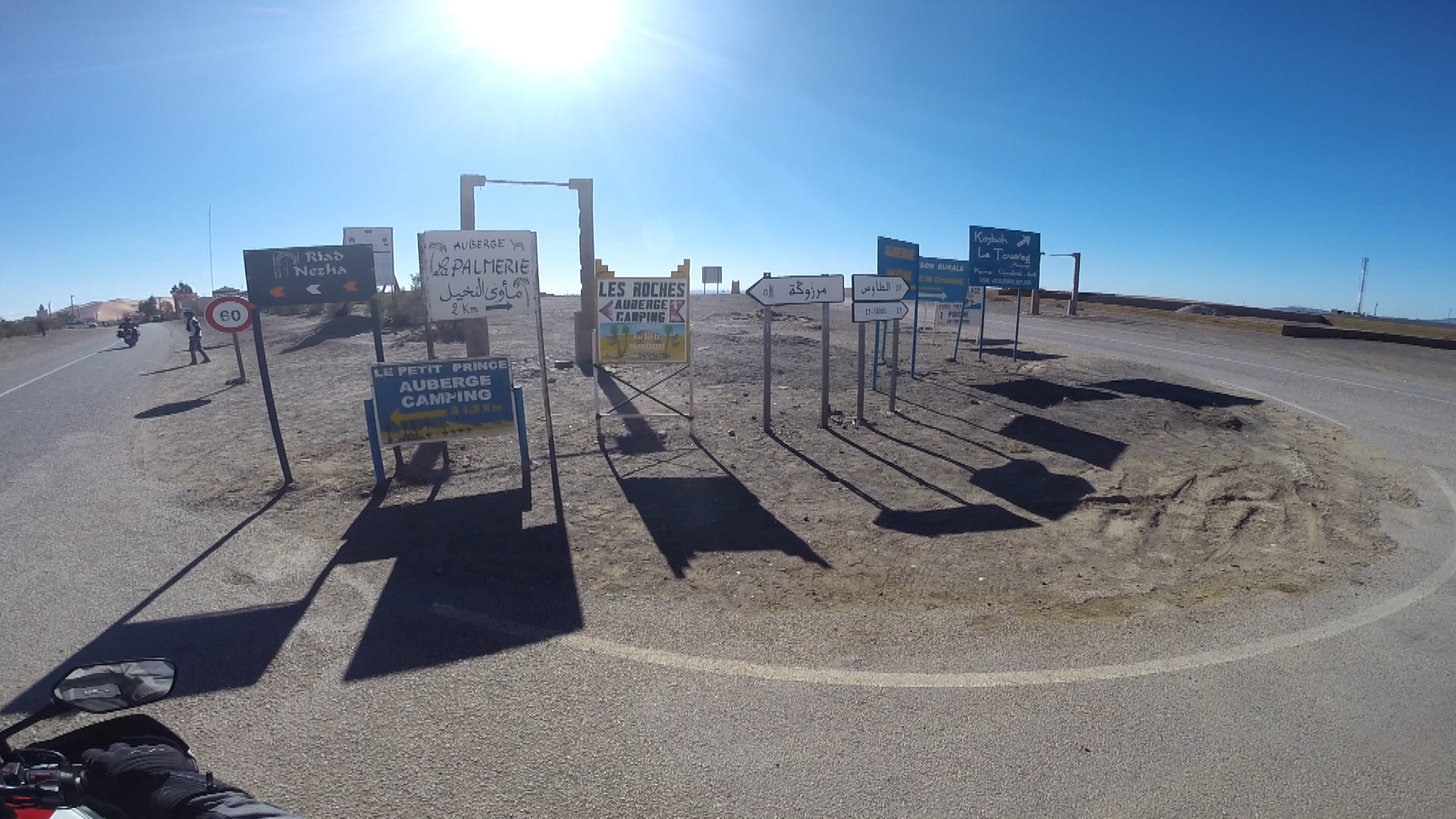
After a rather cold night in our Gite d’Étape, we rose with the sun and headed for Merzouga, the place where everybody goes to get a taste of the Sahara. 4×4 expeditions, quads, motorbikes, tourists on camels, people looking to spend a night in the dunes and see the magical sunset and sunrise all converge on this small town of dusty streets and family run riads where a whole industry has flourished to cover the demand.

merzouga

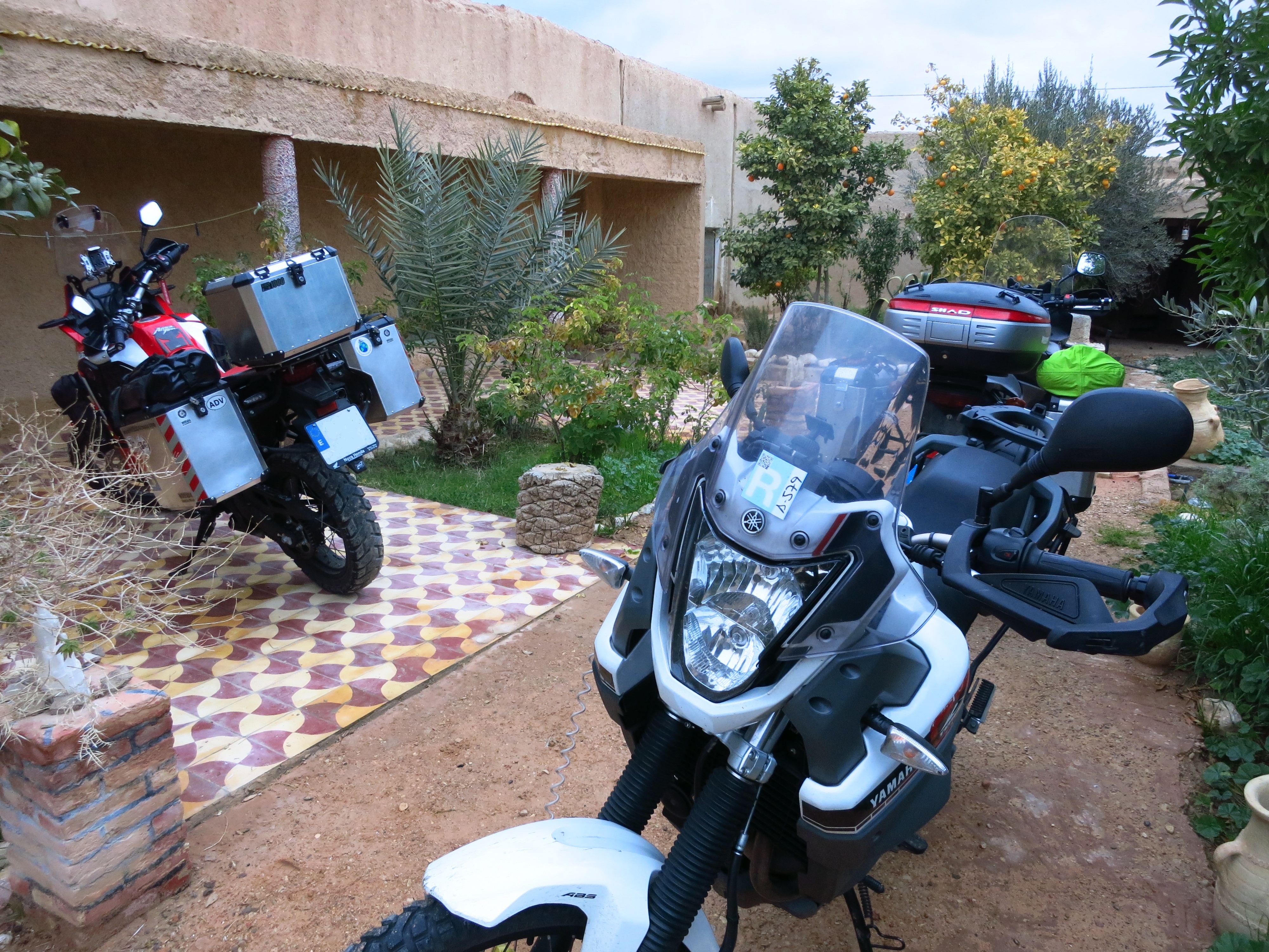
It took us a while to find our accommodation, but it was worth it. This one was the best place where we had stayed so far, all luxury and nice facilities, and after dropping all our stuff we planned the day.

img_1626

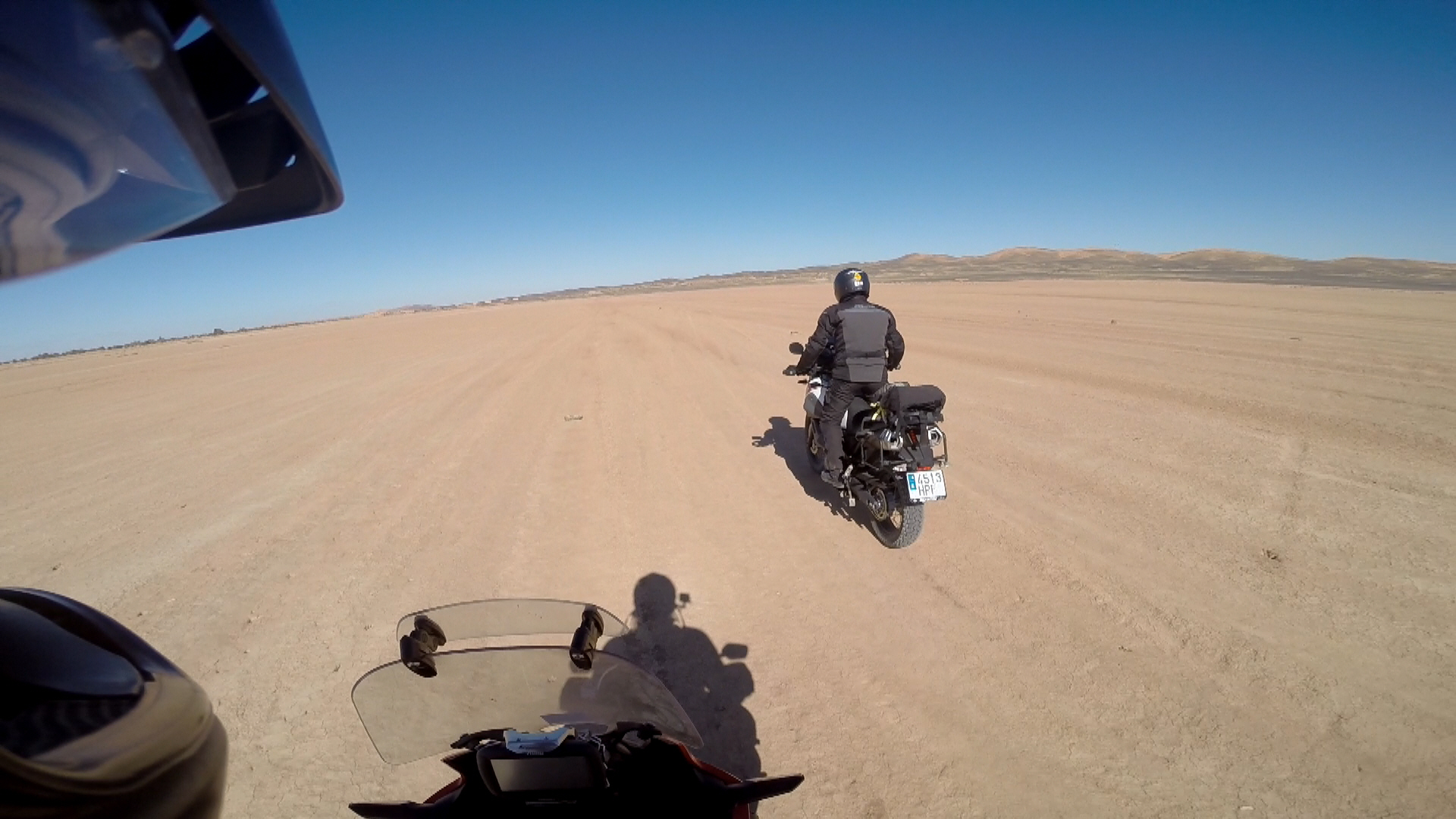
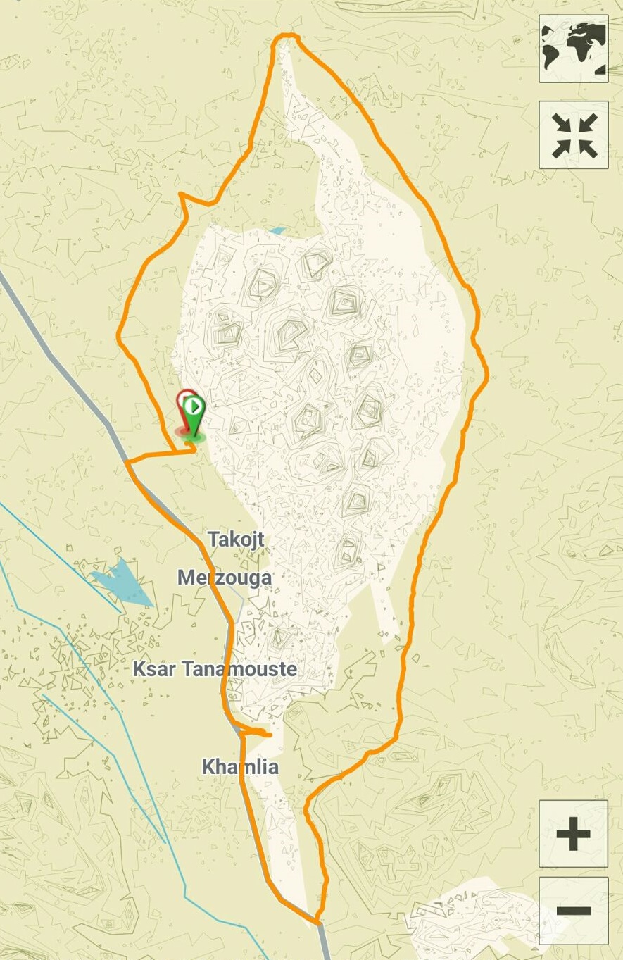
We wanted to go for a ride in the desert and maybe get a taste of the dunes, so we removed all the cases from the bikes and headed out, while the girls booked a tour on quads. We had a track on the GPS that went around the dunes of the Erg Chebbi, a route that was supposed to be a bit under 50km, and we started heading south and then turned left into a track of hard packed sand and stone. However, after just a couple of kilometres we run into soft desert sand and the front wheels of our heavy bikes dug in.

merzouga-2

Not being expert offroad riders, we decided to head back to the road and ride a bit further south to find harder ground that would allow us to ride all the way round the dunes, which was our original intention.

A bit further south we found another track that looked good and headed into the desert – it was easy terrain and we soon started to enjoy the amazing landscape, with some very gentle rocky hills where we came across some ruins of what seemed to have been a village in the middle of nowhere. As we rode through it we saw that there was at least one house that was still inhabited. Past the village the landscape changed into a vast open space and we could see rocky hills far in the distance and much closer, to our left, the majestic dunes of the Erg Chebbi.

merzouga-4

We were riding north along the east side of the dunes, and having started the route further south than we had intended, we set a time and/or petrol level limit, at which point we would decide whether we could continue and complete the tour or head back the way we had come.

Some kilometres further up we ran into softer terrain, not dunes but patches of softer ground, where we had to be more careful, and we rode past a bereber tent here and there. A 4×4 also going north but travelling much faster caught up with us and we took the chance to ask them how much further it was and whether the terrain was going to get much softer, and they reassured us that it was passable on our bikes. After the 4×4 left, a bereber riding a small motorbike appeared out of nowhere and started to ride along us, showing us the best ways to avoid soft terrain and washboard.

merzouga-5

We kept going and going for what it felt like hours, and we started finding more and more patches of soft ground, which turned into desert sand, making our progress slower. Our bereber friend stopped and in very basic French told us that he was near home – we understood that he lived in some settlement nearby – but if we wanted, he offered to show us the rest of the way to complete the tour and get back to Merzouga. We agreed that it would be better to have him around, as he knew which way to go to avoid the sand, of which there was more and more, and negotiated a price of about 6 euros.

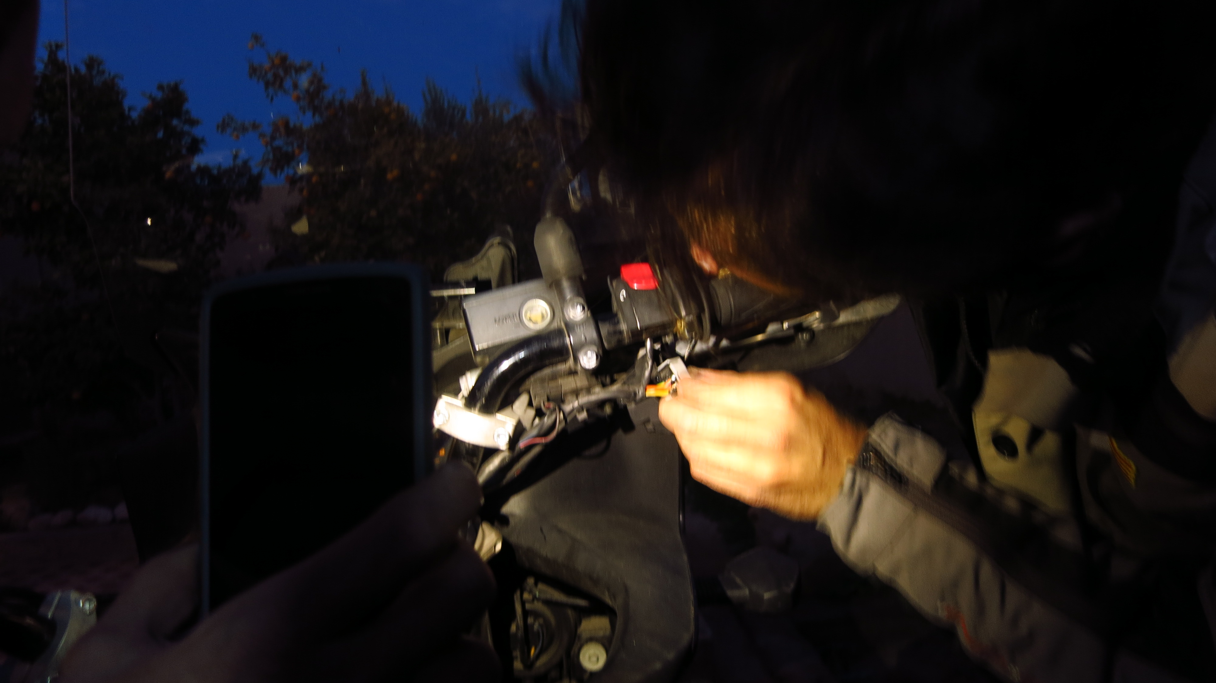
There was quite a lot of sand now, and we were getting tired. All of us had several ‘moments’ where we were about to taste some sand, but we all managed to keep the bikes upright with more or less style. We finally reached the northernmost part of the route and started heading down southwest. The ground turned harder again as we got further away from the northern tip of the Erg Chebbi, but with just a few kilometres to go, as he reached a crest Esteve hit a soft spot, his bike slipped from the back and he ended up on the ground. I opened the gas the get to him faster and help him, but he was already up and lifting his bike on his own. He had not got hurt and the only damage on his bike was a bent brake lever which we tried to straighten as much as we could to make the bike rideable again.

img-20161229-wa0009

After the incident we reached the road to Merzouga in a matter of minutes, said goodbye to our guide and headed into town to find a place where Esteve could get the brake lever into proper shape.

We asked in our riad and were directed to a local workshop where they repaired the lever while we cleaned and oiled the chains in our bikes, which were completely covered in dust.

img_1640

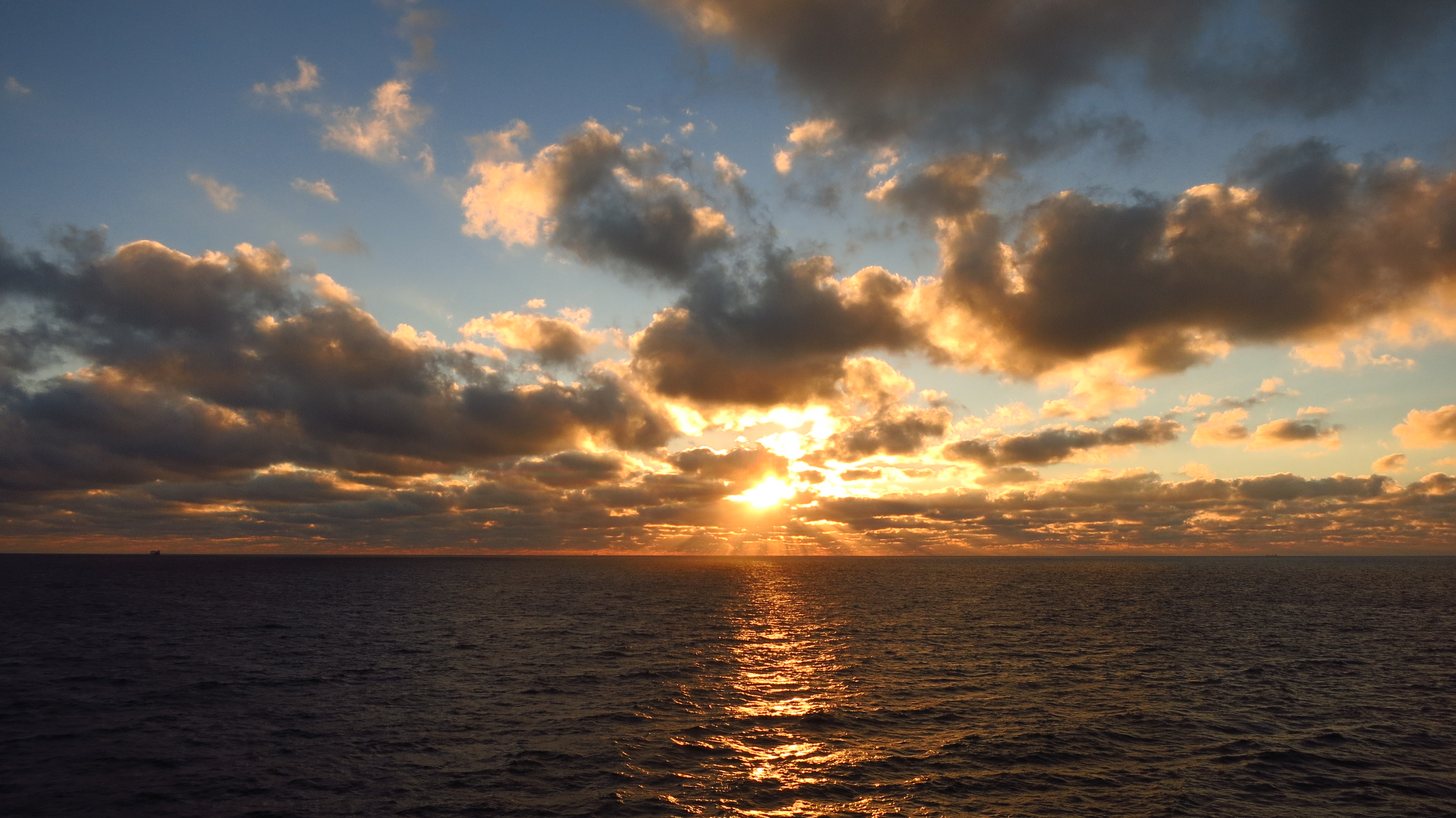
The girls texted us that they had already come back from their quad tour inside the Erg Chebbi, which had been great, and had gone for a walk to visit the town, and when the lever was fixed we saw that we were still in time to see the sunset from the dunes behind Merzouga, so we started the bikes and rode a bit into the desert until we found a small dune and sat on it to see the sun go down over the town.

[video coming soon]

Crossing the Atlas Mountains

Day 3 – 28th December – Fez to Errachidia (356km)

Most people think that the main drawback of travelling by motorbike in winter is the cold, and they are right, but there is another major factor at play that many forget – the hours of sunlight. While it would have been possible to make the most of the day and go directly from Fez to Merzouga in spring or summer, now we had to stop no later than 5pm because it got dark and temperatures drop very low, so we had to do the journey in two days. Because we wanted to spend most of the following day riding in the desert in Merzouga, we decided to go as far as possible today and then ride for only a couple of hours the following day. So, another early start.

Traffic had been the usual chaos in Fez when we arrived the night before, but today it was rather quiet, even though it was the morning rush hour. We left our palace and headed south through the new part of the city, and after leaving it behind, the road started climbing into the Middle Atlas mountains. We would spend most of the day well above 1,000 metres and, worried about the cold, we had put on several extra layers of warm clothes.

img_1567

The next big town was Ifrane, also known as the Moroccan Swirzerland, and it was easy to see why. If you think ‘desert’ when thinking about Morocco, think twice. At over 1,600m above sea level, we found a quaint town with snow and luxurious houses that would not look out of place in the Alps, with a skiing resort past the town.

Past Ifrane, the road took us close to Azrou and then into the foret des Cèdres, a thick forest with a great mountain road where I had a great time and where this amazing country brought us yet another surprise – monkeys! The forest is full of them, and they are a big tourist attraction, together with a tree called Cèdre Gouraud, a cedar over 800 years old.

img_1580

As we kept gaining altitude the forest cleared until there were no more trees and a vast expanse of snow opened in front of us. The temperature dropped gradually and reached a minimum 6 degrees Celsius as we rode over the highest point of the day, the Col du Zad, almost 2200 metres above sea level.

img_1590The snow remained part of the landscape until we started losing altitude again and the landscape turned into rocky desert plains on the way to Midelt, where we stopped to have some much needed hot tea before the last leg of the day.

img_1591

With the sun already low, we descended to the river Ziz, which we followed past the tunnel du Légionnaire and into the Gorges du Ziz, an amazing canyon that opened into a big reservoir built in 1976 to prevent the flooding of the palm tree plains down along the river.

Just after sunset we reached the outskirts of Errachidia, where we turned off the main road and rode a dirt track to a small group of houses made of mud and straw – we were going to spend the night in one of them, Gite d’Étape Khettara Oasis.

img_1607

A group of children, fascinated by the bikes as all children are, pointed us in the way of the house, and a small wooden door opened and man welcomed us into a beautiful inner courtyard. We were allowed to park the bikes inside for the night, and after squeezing the heavy beasts through the door, we unloaded them and were shown our room.

img_1604

Before settling down we set about fixing the headlamp in Gerard’s bike, which had stopped working in the morning. Fortunately, I had had the same problem with my V-Strom a few months later and knew how to fix it – it was a faulty ignition switch contact, which needed cleaning and adjusting.

img_1594

The owner of the house came shortly after and told us about the region and its history. He had been born in that same house, but after several consecutive years of unforgiving draught, his family had been forced to move to the city and try to make a living there. Fortunately for him, his father insisted that he kept going to school, and he had gone on to obtain a degree in physics. Feeling that he owed something back to his hometown, he had returned and turned his family house into a traditional guesthouse that was part of a network of sustainable tourism establishments in the Ziz river region. They employed local people and used local produce, and reinvested the money in improving water and irrigation facilities to support the local farmers.

img_1599

We enjoyed an excellent dinner in front of a fire in the central room of the house and went to bed early, ready for our first desert experience the following morning.

First taste of Africa

Day 2 – 27th December – Ferry from Almeria to Melilla and Melilla to Fez (317km)

Another extremely early rise did not help Gerard feel much better, and by the time we got to the port at 6am he was starting to have second thoughts about starting the trip, but we were all hoping that a good dose of drugs bought the previous evening and four hours to sleep on the crossing to Melilla would make him feel better.

img_1455The rest of us spent our time on the upper deck, the only passengers fool enough to brave the cold to contemplate the sun rise over the sea.

img_1511

When we got off the ferry the temperature was much higher, and after filling the tanks to make the most of Melilla’s special tax regime, we rode across the town to the border, where we officially crossed the door into Africa.

Well, actually, we first had to try to get our bikes across a human flood trying to get across the border. Not the immigrants or refugees that you hear about in the news, trying to reach this small piece of EU territory in Northern Africa, but a mob of Moroccans that cross the border to buy things that are cheaper than in Morocco or impossible to find there and then take it to their country to sell it. To prevent the border facilities from being overrun with people carrying boxes and bags the guards only open the pedestrian crossing at given intervals and then all the people waiting make a run for it. We were riding the bike behind a van and a short distance from the vehicles entrance we saw a lot of people sitting around and waiting, Then, as luck would have it, just when the van was driving over a zebra crossing the guards must have opened the doors, because everybody suddenly stood up, grab their stuff and dashed to the gate. In a matter of seconds, we were surrounded by a human mass, and I feared that someone would bump into or be pushed against us and with such a heavy bike and a passenger I would lose balance and end up on the ground.

Once we had managed to get past the crowd and into the border compound itself the chaos continued – we had prepared the import forms for the bike, but we still had to fill in a small immigration form, get the passport stamped and get the import form signed and stamped at the border and at customs. The immigration forms we had to fill in were nowhere to be found, and the reason was that the ‘helpers’ that are found in most borders had them. The ones here were very persistent, and the attitude of the people working at the border did nothing but encourage them – there were no signs and no explanations at all.

We navigated our way through that mess with the ‘help’ of one of those guys and in a matter of minutes had all the paperwork complete and just had to wait for the rest of our group while we enjoyed a curious show – a ridiculously overloaded car was trying to carry more goods than what I imagined the import regulations allowed, and a border guard had taken the wheel and was driving the car into a separate area of customs, while some men unloaded the trunk as the car was moving and threw bags over the fence where their friends were waiting to avoid having them confiscated.

Once we were all done, we left the border compound, exchanged some money and hit the road south. There was a lot of police, but nobody stopped us, and once the worst of Nador’s traffic was left behind, we enjoyed quite good roads until we found the motorway that led to Fes.

img_1531

After the rest on the ferry and some food, Gerard was feeling better and had decided to go ahead and continue the trip. We had started riding quite late because of the border crossing, and we were worried that nightfall might catch us before reaching the city and finding the place where we were staying, but we managed to get there just after sunset and ride into a maze of backstreets in a neighbourhood overlooking the medina, looking for the house where we were going to spend the night.

We had booked rooms in a property through AirBnB that was advertised as a ‘palace’, but the plain metal door we ended up in front of looked quite uninviting. The owner came out and told us that we were staying further down the road, and led us to the palace.

And what a palace it was! By now it was already dark, and after going through a metal gate we parked the bikes in the garage of a separate building and took our stuff down a street, across a patio, through a big doorway, down an alley… after few hours of sleep and lots of hours of travel, I was completely disoriented and felt I was floating from one place to another, until another big wooden door opened and we were led into a courtyard that could very well have been in the Alhambra.

img_1552After crossing it and walking up some stairs we reached our room – a cavernous space of about 100 square meters, ceilings over six meters tall decorated with elaborate carved and painted wood, thick curtains… it was unbelievable.

img_1546

It seems that the owner’s grandfather had been the Pacha of Casablanca and this was his second residence, where he kept his four wives and at least 12 courtesans while he was meeting the likes of Winston Churchill and Theodore Roosvelt.

img_1543

Overwhelmed by all the things we had experienced in the last 24 hours, we crashed in our beds under several layers of blankets and fell fast asleep.

Cold and boredom

Day 1 – 26th December – Barcelona to Almeria (825km)

6 o’clock in the morning. Pitch black sky over the city. A couple of drunken tourists walking down the street singing the kind of anthem that all drunken tourists sing abroad. A security guard deeply asleep in the warmth of his booth. Suddenly, a high-pitched siren echoes in the car park, and he opens his eyes with a jolt. Some kind of weird astronaut is ringing the bell, demanding that he opens the main door. He rubs his eyes and realises it is a weirdo all dressed up in motorbike gear. ‘For fuck’s sake’, he grumbles. ‘What is this guy doing here so early? It’s a holiday today, he should be in bed, still trying to digest all the food he ate for Christmas.’

Ten minutes later the bike was loaded and we were heading out of the city to meet the first of our travelling companions, Esteve, in Vallirana. To keep things interesting and cheap we combined national road and motorway for the first hours until we left Catalonia and met the two remaining members of our expedition in a service area in Benicarló, Gerard and Raluca.

With our group complete, all that was left to do for the remainder of the day was to cover the rest of the distance to Almeria, where we were going to spend the night before taking an early morning ferry to Melilla.

800 km of motorway were not going to be interesting, and even though we were lucky and the weather was good, it was still cold for most of the day. I had been thinking about replacing my rear tire for this trip, as it had almost 12,000km on it, but had decided against it in the end, not wanting to break a new tire in with so many kilometres of motorway on a loaded bike, so we taking it easy to save fuel and preserve the knobbly tires, which meant that the journey took longer than expected. We were planning on getting to the hotel by mid-afternoon, but sunset caught us still a long way from our destination, blinding us for about half an hour.

After what felt like ages riding in the dark, and with Gerard suffering from a bad cold combined with hay fever, we finally arrived in Almeria, located our hotel and had a warm shower. Gerard called it a day and went to bed without having dinner, hoping to feel well enough the following day to be able to continue the trip, and the rest of us went out to enjoy some beer and tapas.

Moroccan paperwork

Next step on our trip preparation – arranging the import forms for our motorbikes.

I have been told that there are long queues and general chaos at the border crossing in Melilla, and it is possible to expedite the process by having the temporary import forms for the vehicles you are travelling with ready beforehand. That way you save the hassle of finding the right window to obtain the forms, filling them in, dealing with local ‘helpers’, etc.

It is possible to fill in the temporary import form online and print out a copy to hand in directly at the crossing on this website.

Fill in all the information and print a copy. You get three copies of the same form in one A4 page, sign each of them in the ‘signature du déclarant’ section and they will fill the remaining information at the border (date and number). Customs keep the bottom form (Entrée), the second one (Apurement) will have to be handed when you leave the country and the third one (Exemplaire déclarant) is for you to keep.

If you do not speak French and need some help to fill in the online form, there is a translation/explanation in Tim Cullis’ Morocco Knowledge Base.

Planning is half the fun!

Two weeks of holidays for Christmas mean that another big trip is coming up. This time I am going to head south for the first time – Morocco!

I have no excuse for not having visited Morocco yet. Living in Barcelona, Morocco offers a taste of African adventure only a day’s ride away from me, making the desert one of the big must-see destinations for European bikers alongside the Nordkapp, Stelvio Pass, Transfagarasan Road, etc. Well, actually, I do have an excuse – I only have holidays in August, Easter and Christmas, and can not take any days off besides that. Easter would be the perfect time to visit Morocco, but I only have a week, which is too short to ride there, see enough and then ride back. I have a lot more time in the summer, but the temperatures are too high, which leaves the winter holidays. It will be cold and we won’t be able to see most of the Atlas mountains, but there is a lot more to discover.

dsc_0777I won’t be riding alone this time, though – we are going to be five people in three motorbikes.

We’ll keep you posted!

Route – Off: Castellterçol a Orís (76km)

This route is based on a track from the website Moterus, created by Miguel 650, with an extra segment added at the beginning between Castellterçol and Collsuspina by a mate who is a walking atlas when it comes to offroad routes. Gràcies Ricard!

We meet at 8:30 in a bar called Can Joan on the C-59 just outside Caldes. We were supposed to meet in the Bar Olimpo, a regular meeting point for cyclists and bikers alike, but we found it closed on vacation. After a generously-sized sandwich and coffee, we hit the road.

The route that I have programmed in the GPS starts in the outskirts of Moià, heading for Tona, but Ricard suggests approaching the starting point through a track he knows to warm up. Outside Castellterçol there is a small industrial estate called El Vapor, where the track starts between to warehouses. After a short stop to disconnect the ABS and the TCS, the first two members of today’s group shoot off leaving a cloud of dust in their wake. Clearly, they were craving a bit of offroad action… I have no experience in enduro and I do not usually ride dirt tracks on purpose, rather end up in them, but since I got the new motorbike I have been exploring more and more its possibilities, which are far greater than my offroad skills, to tell the truth. The group I am with today, in contrast, have extensive experience on the brown stuff, so I am in for a crash course (literally).

img-20160918-wa0021

The track connects Castellterçol and Collsuspina through fields and is quite flat and easy, in fact it is accessible by car without trouble. Once there, we head west on tarmac for about 5 kilometres until we reach the beginning of the track I have uploaded on my GPS, right outside Moià. The first part of the route is an uphill track through the forest which, after a few tight corners, opens up to faster sections, always with good surface and good visibility, allowing fast progress. A few kilometres further, though, we have to slow down a bit as we see signs of what seems to be a MTB race or event and, sure enough, a bit later we start coming across bicycles heading the opposite way. We ride this bit slowly, and after a short stop to admire the views, leave behind the MTB course and have the track to ourselves until we reach the BV-4316 road just over some tunnels in the C-25.

img-20160918-wa0020

After crossing the road, another short track segment brings us to the C-62 main road. At first it seems that we have to ride tarmac for a while, but then we discover a service track that runs parallel to the road, crossing it here and there, allowing us to stay on the brown stuff until the B-433, where the route takes us inevitably on tarmac until Sant Bartomeu del Grau.

From here we start the most remote part of the route, a narrower and winding track through the forest, where we have a great time. In a tight downhill corner, next to an old electricity company hut and a fire extinction pond, the forest opens into a viewpoint perched over the Riera de Sorreig, with beautiful views.

The track keeps going down from here until a small reservoir and then goes up again, the forest thinning to reveal some farms here and there. While riding past one of them, on another tight downhill corner, my front wheel loses grip and I land on my right side. I must have been doing 30 or 40 km/h and, fortunately, have not hurt myself, but it has been without any warning at all. We lift the bike and check for damage; the upper crash bars have moved and made contact with the fairing, but a good pull between three of us bend them back in position, and there is nothing broken – indicator, mirror, brake lever… everything checks out. A closer look reveals that the brunt of the impact went to the lower crash bars, then the upper ones, the hand guards and the passenger footpeg. Crash bars are a good thing to have.

The track goes on, nice and level, until reaching Sant Boi del Lluçanès, where we ride tarmac for a very short while in the BV-4608 before turning left into the forest again. A few hundred meters in, another track starts to the right, going up to the Sant Salvador de Bellver monastery.

img-20160918-wa0025

The detour is worth taking, the views from the monastery are stunning, in a clear day like today one can see very far.

img-20160918-wa0028

We spend a while enjoying the views, chatting and joking, until we realise that right behind us the monks are in the church, sitting in a circle and meditating, so we decided to move on and not spoil their karma.

img-20160918-wa0030

After riding back down to the main track we pursue the route, which describes a long curve around the hill where the monastery was until we pass below it on the north face and the track starts losing altitude in one of the best sections of the morning. The confidence I had lost in the front tire is slowly coming back, and I increase the pace and enjoy this last bit before Orís, where the route ends.

Map

ruta-1

From here, the C-17 leads back home to Barcelona, but Ricard suggests a nice place to have lunch and make the route a bit longer, this time on tarmac. We ride up the C-17 to Sant Quirze de Besora, where we take a smaller road to Santa Maria de Besora and then an even smaller one, little more than a sealed track, until the Hostal La Serra de Llaers, a farmhouse turned restaurant in the middle of nowhere where we celebrate the end of the route with a huge salad and grilled sausages. The sealed track goes on past the restaurant, but to save ourselves the ride all the way up to the N-260a we take another track, the last bit offroad, that connects to the C-17 just south of Ripoll.

Map

ruta-2

What to see

This is an offroad route (aside from the short connecting tarmac sections), so the most interesting thing is the riding itself and the views. That said, it is worth taking a detour to visit the monastery and church of Sant Salvador de Bellver, whose origins date back to the year 1100. Abandoned during the 20th Century until it fell into disrepair, it has now been occupied by a community that have restored and enlarged the site. From atop the hill you can see great views including the Plana de Vic, Montseny and Montserrat mountains and even the Pyrenees.

Where to eat

At the beginning of the route, the road bar Olimpo is a classic meeting point for cyclists and bikers alike to have a good breakfast before setting off. At the end of the route by lunchtime, and if you are willing to ride a bit longer (30km), the food in Hostal de la Serra de Llaers is excellent.

Route – On/Off: Javalambre mountains II – Amanaderos, Fuente de la Miel, Alto de Barracas (95km)

The starting point of this route is, again, Ademuz. However, if you are coming from the Cuenca province it can be started from the village of Torrebaja, and from Teruel it can be started in Villel, both on the N-330 road.

From Ademuz, I take the N-330 heading towards Teruel. A good road if you are heading south, wide and with good tarmac, but heading north it quickly becomes a narrow country road that should be classed as a regional or even local road instead of a main route connecting Alicante with the French border. The 40km between Ademuz and Teruel are a bottleneck that sees heavy traffic of articulated trucks all year round, but environmental concerns about the Turia valley and, more importantly, the fact that this sparsely populated region has very little political weight have kept a better road from being built for decades.

Halfway to Teruel I reach the village of Villel, where an even narrower road with worse tarmac leads to Camarena de la Sierra and the ski slopes of Javalambre. On the way there there are two more small villages and, just before reaching Camarena, the road goes through a narrow gorge where I find a small picnic area and a fountain with cool mountain water pouring out of a lot of taps. After a short stop I reach Camarena, where I leave the main road right after entering the village and take the TE-34 that goes to the lower car park in the ski slopes.

Shortly after leaving the village, a sealed track starts to the right of the road and follows the Camarena river until reaching another picnic area. From this point, the track starts gaining altitude and becomes a dirt track after a couple of kilometres, but it is still good enough to allow the passage of regular cars without problems.

This track ends in the Matahombres fountain, a picnic area with barbecues, a fountain and a pond, a nice spot, but usually rather crowded, particularly in summer, due both to the ease of access in all kinds of vehicles, as I said before, and to the natural beauty of the place, even though the use of the barbecues is forbidden in the hottest months.

img_1420

img_1422

The circular route continues past the picnic area, but having reached this point it is worth taking a detour to the right and follow the ravine to visit the Amanaderos and the Yeguas waterfall. The surface on this track is a bit more broken, and even though it is not difficult to ride on, I would not take a family car on it. If the weather is dry there are no problems, but if it has been raining hard the usually dry ravine might carry water and complicate the crossing of a couple of spots.

Shortly before reaching the end of the track, a road sign of the same kind used at the entrance of towns and villages informs me that I am in the Amanaderos. I park the bike as close as I can to the edge of the track to visit this part of the ravine, where water springs up suddenly from behind the rocks and quickly becomes a steady flow that a few hundred meters down the valley becomes the Yeguas waterfall.

img_1425

After crossing the river, this time with water flowing across the track, I reach a point where the track widens and is possible to park. Beyond this parking area I can see some wood fences that prevent the oblivious tourist from a serious fall down the Yeguas waterfall, the first of a series of waterfalls until the river reaches the Montereta mill, where the valley opens into an area of orchards belonging to the village of Riodeva. It is a very nice trek on foot, but if there is not another vehicle waiting at the end to take you back to the starting point you’ll need to walk six kilometres back up the river to the Yeguas waterfall.

After admiring the waterfall from below, where it forms a pool where you can swim if you are brave enough to dip into the chilly water, I walk back to the motorbike and ride the track back up to the picnic area to continue with the route.

The track gains some altitude from here on and crosses forests of pine trees, still with no difficulty if it is dry. Shortly after, I reach Fuente de la Miel, where there is another picnic area, this one abandoned.

From this point, the track takes me up the mountains until reaching a plain, Alto de Barracas, where it splits in two – both tracks lead to the village of La Puebla de San Miguel, the one on the left directly, the one on the right through Calderón peak and Vicente Tortajada pine, a centenary pine tree in a flora microreserve. I take the route to the right, and after making my way through a couple of tight downhill corners that the recent rain have made a bit tricky, the track goes round the south side of Calderón peak, the highest point of the region, and reaches another crossroads. To the right it goes back to Alto de Barracas round the north side of the peak, and to the right it goes past Gavilán peak, this one accessible by motorbike and 4×4, since there is a firefighting service surveillance tower at the top.

Past this crossroads the road goes down the mountain fast, with some of the steepest segments paved in concrete, until reaching the last crossroads of the route.

The plan was to head back to the road from here, as I am close to La Puebla de San Miguel, only one kilometre and a little down the valley, from where the road back to Ademuz through a couple of hamlets begins, but I see a sign that tells me that the track to the right goes to Mas del Olmo, the first of those two helmets.  Wanting to stay off road for a bit more, I choose this option.

This last segment has no difficulties either, it is a nice track that winds its way through terraces of almond trees cut into the mountain, trying to steal some lands for crops from the jagged mountains, a good reminder of how hard life must have been for our grandparents in this area.

Once I reach Mas del Olmo the only thing left to do is follow the tarmac road back to Ademuz, my starting point.

Map

ruta-javalambre-ii

What to see

Ademuz – With a little over 1,000 inhabitants, this town is the capital of the enclave, built on the mountainside with a maze of narrow streets that confirm the Arab influence that its name hints to. At the top of the mountain stand the ruins of a castle, an old arab fortress called Al-Damus. From the entrance of the town a dirt track goes up the Pico Castro, a peak with excellent views over the town and its surroundings, including the river Turia. The shrine of Nuestra Señora de la Huerta, from the XIV century, is also worth a visit.

The Amanaderos – This is the point where the Rambla de los Amanaderos, the stream that later becomes the Ríodeva river, springs up. In this apparently dry part of the ravine water springs up from several places between the boulders. There is no place to park, but motorbike might be left as close to the edge of the track as possible to allow the passage of other vehicles. Alternatively, this spot can be reached on foot from the car park in the Yeguas waterfall, a short distance down the ravine.

Yeguas waterfall and Ríodeva river trek – This waterfall is the first of the several that, together with a few natural pools, make up an interesting trek down the river until reaching the Montereta mill. If you have another vehicle waiting for you in Ríodeva it is possible to do the whole trek and enjoy the views of the waterfalls and the valley, if not, you’ll have to walk 6km back up from the mill. In any case, it is worth walking the first part to see the waterfalls.

Puebla de San Miguel natural park – Part of the route goes through this park. Here you can find Calderón peak, the highest peak in the Comunidad Valenciana with a height of 1,837 metres. Reaching the top has zero difficulty, it is just a leisurely walk from Alto de Barracas. The park also has several flora microreserves, all of them signposted and with information panels.

Shrine of La Puebla de San Miguel – If we take the route down to this village, the track joins the main road just past this good example of the typical shrine architecture in the region, with a porch over the front entrance.

Where to eat

Casa Domingo, the main hotel in Ademuz, has bar and restaurant service. In Camarena de la Sierra, just after turning into the camino del Balneario, the road that takes us to the start of the off road part of the route, there is the Hotel Esmeralada.

Greek road shrines

I had never had so many near misses as I had on the roads in Greece. As I explained in the story of my trip through the Balkans, Greek drivers are the epitome of all types of bad behaviour on the road – they do not mind their surroundings, use their mobile phones while driving, run stop signs, ignore right of way… and worst of all, they are incompetent drivers. They floor it on straights but can’t keep a decent speed through a corner, they don’t seem to be able to judge speed and distance accurately and they have total disregard for other users.

A testament to the consequences of all of this can be found everywhere in the Greek road network. I crossed the border from Bulgaria in a small crossing and took regional roads on the Greek side, a beautiful route going down the mountains. It was not long before I saw a small shrine by the side of the road, at the exit of a tight corner – it looked like a miniature church on a stand, and had fresh flowers on it. The flowers and the location made me think that it was there to commemorate the victim or victims of a road accident, in the same way that some people leave a bunch of flowers attached to a signpost or an Armco barrier in other countries.

img_1351

But then, a few corners down the road I saw another one. And another one. And another one. Some were quite new and well taken care of, some were older. The varied in size and complexity, some were made of stone, some were made of wood or iron, and all that remained of some were a few pieces of wood or metal hanging from a pole. They were everywhere, there was practically not a corner or crossroads without one on them, and I started to ride more slowly, more carefully, afraid that if each one represented an accident, I was on the deadliest road in the world.

They were a constant presence in my trip throughout the roads of Greece. I later discovered that they are called Kandylakia and do not always represent a road death – they are also built to express gratefulness at having escaped or survived and accident, but even if they are not always associated to a tragic ending, the sheer number of them bears witness to the dangers of driving in that country.


Sources:

About.com – Travel in Greece

Hellenic Communication Service

Bob Cromwell – International Travel